Wyoming got a lot of much-needed moisture this week. It wasn’t enough to bust the severe and extreme drought impacting most of the state, but it was something.
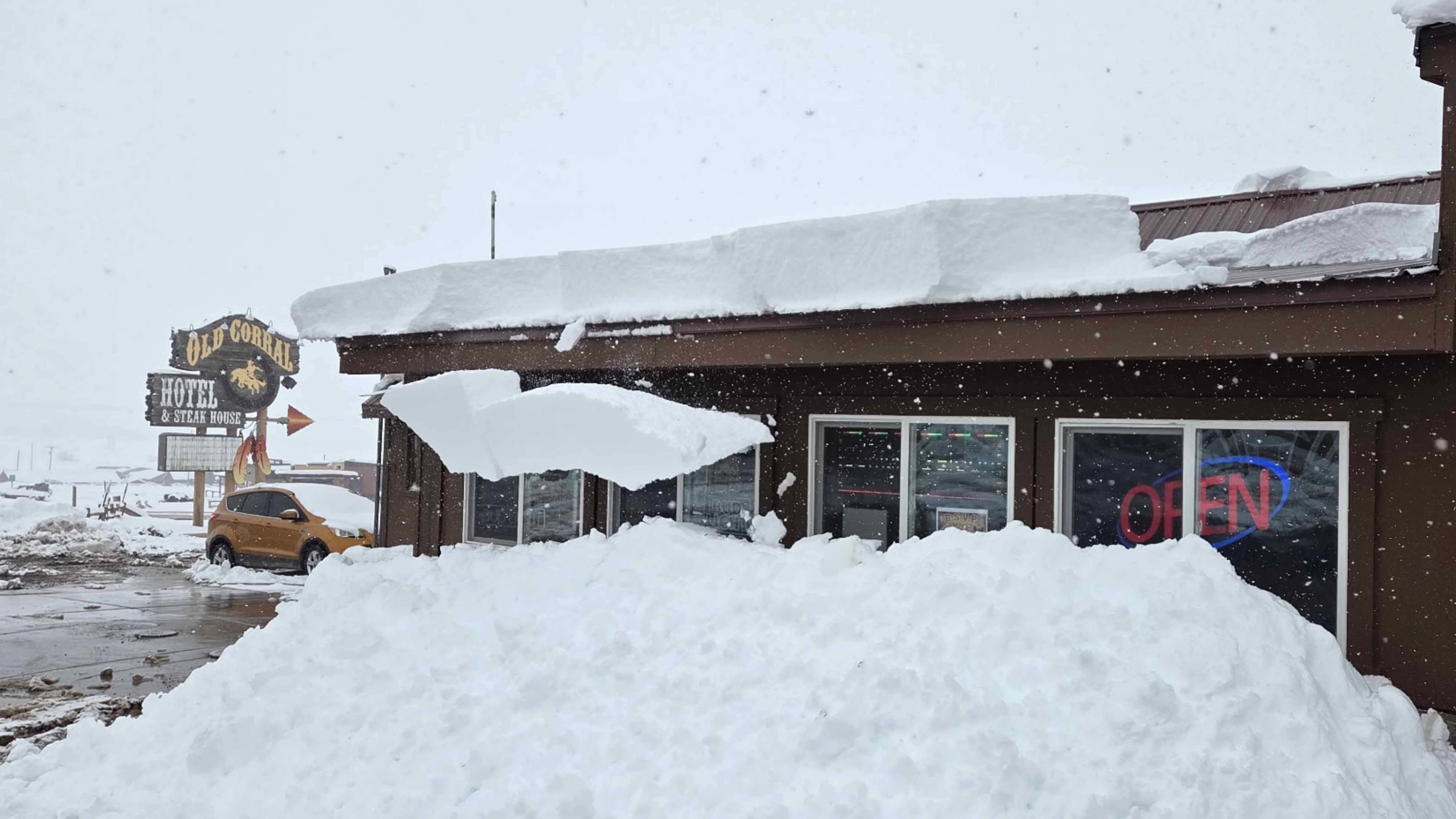
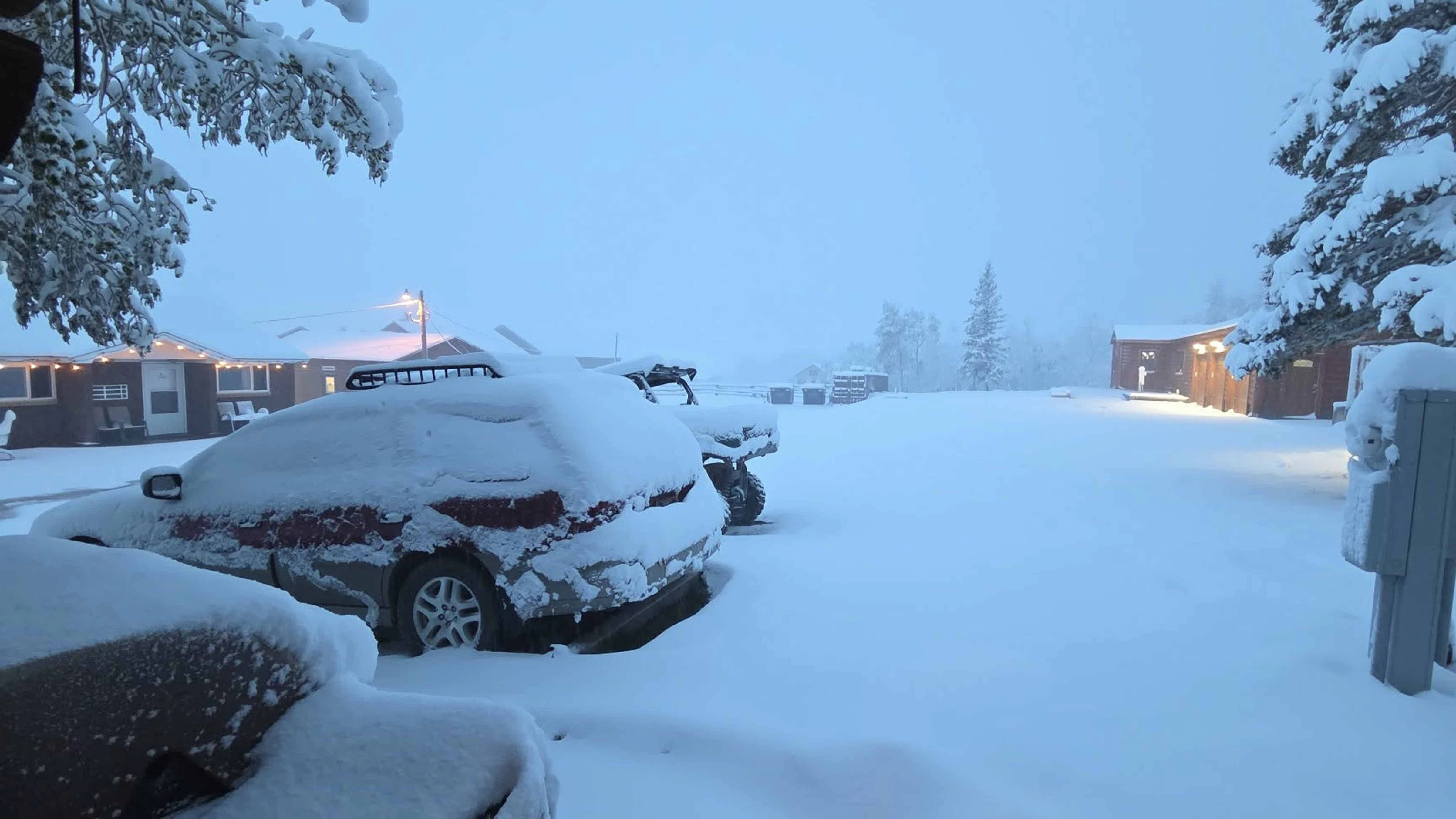
Precipitation totals from this week’s spring snowstorm are still being compiled by the National Weather Service, but the numbers are impressive. Many places saw several inches of snow from the southeast Wyoming storm that closed Interstate 80 for a day and stranded motorists for hours — some overnight.
That heavy, wet snow translates to more than an inch of liquid water.
“Some parts of southern Wyoming have already reached their average for the month of May, and maybe even gone above that,” said Cowboy State Daily meteorologist Don Day. “Some areas of the Snowy Range got up to 30 inches.”
That’s great news for areas in the depths of severe or extreme drought, but it wasn’t nearly enough to reverse the deficit. Anything’s better than nothing, but there’s a lot of ground to cover with water if Wyoming wants out of its drought.
“I’ll go back to my elephant analogy,” Day said. “Getting rid of a drought is like eating an elephant — one bite at a time. These storms have taken nice chunks out of it, but there’s a long way to go.”
Good Numbers
Meteorologist Mike Natoli with the NWS office in Cheyenne was still compiling the total water content from this week’s winter storms on Wednesday.
One of the holdups was a lack of reported data from Rawlins, probably because of the significant power outage caused by the wet, heavy snow between Monday night and Tuesday afternoon.
“I would estimate they probably received between 1 and 2 inches of liquid water, based on the measured snow that we received from the area, which was between about 8 and 16 inches,” he said.
Cheyenne got 0.85 inches of liquid water, either from rain or melted snow, during the storm. Add that to the 1.10 inches it got from a winter storm during the first week of May, and that’s a water windfall for southeast Wyoming.
Natoli added that Laramie received between 0.5 and 0.75 inches of liquid water during the same period, and Casper got 0.73 inches.
“The south and south-central parts of the state received the most moisture from this system, and that will definitely help in the short term,” he said. “It’ll temporarily reduce the fire danger and, most notably, it will prevent the drought from getting worse.”

A Drop In The Bucket
Moving from exceptional to extreme drought is an improvement, but it demonstrates just how dry it’s been in Wyoming. Spring systems have chipped away at the drought deficit, but two solid storms aren’t enough to reverse a drought fueled by the warmest, and one of the driest, winters on record.
“Many locations haven’t benefitted from these storms,” Day said. “Platte, Goshen, Niobrara, Converse, and Campbell counties need a good soaker, but they haven’t had a good moisture situation in a while.”
That’s the problem with a state as big and topographically diverse as Wyoming, he said. Incoming weather systems impact areas differently, and a good spring storm will usually be regulated to one area at the expense of others.
Natoli said the last two weeks have been “a drop in the bucket” for Wyoming’s drought deficit and not nearly enough to reverse the trend. That opportunity probably won’t come this season.
“A lot of our water supply issues are coming from mountain snowmelt,” he said. “The mountains did receive a good amount of snow from this storm, but a lot of the snowpack has already been lost after those very warm temperatures we saw in March.
"That's why we're probably not going to completely eliminate the drought this year.”

D4 Free
Tony Bergantino, the director of the Water Resources Data System and the Wyoming State Climate Office (WSCO), said May’s moisture has been a definite improvement for drought deficits across the state.
“The cooler weather and precip has helped a little as far as easing conditions,” he said.
According to the WSCO’s analysis, the extreme drought in Albany, Laramie, Goshen, Platte, and Carbon counties has been “trimmed back a bit” in May.
As of May 19, most of Wyoming is experiencing either severe or extreme drought. That’s not ideal, but it’s an improvement from the situation just a month ago.
Even better, the area of exceptional drought (D4) in far southern Carbon and southeast Sweetwater counties has been eliminated. They finally got enough moisture to be only in extreme drought, and that’s a definite change for the better, Bergantino said.
“The SWE in the Lower North Platte this week got to the highest it had been since the last week of March and is closely following its historical median,” Bergantino said.
Once the additional moisture from the last storms is factored into the state’s drought assessment, the map is likely to look even better as May ends.
Wyoming is slowly eating away at its elephant and, for once, the trend going forward is looking positive.
“It is good to be completely free of D4 in Wyoming again,” Bergantino said.
More Where That Came From?
The last seven months of Wyoming weather forecasts have been hopefully looking on the horizon for wet weather that never came. As May ends and June arrives, the outlook for more wet weather looks positive.
“The weather pattern we have coming up is definitely the best that we've seen in the last six months across the state,” Natoli said. “It's not going to totally end the drought, but we're liking what we're seeing in the next couple of weeks.”
Natoli said the extended forecast indicates there will be “frequent chances for precipitation” over the next several weeks. That’s a marked change from the winter season, which was “constantly warm and dry.”
“The first one … (began) in northwest Wyoming Wednesday night, and then move southeast through the day Thursday, and wind down by Friday morning,” Natoli said. “That should bring some fairly widespread rain, and then mountain snow as well.”
Wyoming doesn’t want a single, drought-ending storm. The amount of moisture required to end the drought would be devastating and cause widespread flooding.
However, Natoli said multiple storms that drop up to an inch of water at a time could “go a long way” to reduce the severity of the drought. If that pattern continues, it’ll bode well for next winter’s snowpack.
“That is probably what’s needed to change the hydrological outlook before next winter,” he said. “If we get a strong winter snowpack next winter, things could be easily turned around by next spring, but it's far too early to be talking about that.”

It Looks Better
Day also sees promising signs on the horizon.
May has been better than most of the last winter season, and there’s a historical precedent for hope.
“We’ve got a long history of May storms like we’ve had so far this month,” Day said. “Some of the worst drought areas in south-central and southeastern Wyoming have benefited with these two storms, and there’s another opportunity coming with his incoming system on Thursday and Friday.”
Bergantino was cautiously optimistic. The outlook for precipitation looks decent in the short term, but long-term forecasts are skewing back toward drier, warmer months ahead.
“The cooler temperatures and recent precipitation have definitely improved some of the conditions, and we are looking at slightly better chances of above-normal precipitation for the next few weeks,” he said. “The longer-term forecasts are not too certain on future precipitation, though they lean toward above normal.
"For temperature, however, the outlook is much more bullish on being above normal, with those chances being higher for the western part of the state, though even in the east, the chances are also elevated.”
Looking beyond the next seven to 10 days has been too far for Day for the last few months. He isn’t getting his hopes too high and encourages Wyomingites to keep their heads on Wyoming’s still dry land.
“If we were going to put some big dents in the drought, we have areas these storms missed that need a lot more moisture,” he said. “This is what we want, but we need more.”
Andrew Rossi can be reached at arossi@cowboystatedaily.com.