Cowboy State Daily - Wyoming News
News
Headlines
View all
National Geographic Profiles Wyoming’s Famous Hell’s Half Acre
National Geographic has raised the profile of Wyoming’s famous Hell’s Half Acre by featuring the alien landscape in its latest issue. It comes at a time when much of Hell’s Half Acre that had been inaccessible to the public for roughly 20 years is open again.
Renée JeanJuly 19, 2026

Green River Rendezvous: 200 Years Of The Ultimate Wilderness Swap Meet
The Green River Rendezvous is a multi-day celebration of the historic mountain men rendezvous that took place between 1825 and 1840. Its rodeo is the Goldilocks of the summer rodeo circuit — big enough to draw serious talent but maintains a uniquely local feel.
Zakary SonntagJuly 18, 2026

Some Riders Say Cheyenne Frontier Days Isn't The Same After Eliminating Slack
For the first time in more than a century, Cheyenne Frontier Days won’t have slack competition, which is for overflow competitors. Although some are saddened by the move, the rodeo says it has outgrown its ability to handle the hundreds of extra riders.
Julie MankinJuly 18, 2026

Wyoming History: Silent Film Stuntman Got Start In Buffalo Bill’s Wild West Show
A Wyoming cowboy learned life was more dangerous on movie sets in the early 1900s than riding broncs for Buffalo Bill’s Wild West Show. Harry Webb recounted how he barely survived his career as a stuntman for silent Westerns.
Jackie DorothyJuly 19, 2026

Lander Girl To Be Featured On Giant Times Square Video Screen
A 15-year-old Lander girl will be featured on a giant screen in New York City’s Times Square as part of an annual fundraising event for the National Down Syndrome Society. “This is a huge honor and celebrates her achievements,” her mom said.
Dale KillingbeckJuly 18, 2026

Even If Grizzlies Have ‘Recovered,’ Advocates Still Don’t Want The Bears Delisted
Grizzly advocate Pete Bengeyfield, who has been watching and photographing the bears for decades, said even he has to admit there are probably enough of them to consider the species “recovered." However, he still opposes having the bears delisted.
Mark HeinzJuly 18, 2026

Holy Cow: Motorhome Appears To Lose Brakes On Teton Pass, Motorist Captures Video
A routine drive over Teton Pass turned into a white-knuckle spectacle Wednesday when an RV appeared to lose its brakes and barreled downhill, weaving through traffic before somehow reaching the bottom without crashing. One motorist captured the video.
Kolby FedoreJuly 17, 2026

‘The Way It Should Be’: New $10M Indian Village Opens At Cheyenne Frontier Days
The new $10 million Morning Star American Indian Village opened Friday for the first day of Cheyenne Frontier Days. Visitors said they were astonished by the transformation. "I got emotional, because this is so amazing," a Native American visitor said.
Greg JohnsonJuly 17, 2026

FEC Report: Four Wyoming House Candidates Loan Themselves More Than $1 Million Each
Second-quarter campaign finance reports for Wyoming’s GOP primary House race are in. Steve Friess has amassed the most with $2.5 million, which includes a $2 million self-loan. Reid Rasner is second, loaning himself $1.7 million out of $2 million.
Clair McFarlandJuly 18, 2026

Opponents Of Massive Data Center In Uinta County Launch Petition For Court Review
Opponents of Prometheus Hyerpscale’s massive data center near Evanston are challenging permits and zoning for the project due to fears about water, energy, and land use. Supporters say the project is a rare lifeline for Uinta County’s struggling economy.
Renée JeanJuly 17, 2026

Oldest Yellowstone Wolf Pack Strays Into Hunt Area, Activists Want Pack Protected
The Mollie’s Pack is Yellowstone's oldest wolf pack and includes the famous Wolf 1090F. The pack has strayed outside the park into a Wyoming wolf hunt area, and activists worry that 1090F will be shot this fall. They are requesting the pack be protected.
Mark HeinzJuly 17, 2026

Rep. Allemand Issues Public Apology For Drunk Driving
Rep. Bill Allemand issued a public apology Friday for driving drunk last December. The state legislator pleaded guilty Wednesday to a DUI charge and was fined and sentenced to probation. “I do apologize for drinking while driving on a public road," he said.
Clair McFarlandJuly 17, 2026
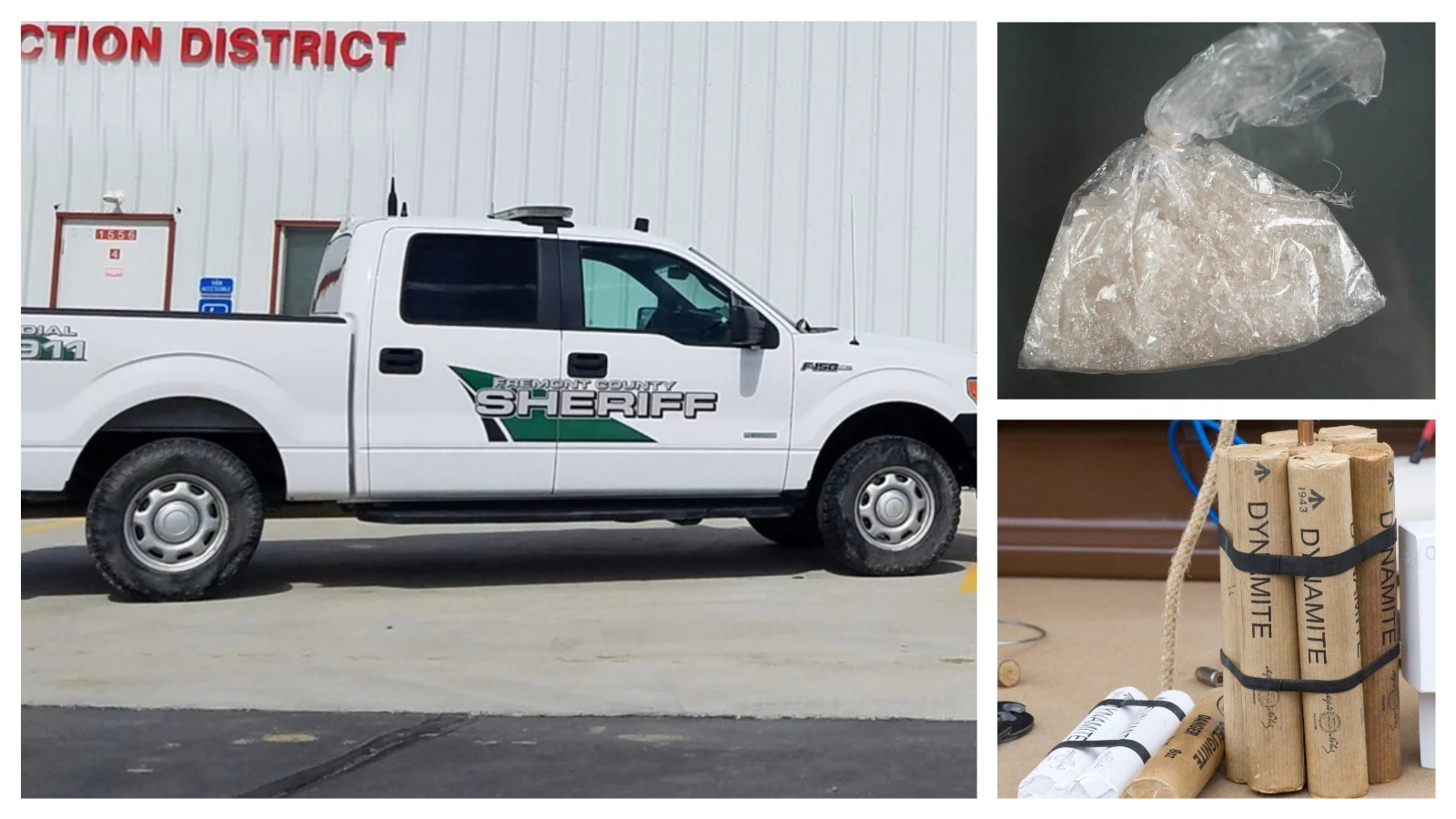
Decades After Bombing A Patrol Car With Dynamite, Riverton Man Back To Prison For Meth
More than 50 years after he admitted using dynamite to blow up a Fremont County patrol car, and four decades after being convicted of running a major methamphetamine trafficking enterprise, Buzz Apodaca, 72, is once again headed to federal prison.
Kolby FedoreJuly 17, 2026
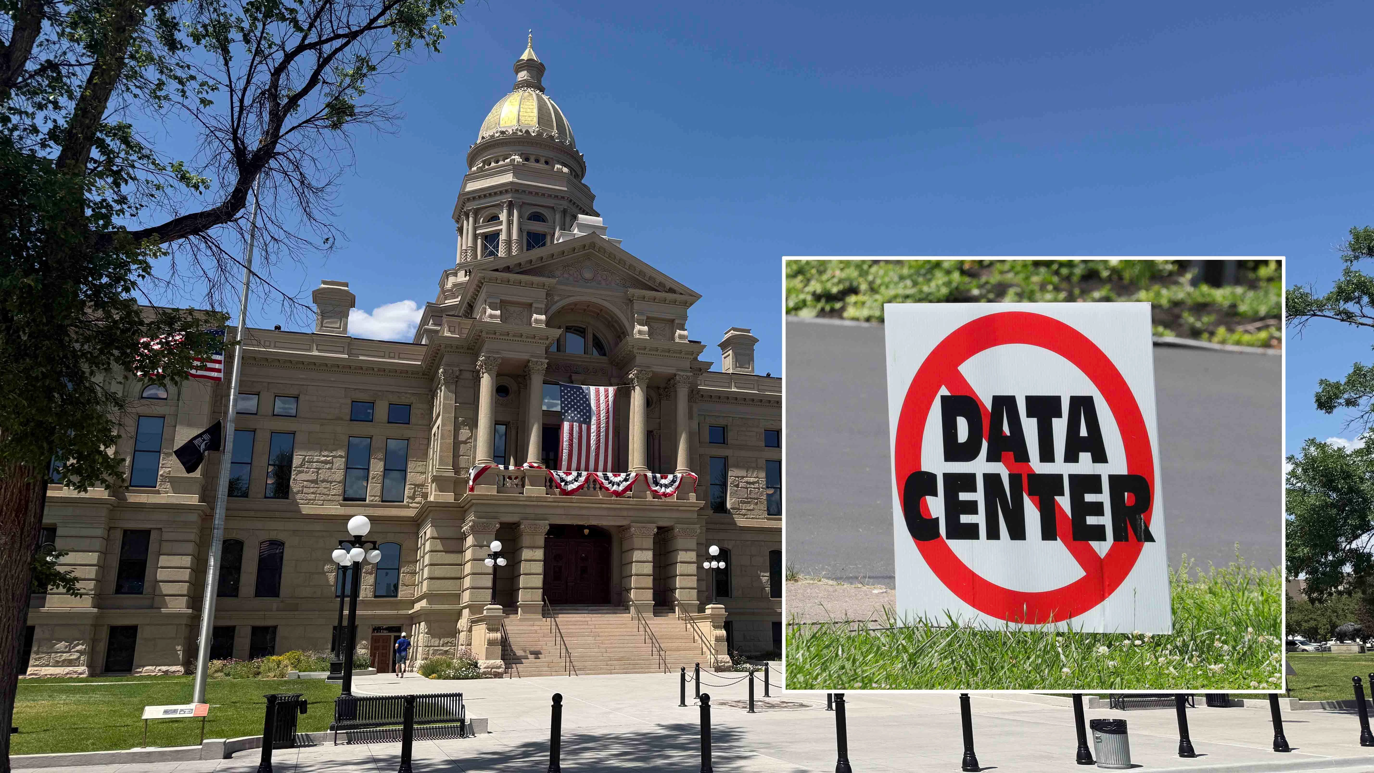
Cheyenne To Join National Protest Against Data Centers; Detractors Laugh
Protesters will gather on the Wyoming Capitol steps Saturday as Cheyenne joins a nationwide day of demonstrations opposing data centers. Organizers say it's a way to protect "our way of life" while detractors lampoon them as "modern-day Luddites."
Kate MeadowsJuly 17, 2026

Wyoming Man Accused Of Kidnapping, Assaulting 12-Year-Old Oklahoma Girl Pleads No Contest
A Kemmerer man accused of driving 16 hours to Oklahoma to bring a 12-year-old girl back to Wyoming pleaded no-contest to kidnapping and two sex abuse charges and now faces up to 120 years in jail. The affidavit said he told police he was "really sorry."
Kolby FedoreJuly 17, 2026

Study Says Wolves Stress Cows Out; Ranchers Say, ‘We Told You So’
Ranchers in Wyoming said a new study that shows cattle get stressed out by wolves is something they've been saying all along. “We ranchers have known about this for years. Why do you think our great-great grandfathers eradicated them?" one rancher said.
Mark HeinzJuly 17, 2026

Groundbreaking Bill Would Give Wyoming Residents Property Rights Over Their Data
Wyoming legislators are working on a bill to give Wyomingites property rights over their own personal data — and another to restrict license plate reader usage. "It would be far and away the strongest privacy right on the planet,” said a lawmaker.
Clair McFarlandJuly 17, 2026
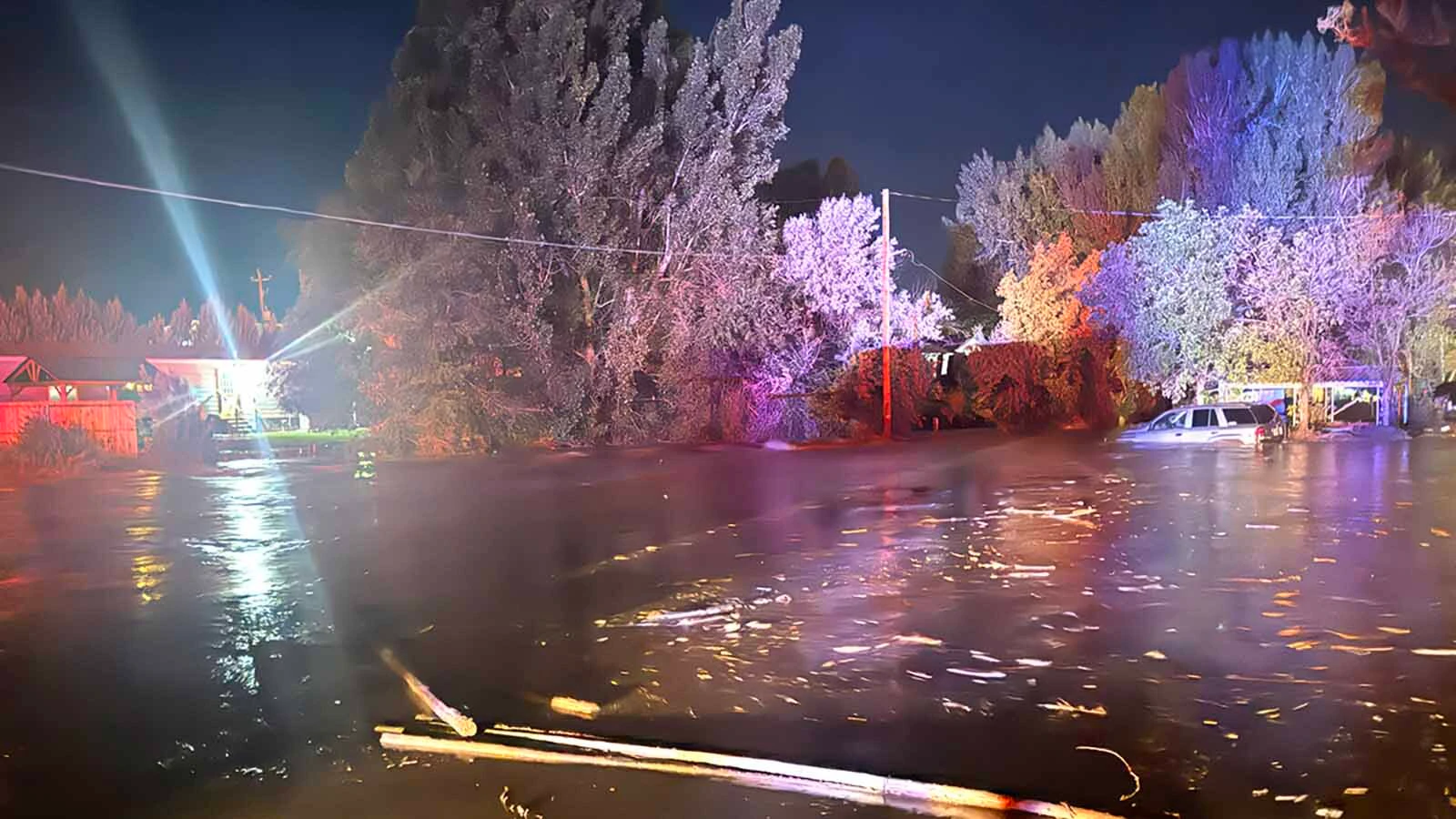
‘We’re In Trouble’: East Thermopolis Floods After 4.5 Inches Of Rain In An Hour
A wall of water surged through East Thermopolis late Wednesday, stranding people and breaking a gas main after 4.5 inches of rain fell in an hour near the town. "You need to send rescue out here. We’re in trouble,” one resident said when he called 911.
Jackie DorothyJuly 16, 2026
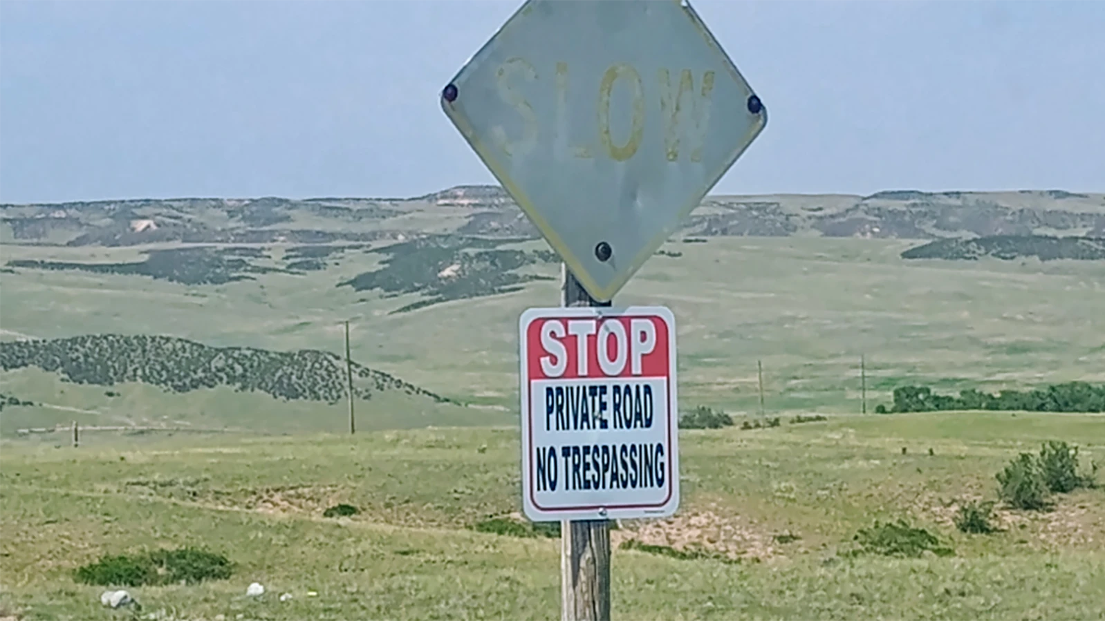
Wyoming Hunter Wants To Clear Up Confusion Over Public Lands Marked ‘Private’
A Wyoming hunter is on a mission to undo confusion after repeatedly encountering "Private Property" and "No Trespassing" signs where the public should legally be allowed. "Knowing which roads are actually public is really challenging,” said a landowner.
Kate MeadowsJuly 16, 2026

Wyoming Gun Activists Increasingly Alarmed Over AI Cameras Searching For Guns
Although manufacturers of AI software that uses surveillance cameras to search for guns say it makes people safer, gun rights activists are alarmed. Buffalo's Mark Jones, of Gun Owners of America, says it violates the Second and Fourth Amendments.
Mark HeinzJuly 16, 2026

Flash Flood Damages Bridge, Cuts Off Only Access For Park County Residents
Park County officials say a Wednesday flash flood nearly destroyed a bridge over the Shoshone River and cut off access for some county residents. “We watched a wall of debris build up and surging muddy water begin to overflow the banks,” said one witness.
Andrew RossiJuly 16, 2026
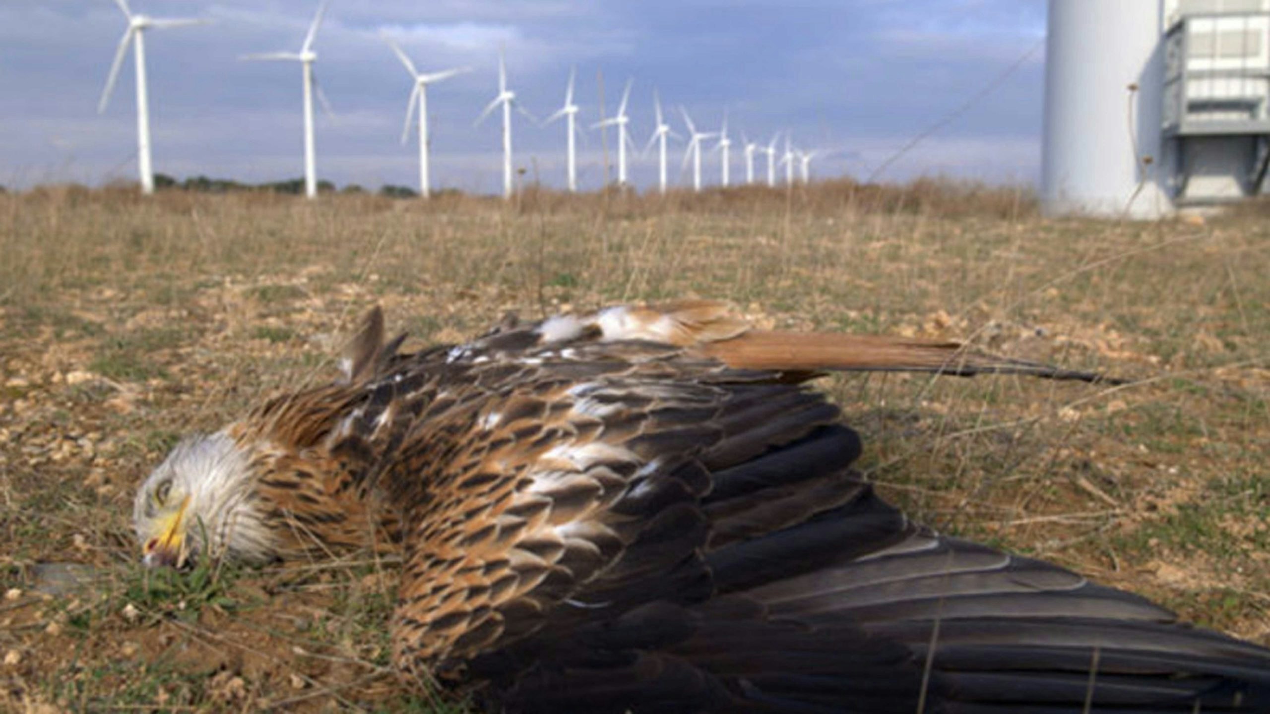
Wyoming Wind Turbines Killed More Than 23,000 Birds And Bats Last Year
More than 23,000 birds and bats were killed by wind turbines in Wyoming in 2025, according to a report presented Wednesday to the state Game and Fish Commission. “They’re flying around and they’re not paying attention to those blades,” said an official.
Mark HeinzJuly 16, 2026

Galloping Horse Is Galloping Again Over The Wrangler In Downtown Cheyenne
The Galloping Horse is galloping again — or at least it will be when someone at The Wrangler turns the power on. After years of being inoperable, the iconic 400-pound folk art cowboy was fixed, refurbished and put back in place Thursday morning.
Greg JohnsonJuly 16, 2026

7 Teens Arrested In Western Nebraska SWAT Raid For Illegal Machine Guns, Drugs
Seven teens were arrested Wednesday in a sweeping western Nebraska raid over illegal machine guns and drugs. Investigators say they found Instagram posts of the teens posing with and firing Glock-style guns equipped with illegal switches.
Kolby FedoreJuly 16, 2026

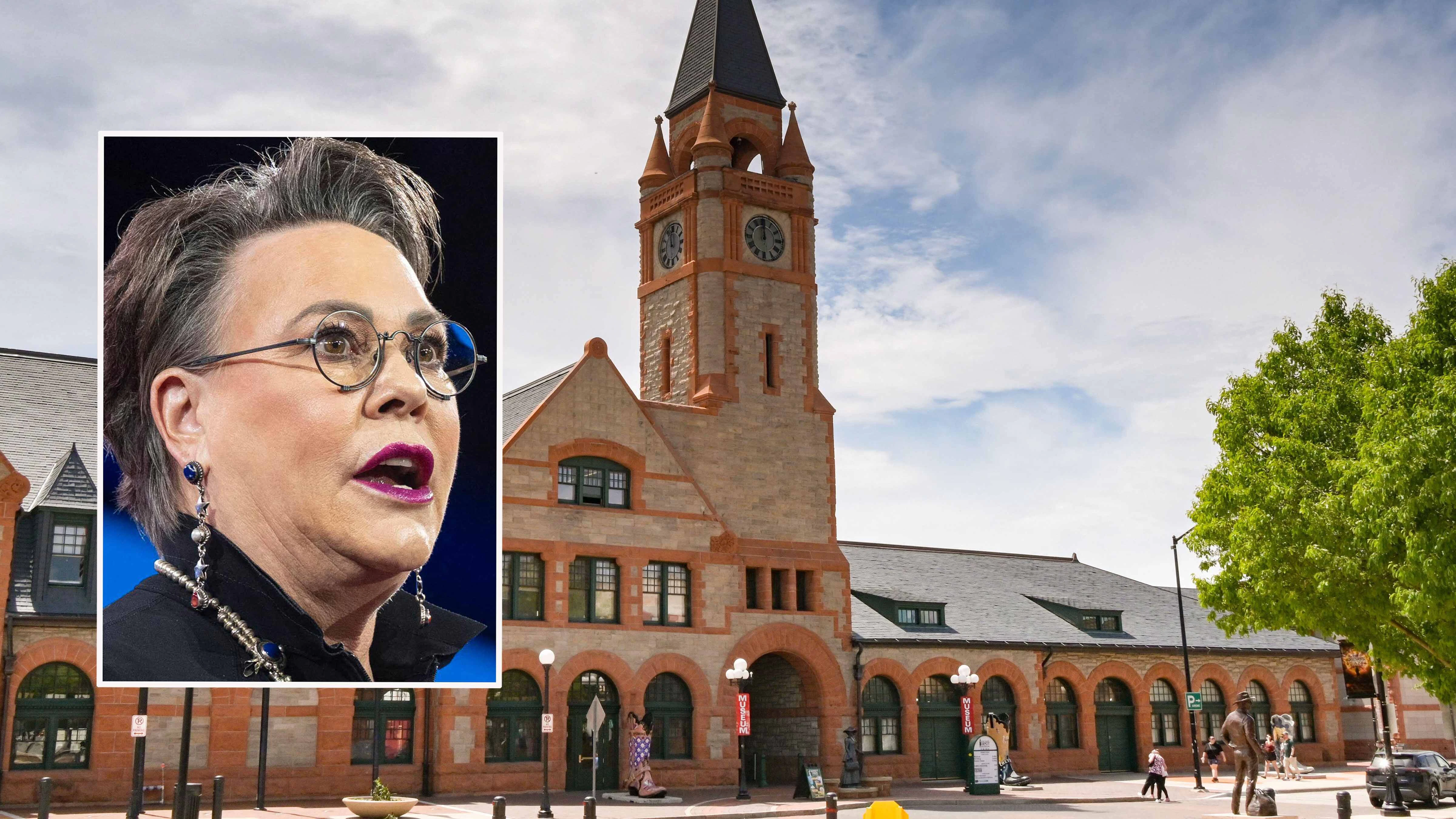
Degenfelder Releases Trump Double-Down Endorsement With A Month Before Primary
Megan Degenfelder’s campaign for Wyoming governor released a video early Thursday of President Donald Trump doubling down on his endorsement of her. The push comes with a month to go before Wyoming’s hotly contested Republican Primary election.
Clair McFarlandJuly 16, 2026
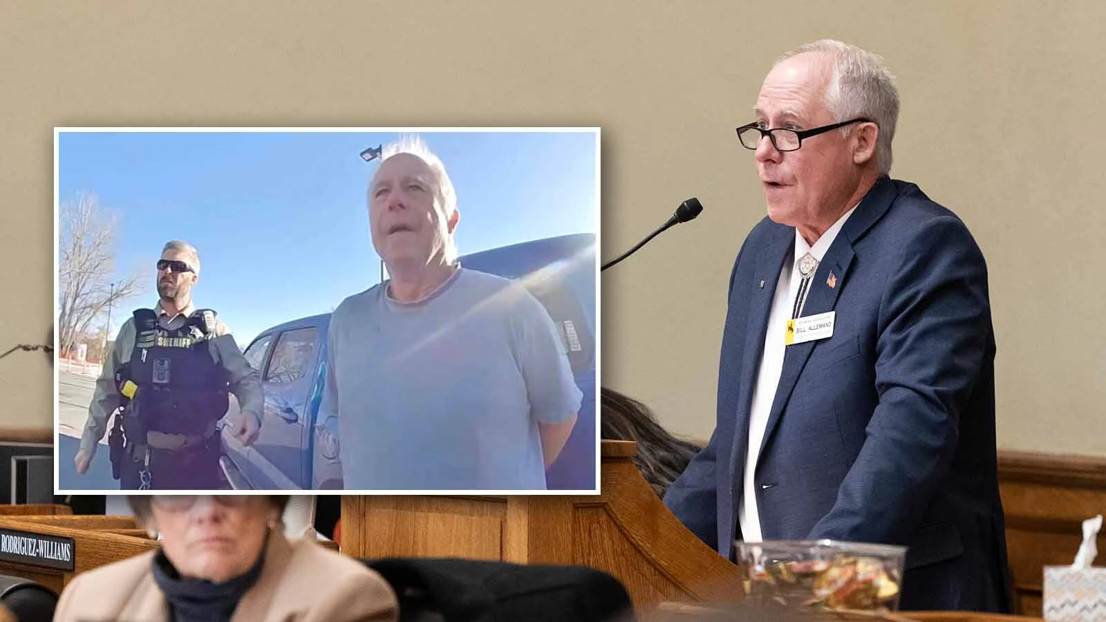
Rep. Bill Allemand Pleads Guilty To DUI, Gets Probation And $500 Fine
Wyoming state Rep. Bill Allemand pleaded guilty to DUI in court Wednesday and was given one year probation and fined $500. He faces 88 days in jail if he fails probation.
Clair McFarlandJuly 15, 2026

Yellowstone Records Earthquake Thursday Morning, Tourist Hears Explosion At Epicenter
A magnitude 3.3 earthquake in Yellowstone on Thursday was felt by people as far away as 30 miles. One tourist, who was standing at the epicenter of the quake, said the earth under her feet shake and she heard a loud explosion. "We were shocked by the sound of it."
Andrew RossiJuly 16, 2026

Most Destructive Tornado In Wyoming’s History Leveled Cheyenne 47 Years Ago
It was 47 years ago on July 16, 1979, when a massive tornado ripped through Cheyenne, leveling hundreds of homes and killing a 14-month old. Decades later, it’s still the most destructive tornado in Wyoming history.
Kerry DrakeJuly 16, 2026

Yellowstone Won’t Kill Angry Bison That Tossed, Seriously Hurt Man At Campground
Yellowstone National Park will spare the life of the bison that seriously hurt a 65-year-old grandpa from Washington. Park officials said “no management action” will be taken against the bison which means it won’t be relocated or euthanized.
Andrew RossiJuly 15, 2026

Guest Column: Data Centers — Lead, Follow, Or Get Out of the Way
Wyoming Gov. Mark Gordon writes, "President Trump, in a recent statement said this, 'Data centers are tremendous wins for the states and communities that are lucky enough to get them.' I concur. He is exactly right."
Guest ColumnJuly 16, 2026

Reporter’s Notebook: How Photo Of 1979 Cheyenne Tornado Made National News
Cowboy State Daily reporter Kerry Drake covered the July 16, 1979 Cheyenne tornado for the Wyoming State Tribune newspaper. Now, 47 years later, Kerry discusses how he and his colleague reported on the deadly tornado, the biggest to ever hit the state.
Kerry DrakeJuly 16, 2026

Family Hurt In Semi Crash That Killed 2 West Of Casper Sues Trucker, Company
A family hurt in a crash west of Casper that killed two people when a semitruck plowed into a construction zone is suing the trucking company and the as-yet unidentified truck driver. No criminal charges have yet been filed as an investigation continues.
Kolby FedoreJuly 15, 2026

License Plate Reader Map Right That Lusk Has Them, Wrong About Cody And Gillette
As people across Wyoming raise concerns over license plate reader cameras, they're mapping cameras that might not actually be license plate readers. A new Deflock.org entry saying Lusk has them is right, but it’s wrong about Cody and Gillette.
Clair McFarlandJuly 15, 2026

Full Implications Of Fed Move To Hand Grizzly Management Over To States Unclear
It remained unclear Wednesday whether a federal decision to hand management of grizzlies over to the state will set the stage for a full delisting of grizzlies. But Rep. Harriet Hageman said efforts will continue to get them delisted through legislation.
Mark HeinzJuly 15, 2026

$30M Kemmerer Wildlife Crossing Ahead Of Schedule, $28M Dubois Project Stalled
A $30 million wildlife crossing in a “death zone” for deer on U.S. Highway 189 near Kemmerer is about a year ahead of schedule. But another $28 million project near Dubois, which conservationists say is equally vital, is stalled over money.
Mark HeinzJuly 15, 2026

Former Shoshoni Senior Center Official Accused Of Scamming $33K From 93-Year-Old
The former assistant director of the Shoshoni Senior Center has been charged on suspicion of scamming more than $33,000 from a 93-year-old client. She told police the woman would sometimes hand her $1,000 and say, “Go have fun."
Kolby FedoreJuly 15, 2026

Meta Appeals Cheyenne Notice Of Violation Over Sewer Contamination
Meta told Cowboy State Daily on Tuesday that it is appealing a violation notice issued by Cheyenne's Board of Public Utilities arguing the city has not provided evidence that the company's construction project contaminated the city's sewer reuse system.
Kate MeadowsJuly 15, 2026

Crash Shuts Down Highway 20/26 Near Shoshoni For Hours In Near 100-Degree Heat
A blown tire on a semitrailer sent it into the opposite lane, sideswiping a GMC Yukon and closing U.S. 20/26 near Shoshoni for more than four hours Wednesday, stranding motorists in near 100-degree heat.
Kolby FedoreJuly 15, 2026

U.S. House Hopefuls Biteman, Balow Grilled By Riverton's Political Old Guard
U.S. House hopefuls Bo Biteman and Jillian Balow became the latest candidates to face a grilling Wednesday, by Riverton's political old-guard coffee group "The Gentry." Balow said the race has people of good character, and some "of suspect character."
Clair McFarlandJuly 15, 2026
House Passes Permanent Daylight Saving Time Bill, Hageman Votes Against
The U.S. House passed a bill Tuesday to make daylight saving time permanent, but Rep. Harriet Hageman was one of only 22 Republicans who voted against it, arguing it would put schoolchildren in the dark and take morning sunlight from farmers and ranchers.
Kolby FedoreJuly 15, 2026

Teton County Is So Desperate For Housing It Wants To Build It On A Morgue
Some county commissioners say putting an employee housing complex on top of a morgue makes sense due to the housing shortage but the coroner's office is strongly against it. They say the smell is like being “downwind of the carcass disposal pit."
Clair McFarlandJuly 14, 2026

Why Microsoft Can Skip State Review For 3,500 More Data Center Acres In Cheyenne
Why can a project as massive as Microsoft’s planned 3,500-acre expansion avoid Wyoming’s Industrial Siting Council while wind farms and other major industrial facilities usually cannot? It’s not a loophole or a data-center-specific workaround. It's state law.
Renée JeanJuly 14, 2026

Wyoming Game And Fish Commission Cuts Wolf Hunt Quotas By More Than Half
With northwest Wyoming’s wolf population at a 20-year low, the state Game and Fish Commission on Tuesday cut the wolf hunt limits by more than half. Some advocates said that’s not enough, arguing to suspend hunting wolves altogether.
Mark HeinzJuly 14, 2026

Yellowstone Photographer Ran After Bison To Get It Away From Flipped Grandpa
The photographer who shot video of the Yellowstone bison attacking the 65-year-old grandpa ran after the animal when he saw it standing over the man. "I just started running at the bison, yelling, jumping in the air, trying to be intimidating,” he said.
Andrew RossiJuly 14, 2026

On Second Thought, No Press Conference On Cheyenne Meta Data Center Contamination
Despite promising a press conference this week to address the Meta data center contamination of Cheyenne’s wastewater system, the Board of Public Utilities now says it won’t, opting instead to release a statement addressing questions.
Kate Meadows & Clair McFarlandJuly 14, 2026

Judge May Hit Allemand’s Defense Lawyer With Contempt Charge For Missing Hearing
The judge in state Rep. Bill Allemand's ongoing DUI case may hit his defense attorney with a contempt charge for missing a hearing. The attorney says he “did not intentionally fail to appear” and calls the no-show a scheduling mishap.
Clair McFarlandJuly 14, 2026

Gold Dust, Hoop Skirts And Cannon Booms: Gold Rush Days In South Pass City, Wyoming
Once a roaring gold capital, South Pass City, Wyoming, comes to life for one summer weekend every year for Gold Rush Days. There's cannon fire, gold panning, and guests who look the part in one of the West’s best-preserved Gold Rush towns.
Renée JeanJuly 14, 2026
Daily Features
View all
Today's Wyoming sunrise was captured by Lisa Gillem. Lisa writes, "Today’s sunrise was taken outside of Cody, Wyoming, at 0544 hours this morning off of Southfork Road."


Today's question to Don Day
In regard to your thunderstorm season article, can you reassess the data on a per-capita basis, especially when considering population of the states? It could affect me as I own a hill on my property which I plan a communications tower and likely will have a lightning rod installed when it goes in.
FEMA has a good lightning database that takes into account lightning risk, potential property loss, etc. based on population and lightning frequency. Data is available on a county by county basis. Lots and lots of lightning data available here which may help in quest for more lightning information. https://hazards.fema.gov/nri/lightning
Opinion
Joan Barron: Does Trump Help Or Hurt Degenfelder?
Opinion by Joan Barron
Bill Sniffin: This Crazy U. S. House Race Is Historical For Its $20 Million Cost
Opinion by Bill Sniffin
Dennis Sun: Consumers Are More Selective When Buying Protein
Opinion by Dennis Sun
Jonathan Lange: Nameless Libertarians Refute Themselves
Opinion by Jonathan Lange
Rod Miller: Lions and Tigers And Data Centers, Oh My!
Opinion by Rod Miller
Sponsored
View all
Heading to Cheyenne Frontier Days™?
Here's What You Need to Know Before You Go
July 08, 2026

The Wyoming Way: Helping Neighbors, Feeding Families, Strengthening Communities
From young families and grandparents raising grandchildren to caregivers and retirees, Wyomingites across the state are feeling the pressure of rising costs. Food Bank of Wyoming is encouraging communities to come together to ensure everyone has access to nutritious food. This WyoGives Day, July 15, donors can help support both local families and Wyoming producers.
July 07, 2026

AAA Urges Drivers to Keep Wyoming Roads Safe This Fourth of July
With 61.4 million travelers expected to drive to celebrate the Fourth of July, AAA calls on Wyomingites to protect everyone on the road by planning a safe ride home, and slowing down and moving over for stopped vehicles on the shoulder.
June 29, 2026
Opinion
View all
Rod Miller: Sombrero Etiquette for Politicians
Columnist Rod Miller writes, "Nothing says 'dude' or 'drugstore' more than a politician wearing a hat that makes them look they are cos-playing. So please consider this screed as a helpful primer on the proper wearing of a cowboy hat – a Stetsons for Dummies, if you will."
Rod MillerJuly 10, 2026
Bill Sniffin: July’s Parades Are Coming Out Parties For Our Wyoming Politicians
Columnist Bill Sniffin writes: “Early in the year, most politicians operate in obscurity. But once July’s parade season hits, political competition rises to the top of favorite activities.”
Bill SniffinJuly 11, 2026

Joan Barron: 'Property Tax Initiative’ May Be Too Generous
Columnist Joan Barron writes, "Property taxpayers like me are confused. Property taxes pay a large share of the cost of public schools. That lost property tax money will need to be replaced — back-filled — most likely by sales taxes."
Joan BarronJuly 11, 2026
Wyoming Life
View all
Holy Smokes: Muzzleloader Is Loads And Reloads Of Fun For Kids At State Shoot
Jackie DorothyJuly 13, 2026
Glass-Plate Family Photos Help Tell Story Of Buffalo Bill State Park In Early 1900s
Amber SteinmetzJuly 13, 2026
From Wyoming Coal Miner’s Son To Closer: How Larry Morgan Achieved The American Dream
Renée JeanJuly 12, 2026
Wyoming History: Chief Red Cloud Was Locked Up In Casper For Killing Wild Game
Dale KillingbeckJuly 12, 2026
Longtime Knifemaker Transforming Dubois' Outlaw Bar From Dive Into Destination
Renée JeanJuly 12, 2026
Outdoors
View all
Washington Grandfather Recovering In Hospital After Yellowstone Bison Attack
Andrew RossiJuly 13, 2026
Tourist Seriously Injured After Yellowstone Bison Launches Man 8 Feet In The Air
Andrew RossiJuly 11, 2026
Save It For Later: 'Snow Farming' Is Keeping Ski Seasons Alive Across Rockies
Leo Wolfson For Cowboy State DailyJuly 06, 2026
Inside The Mission To Save 136-Year-Old Anderson Lodge In Wyoming Bear Country
Renée JeanJuly 05, 2026
Montana Rancher More Than 100 Miles From Rocky Mountains Says Grizzly Mauled Horse
Mark HeinzJuly 04, 2026
Crime & Courts
View all
Casper Man Pleads Not Guilty To Role In Deadly Apartment Shootout
Dale KillingbeckJuly 14, 2026
Repeat Cody Sex Offender Accused Of Pleasuring Himself Next To Van Of Camp Kids
Kolby FedoreJuly 14, 2026
Wheatland Officer Runs Out Of Gas During 112 MPH Chase, Still Gets Driver
Greg JohnsonJuly 14, 2026
Gillette Couple Accused Of Scamming Neighbor With Dementia Out Of 1965 Mustang
Kolby FedoreJuly 14, 2026
Lovell Woman Charged With Felony For Allegedly Burning Child, Fracturing Skull
Kolby FedoreJuly 13, 2026
Wyoming Life
View allHoly Smokes: Muzzleloader Is Loads And Reloads Of Fun For Kids At State Shoot
Jackie DorothyJuly 13, 2026
Glass-Plate Family Photos Help Tell Story Of Buffalo Bill State Park In Early 1900s
Amber SteinmetzJuly 13, 2026
From Wyoming Coal Miner’s Son To Closer: How Larry Morgan Achieved The American Dream
Renée JeanJuly 12, 2026
Wyoming History: Chief Red Cloud Was Locked Up In Casper For Killing Wild Game
Dale KillingbeckJuly 12, 2026
Longtime Knifemaker Transforming Dubois' Outlaw Bar From Dive Into Destination
Renée JeanJuly 12, 2026
Outdoors
View allWashington Grandfather Recovering In Hospital After Yellowstone Bison Attack
Andrew RossiJuly 13, 2026
Tourist Seriously Injured After Yellowstone Bison Launches Man 8 Feet In The Air
Andrew RossiJuly 11, 2026
Save It For Later: 'Snow Farming' Is Keeping Ski Seasons Alive Across Rockies
Leo Wolfson For Cowboy State DailyJuly 06, 2026
Inside The Mission To Save 136-Year-Old Anderson Lodge In Wyoming Bear Country
Renée JeanJuly 05, 2026
Montana Rancher More Than 100 Miles From Rocky Mountains Says Grizzly Mauled Horse
Mark HeinzJuly 04, 2026
Crime & Courts
View allCasper Man Pleads Not Guilty To Role In Deadly Apartment Shootout
Dale KillingbeckJuly 14, 2026
Repeat Cody Sex Offender Accused Of Pleasuring Himself Next To Van Of Camp Kids
Kolby FedoreJuly 14, 2026
Wheatland Officer Runs Out Of Gas During 112 MPH Chase, Still Gets Driver
Greg JohnsonJuly 14, 2026
Gillette Couple Accused Of Scamming Neighbor With Dementia Out Of 1965 Mustang
Kolby FedoreJuly 14, 2026
Lovell Woman Charged With Felony For Allegedly Burning Child, Fracturing Skull
Kolby FedoreJuly 13, 2026