
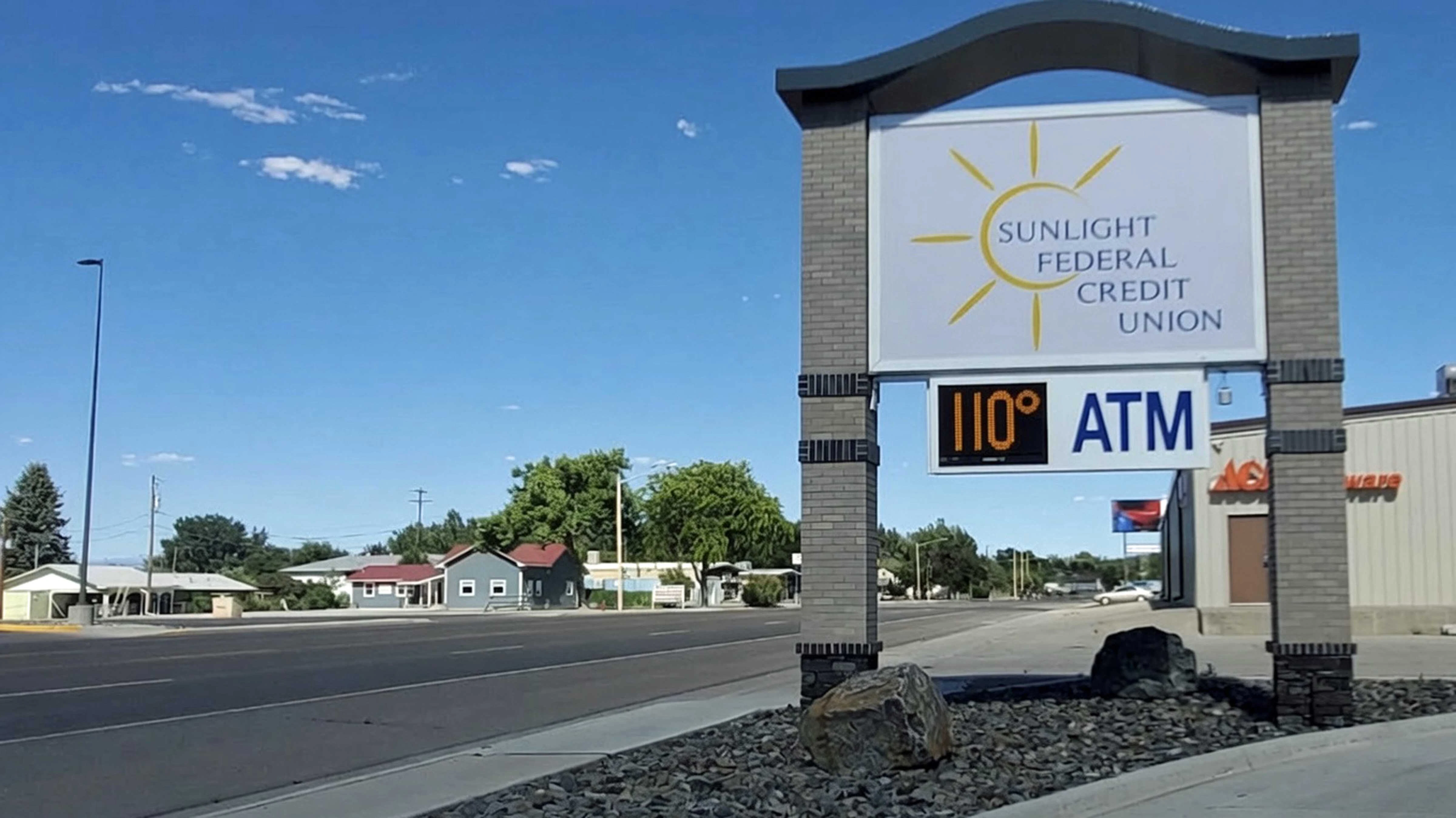
For many Wyoming communities, Sunday was the hottest day in recorded history.
The hottest in Worland’s recorded history was June 30, 1990, when it was 107 degrees. According to the National Weather Service office in Riverton, the high at Worland Municipal Airport on Sunday was 110.
The daytime high at Sheridan County Airport was 109 degrees. That broke the old record of 104 set in July 2021.
Buffalo's all-time high was also 104 degrees, set in July 2021. Its threshold was broken with a high of 105 degrees Sunday.
At Lake Yellowstone in Yellowstone National Park, Sunday’s high was 88 degrees. The previous record was 86, set on July 19, 2021.
“It was certainly a hot day in Wyoming,” said meteorologist Trevor Lavoie with NWS Riverton.
Hot, Hot, Hot
Lavoie said the source of Sunday’s high temperatures was “an anomalous area of high pressure” that settled over the Rocky Mountain Region this weekend. Wyoming was on the outside edge, so it didn’t get as hot as it could have.
Miles City, in eastern Montana, reached an all-time high of 115 degrees Sunday. That’s two degrees shy of the hottest temperatures ever recorded anywhere in Montana.
In Wyoming, Riverton also experienced an all-time record-high temperature.
“Riverton Airport hit 104, breaking the all-time record of 102 on June 18, 2006,” Lavoie said.
The temperature most notable to Lavoie was a tie for the all-time high in Lander.
“Lander tied its all-time record at 102, set on July 27, 1935,” he said.
That 102-degree tie stood out because Lander has one of the longest climate records in Wyoming, going back to 1896.
“Some records are longer, and there might be outliers in those records,” he said. “The fact that Lander tied its all-time record is, in and of itself, significant.”
Called It, Don’t Read Into It
Cowboy State Daily meteorologist Don Day wasn’t surprised by the records. He also discouraged people from trying to make broad assumptions from that data.
“I don't think you should try painting with a broad brush with this from a geographic standpoint,” he said. “Sunday was certainly extreme, there's no doubt about it, but breaking an all-time record on Sunday means it’s the hottest since they’ve been keeping records.”
Many Wyoming communities broke records for July 12, specifically, but not all-time highs. That was expected, according to Day.
“The southern part of the state was saved by upslope, so we didn't see any records,” he said. “Cheyenne didn't break a record. Laramie didn't break a record. Douglas did by one degree. This heat wave was biased toward the northern part of the state.”
Day went as far as to say it was “the most intense heat wave in the Northern Hemisphere this summer.” However, Wyoming got off comparatively easy.
“Ground zero was southeast Montana and the western halves of the Dakotas,” he said. “That’s why we didn’t see as many all-time records broken in Wyoming. It’s hard for a heat wave to break all-time high records, even in July, which is the hottest month of the year.”
Barely Cooling It
Monday wasn’t as warm as Sunday, but temperatures still hit triple digits in Greybull, Riverton and Shoshoni. Greybull might have set an all-time high Sunday, but it hadn’t been reported as of Monday afternoon.
The extended forecast isn’t providing much relief. Both Day and Lavoie said Tuesday is poised to be as hot as Monday, if not hotter, and the rest of the week will be only slightly cooler.
“We’re still looking at temperatures in the range of 100 to 105 degrees east of the Continental Divide on Tuesday,” Lavoie said. “The main factor that will be a bit of a hindrance to the heat is an increase in moisture and a rise in the dew points later on this week.”
Higher dew points mean more moisture in the atmosphere. That will decrease daytime temperatures across Wyoming, even if only by a few degrees.
There will be more relief as the “anomalous area of high pressure” starts to dissipate and shift eastward. When that happens, the void could be filled by cooler, wetter weather.
“Temperatures will spike up on Tuesday, but I don't think they'll go back to Sunday's levels,” Day said. “Once we get into mid to late week, we're going to start to see subtropical moisture get into northern Wyoming. That will produce some cloudiness and a few showers, which will be enough to stave off the worst of it.”
Of course, Wyoming’s weather is never a one-size-fits-all solution. While relief will slowly reach everyone, some will be waiting longer than others.
“I need to make it absolutely clear that the western side of the state is going to have the first taste of (monsoonal moisture) later this week and this weekend,” Day said. “It’s not going to get into Cheyenne, Laramie, Casper, Torrington, Gillette, and Sundance until next week.”
That means Wyomingites need to keep themselves well hydrated and out of the sun, if they can, during the heat of the day, he said. There’s another week, at least, of scorchingly high temperatures to endure.
Can it get worse? It’s possible, but Day said he believes it’s unlikely.
“I would say that it's going to be warmer than average for the rest of July and early August,” he said. “However, I don’t think there’s going to be another mechanism that could get as intense as or surpass what happened on Sunday.”
Andrew Rossi can be reached at arossi@cowboystatedaily.com.


