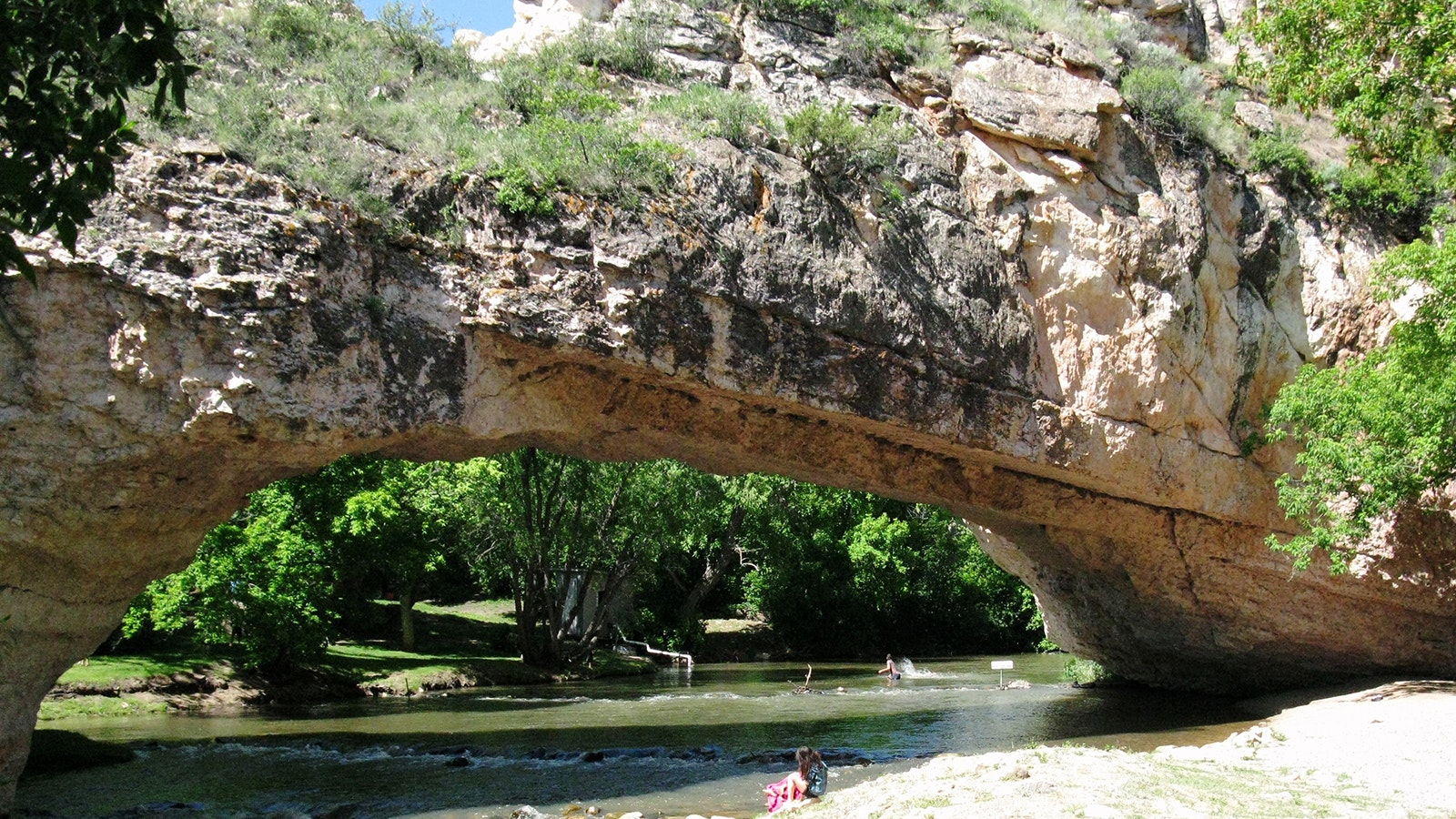
As the main north-south corridor through Wyoming, thousands of vehicles daily making good time on Interstate 25 at 80 mph speed past the signs at Exit 151: “Ayres Natural Bridge.”
What many of those drivers don’t know is that just minutes off the interstate about 15 minutes southwest of Douglas is one of the rarest geologic formations in the United States, and an often-overlooked item on many Wyoming tourism bucket lists.
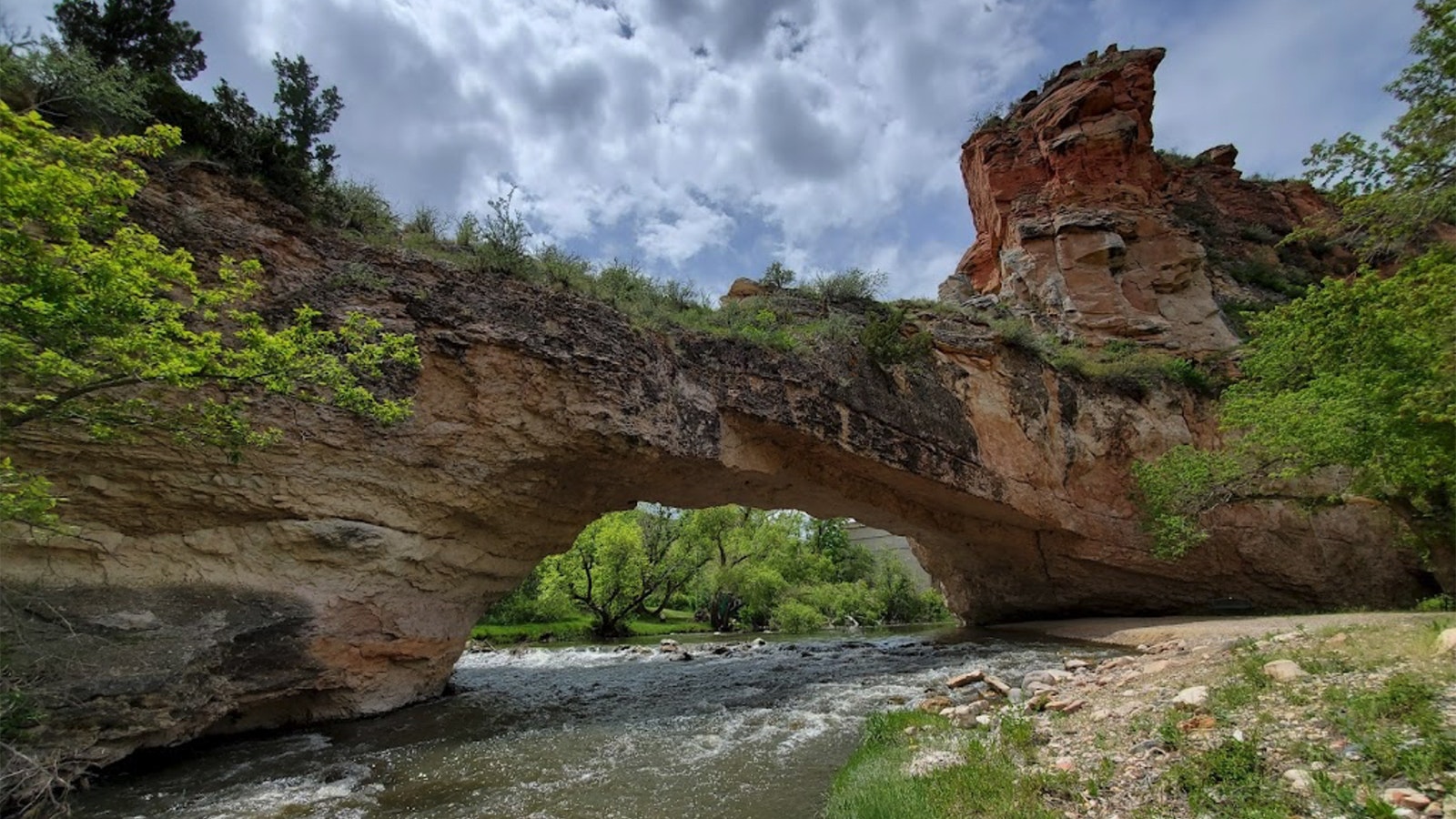
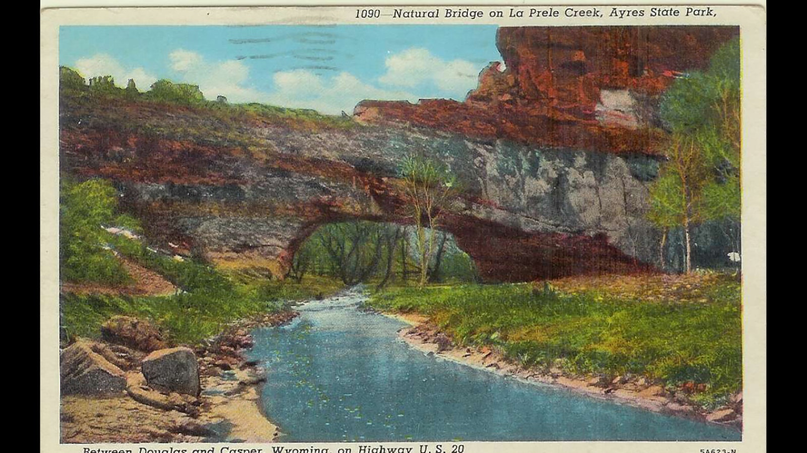
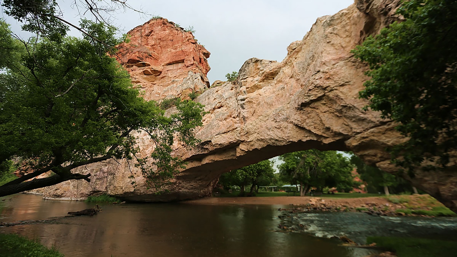
Ayres Natural Bridge is just what it says — a natural limestone and sandstone bridge that formed naturally over La Prele Creek over millions of years. And while there are many famous and spectacular natural arches in the American West, Ayers is one of only three natural bridges in the United States with water still running beneath it.
And despite it only being about 2 miles from the Oregon Trail, few making the migration Westward ever knew it was there.
What Is It?
Ayres Natural Bridge is a 30-foot-high, 50-foot-wide span of natural limestone and sandstone that built up in layers over the millennia.
As La Prele Creek meandered through the region, a small space between bends in the creek allowed water in, and over time that water ate away at those layers of rock until they finally collapsed, forming the natural bridge.
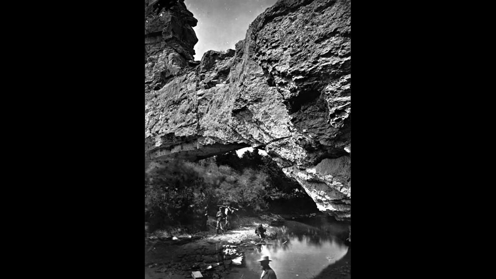
And while thousands of people passed so close to it on the Oregon Trail, it remained relatively obscure because few would expend extra energy venturing off the trail. That’s likely why the bridge isn’t mentioned much in journals of the time, along with the fact that before La Prele Dam was built in 1909, accessing the site required a challenging hike down a steep canyon wall through heavy brush.
Westward, Ho
But for those who explored a little, the natural bridge was a hidden marvel.
“Rode off in advance of the camp with Sir Wm. (William Drummond Stewart) to visit a remarkable mountain gorge,” wrote Matthew Field on July 13, 1843, according to the Wyoming Historical Society. A reporter for the New Orleans Picayune newspaper, Field was traveling with Stewart, a noted British Army officer and explorer.
He described the bridge as “regular as tho’ shaped by art — 30 feet from base to ceiling, and 50 to the top of the bridge; wild cliffs 300 feet perpendicular beetled above us, and the noisy current swept along among huge fragments of rock at our feet.”
Although the bridge was over La Prele Creek, Field wrote that, “We call the water ‘Bridge Creek.’”
Four years after Field’s visit, Brigham Young and the first group of Mormons making their way West came through. And it’s earned notes in the journals of other early explorers.
In an 1850 journal entry, a man named Isaac Starr described coming upon the bridge.
“I passed up the river, rode through beneath the arch, and viewed with delight the grand works of Nature,” he wrote.
Because Native Americans in the region believed evil spirits lived under the natural bridge, early settlers sometimes would seek refuge there.
It wasn’t until 1910 that someone claimed the land. That’s when Alvah Ayres was awarded a land patent for it, and in 1919 his son donated the property to Converse County.
It remains a free-access public park.
Worth A Stop
It didn’t take long for the county to market the area as a park to the point Ayers Natural Bridge was considered one of Wyoming’s first tourist attractions. It remains a poplar local spot for hiking, rafting, mountain biking and fishing, along with hosting outdoor weddings and other celebrations (weather permitting).
To get there, take exit 151 off I-25 about 10 miles west of Douglas, then turn south. There are plenty of signs pointing the way.
Editor's note: This story has been corrected to clarify that Ayers Natural Bridge is one of three in the U.S. with water still running under it, not one of three overall.
Want to know what the heck something is in Wyoming? Ask Managing Editor Greg Johnson and he’ll try to find out. Send your “What the heck is …” questions to him, along with high-quality horizontal photos of whatever it is to Greg@CowboyStateDaily.com.
Other stories in Cowboy State Daily’s “What The Heck …” series:
Who The Heck … Decorates That Tree In The Middle Of Nowhere North Of Sheridan?
Why The Heck … Does Green River, Wyoming, Have An Intergalactic Spaceport?
What The Heck … Is That Apocalyptic Ruined City On The Way To Yellowstone?
What The Heck … Is That 400-Foot Snaggle Tooth Rock North Of Rock Springs?
What The Heck … Is That Giant Mineral Dome In Thermopolis?
Why The Heck … Is A Camel The Mascot For A Wyoming High School?
What The Heck Is … That Old Stagecoach Stop Off I-80 Near Green River?
What The Heck Is … That Airplane On A 70-Foot Pole Along I-90 In Wyoming?
What The Heck Is … That 30-Foot Virgin Mary Statue On I-80 At The Nebraska Border?
What The Heck … Is That Giant Face On The Hill Overlooking Green River?
What The Heck Is … That 60-Foot Pyramid In the Middle Of Nowhere Off I-80?
What The Heck Is … The Vore Buffalo Jump Along I-90 In Northeast Wyoming?
What The Heck Is … With Betty Boop, Big Boy And That Sinclair Dinosaur North Of Cheyenne?
What The Heck Is … That Giant Abraham Lincoln Head Overlooking I-80 At The Top Of Sherman Hill?
What The Heck Is … That Lonely Grave On A Hill Overlooking Interstate 80?
What the heck is … That Lonely Tree Growing Out Of A Rock In The Middle Of I-80?
What The Heck Is … That Lonely Big Boy Statue In the Middle Of A Field In Wapiti, Wyoming?
What The Heck Is … That Giant 13.5-Foot-Tall Head On A Corner In Laramie, Wyoming?
Greg Johnson can be reached at greg@cowboystatedaily.com.

