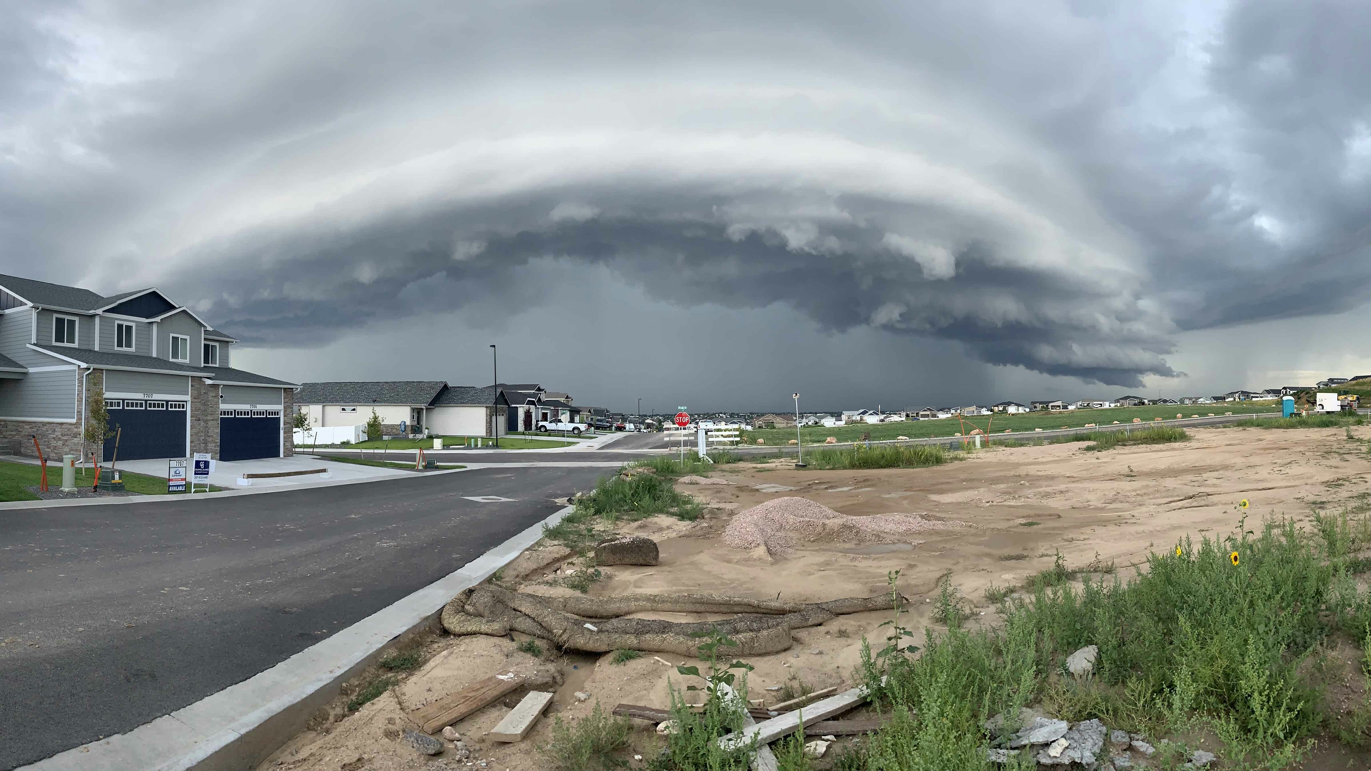
It’s Tuesday, August 8, and the cool and unsettled weather continues for today, and severe weather possible in southeastern Wyoming. A warmup begins Wednesday, with temperatures returning to near normal by the end of the week.
Central:
Casper:
Scattered showers and thunderstorms today, and mostly cloudy, with a high near 72. Winds could gust as high as 20 mph. Partly cloudy and breezy tonight, with a low around 52, and gusts as high as 20 mph.
Lander:
There’s a 40 percent chance of showers and thunderstorms this afternoon, with a high near 67. Mostly clear tonight, with a low around 48.
Shoshoni:
Isolated showers before noon, then isolated showers and thunderstorms between noon and 4pm, with a high near 73. Mostly clear overnight, with a low around 52.
Southwest:
Evanston:
A chance of showers, with thunderstorms also possible after 9am, otherwise partly sunny, with a high near 68. Mostly clear overnight, with a low around 42.
Green River:
Scattered showers and thunderstorms, mainly before 3pm. Mostly cloudy and breezy, with a high near 65, and winds gusting as high as 23 mph. Mostly clear and breezy overnight, with a low around 46; winds could gust as high as 21 mph.
Cokeville:
A 50 percent chance of showers and thunderstorms in the morning, then gradually becoming mostly sunny, with a high near 64. Overnight, patchy fog after 1am, otherwise, mostly clear and breezy, with a low around 41 and wind gusts as high as 21 mph.
Western Wyoming:
Pinedale:
A chance of showers, with thunderstorms also possible after 9am, and a high near 59. Overnight, mostly clear, with a low around 41.
Afton:
Showers and thunderstorms likely, mainly before 4pm, with a high near 64. Patchy fog after 2am, otherwise, mostly clear overnight, with a low around 43.
La Barge:
A 50 percent chance of showers and thunderstorms, mainly before 3pm, with a high near 65. Breezy, with wind gusts as high as 23 mph. Overnight, mostly clear and breezy, with a low around 40 and winds gusting as high as 21 mph.
Northwest:
Dubois:
A chance of showers, with thunderstorms also possible after 10am, and a high near 60. West northwest wind 6 to 14 mph, with gusts as high as 20 mph. Overnight, mostly clear and breezy, with a low around 42, and gusts as high as 20 mph.
Jackson:
A chance of showers, with thunderstorms also possible after 9am, and a high near 62. Overnight, partly cloudy, with a low around 41.
Old Faithful in Yellowstone National Park:
A chance of showers, with thunderstorms also possible after 9am; mostly cloudy, with a high near 60. Patchy fog after 2am, otherwise, partly cloudy overnight, with a low around 41.
Bighorn Basin:
Thermopolis:
Scattered showers and thunderstorms, mainly before 4pm, with a high near 73. Overnight, mostly clear, with a low around 56.
Cody:
Scattered showers and thunderstorms, mainly before 4pm; mostly cloudy, with a high near 70. Overnight, partly cloudy, with a low around 53.
Lovell:
Isolated showers before noon, then isolated showers and thunderstorms between noon and 5pm; otherwise partly sunny, with a high near 76. Overnight, partly cloudy, with a low around 55.
North Central:
Buffalo:
Scattered showers and thunderstorms before 2pm, then showers likely and possibly a thunderstorm between 2pm and 4pm, then scattered showers and thunderstorms after 4pm. Otherwise mostly cloudy, with a high near 69. Overnight, isolated showers and thunderstorms, but partly cloudy, with a low around 54.
Sheridan:
A 50 percent chance of showers and thunderstorms after noon, otherwise mostly sunny, with a high near 79. There’s a 20 percent chance of showers and thunderstorms before 9pm. Mostly clear overnight, with a low around 49.
Story:
Showers likely and possibly a thunderstorm, mainly after noon, otherwise partly sunny, with a high near 72. There’s a 20 percent chance of showers and thunderstorms before 9pm, otherwise mostly clear overnight, with a low around 50.
Northeast:
Gillette:
There’s a 40 percent chance of showers and thunderstorms after noon, otherwise mostly sunny, with a high near 76. There’s a 20 percent chance of showers and thunderstorms before midnight. Partly cloudy overnight, with a low around 53.
Sundance:
A 30 percent chance of showers and thunderstorms, mainly after 3pm, otherwise mostly sunny, with a high near 72. There’s a 20 percent chance of showers and thunderstorms before midnight. Partly cloudy overnight, with a low around 52.
Hulett:
A 30 percent chance of showers and thunderstorms, mainly after 3pm, otherwise mostly sunny, with a high near 78. Mostly clear overnight, with a low around 52.
Eastern Plains:
Torrington:
Severe weather possible this afternoon with possible hail, damaging winds, heavy rain. A 30 percent chance of showers and thunderstorms after noon, otherwise partly sunny, with a high near 80. There’s a 30 percent chance of showers and thunderstorms before midnight. Mostly cloudy overnight, with a low around 51.
Lusk:
Severe weather possible this afternoon with possible hail, damaging winds, heavy rain. A 40 percent chance of showers and thunderstorms after noon, otherwise partly sunny, with a high near 74. There’s a 30 percent chance of showers and thunderstorms before midnight. Mostly cloudy overnight, then gradually becoming mostly clear, with a low around 51.
Wright:
A 40 percent chance of showers and thunderstorms after noon, otherwise partly sunny, with a high near 74. There’s a 20 percent chance of showers and thunderstorms before midnight. Partly cloudy overnight, with a low around 51.
Southeast:
Cheyenne:
Severe weather possible this afternoon with possible hail, damaging winds, heavy rain. A 40 percent chance of showers and thunderstorms after noon, otherwise partly sunny, with a high near 76. There’s a 30 percent chance of showers and thunderstorms before midnight. Partly cloudy overnight, with a low around 50.
Laramie:
Severe weather possible this afternoon with possible hail, damaging winds, heavy rain. A 40 percent chance of showers and thunderstorms after noon, otherwise partly sunny, with a high near 73. There’s a 20 percent chance of showers and thunderstorms before midnight. Mostly cloudy overnight, then gradually becoming mostly clear, with a low around 45.
Pine Bluffs:
Severe weather possible this afternoon with possible hail, damaging winds, heavy rain. A 30 percent chance of showers and thunderstorms after noon, otherwise partly sunny, with a high near 80. There’s a 40 percent chance of showers and thunderstorms before midnight, otherwise partly cloudy, with a low around 50.
South Central:
Rawlins:
A slight chance of showers between 7am and 1pm, then a chance of showers and thunderstorms after 1pm. Mostly cloudy and breezy, with a high near 71, and winds gusting as high as 30 mph. There’s a 40 percent chance of showers and thunderstorms before 7pm. Partly cloudy and breezy overnight, with a low around 46, and winds gusting as high as 30 mph.
Saratoga:
A 30 percent chance of showers and thunderstorms after 1pm. Partly sunny and breezy, with a high near 74 and winds gusting as high as 30 mph. There’s a 30 percent chance of showers and thunderstorms before 7pm. Mostly cloudy overnight, then gradually becoming mostly clear, with a low around 43.
Wamsutter:
A slight chance of showers between 9am and noon, then scattered showers and thunderstorms after noon. Mostly cloudy and breezy, with a high near 64 and wind gusts as high as 25 mph. Mostly clear and breezy overnight, with a low around 44, and wind gusts as high as 25 mph.


