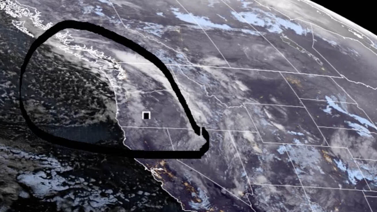
It’s Friday, March 24 – and the snow will start in this afternoon for the north and west parts of the state. In some places, a winter storm warning will be in effect through Monday.
Central:
Lander can expect isolated snow showers this afternoon, otherwise partly sunny, with a high near 36. Mostly sunny and breezy in Casper today, with a high near 45 and wind gusts as high as 30 mph. Partly sunny today in Shoshoni, with a high near 38; breezy, with gusts as high as 20 mph.
Scattered showers tonight in Lander, with a low around 19; new snow accumulation of less than a half inch possible. Casper can expect scattered snow showers overnight, with a low around 24; windy, with gusts as high as 39 mph. Shoshoni can expect 1 to 3 inches of snow overnight, with a low around 17; breezy, with wind gusts as high as 24 mph.
Southwest:
Snow showers are likely in Green River today (new snow accumulation less than one inch possible), with a high near 31; windy, with wind gusts as high as 44 mph. Evanston can expect 1 to 3 inches of snow today, with a high near 27 and wind chill values as low as 4. There’s an 80% chance of snow today in Lyman (less than an inch possible), with a high near 31 and wind chill values as low as 8; windy, with gusts as high as 33 mph.
Green River can expect isolated snow showers overnight, with a low around 12 and wind chill values as low as -5; windy, with gusts as high as 40 mph. There’s a 40 percent chance of snow showers tonight in Evanston (less than a half inch of new snow possible), with a low around 7 and wind chill values as low as -11; windy, with gusts as high as 30 mph. There’s a 20 percent chance of snow showers tonight in Lyman, otherwise partly cloudy, with a low around 10 and wind chill values as low as -9; breezy, with gusts as high as 37 mph.
Western Wyoming:
Alpine can expect 1 to 3 inches of snow today, with a steady temperature around 25; breezy, with gusts as high as 20 mph. Snow showers are likely in Pinedale today (around an inch possible), with a high near 24; blustery, with gusts as high as 26 mph. 1 to 3 inches of snow is expected in Thayne today, with a steady temperature around 25; breezy, with winds gusting as high as 21 mph.
Snow showers are likely tonight in Alpine, with 1 to 3 inches of new snow possible, and a low around 15. Pinedale could see scattered snow showers overnight (less than half an inch expected), with a low around 6 and wind chill values as low as -10; blustery, with gusts as high as 26 mph. Snow showers are likely overnight in Thayne (around an inch possible), with a low around 14.
Northwest:
Jackson can expect about an inch of new snow today, with a steady temperature around 25; breezy, with gusts as high as 23 mph. 1 to 2 inches of new snow is possible in Dubois today, with a high near 34; breezy, with wind gusts as high as 31 mph. Yellowstone National Park could see an inch of new snow today, with a high near 33; breezy, with gusts as high as 26 mph.
Snow showers are likely overnight in Jackson (less than an inch of new snow possible), with a low around 13; breezy, with gusts as high as 20 mph. Snow showers are likely tonight in Dubois (less than one inch expected), with a low around 16; breezy, with gusts as high as 31 mph. 1 to 3 inches of new snow could fall in Yellowstone overnight, with a low around 19; breezy, with gusts as high as 23 mph.
Bighorn Basin:
Cody can expect scattered snow showers this afternoon, with a high near 42; new snow accumulation of less than a half inch possible. Worland could see isolated showers this afternoon, otherwise partly sunny and breezy, with a high near 48; winds could gust as high as 23 mph. There’s a slight chance of rain and snow showers tomorrow afternoon in Thermopolis, otherwise mostly sunny and breezy, with a high near 48; winds could gust as high as 24 mph.
3 to 5 inches of snow is expected to fall in Cody overnight, with a low around 24; breezy, with gusts as high as 34 mph. Worland can expect rain showers turning to snow overnight (1 to 3 inches of new snow possible), with a low around 23; breezy, with gusts as high as 21 mph. Rain showers will turn to snow overnight in Thermopolis, with a low around 26; new snow accumulation of 2 to 4 inches possible.
North Central:
Buffalo can expect scattered snow showers this afternoon, with a high near 42. There’s a chance of rain and snow showers this afternoon in Sheridan, with a high near 45. Ranchester has a chance of rain and snow showers in the afternoon, with a high near 43.
WINTER STORM WARNING IN EFFECT THROUGH MONDAY
3 to 5 inches of snow is expected overnight in Buffalo, with a low around 24; blustery, with gusts as high as 25 mph. Sheridan can expect rain turning to snow tonight, with around 3 inches of new snow expected, and a low around 22. Heavy snow is expected in Ranchester tonight, with a low around 21; new snow accumulation of around 4 inches possible.
Northeast:
Mostly sunny today in Gillette, with a high near 46, but wind chill values as low as 19. Sundance has a 20 percent chance of snow showers this afternoon, otherwise mostly sunny, with a high near 45 and wind chill values as low as 14. Mostly sunny in Upton today, with a high near 47 but wind chill values as low as 16.
There’s a 40% chance of rain and snow tonight in Gillette, with a low around 26 and wind chill values as low as 18. Sundance has a chance of snow overnight, with a low around 22. Upton has a chance of snow tonight, with a low around 24 and wind chill values as low as 17.
Eastern Plains:
Mostly sunny in Torrington today, with a high near 52. Sunny today in Lusk, with a high near 43. Mostly sunny today in Wright, with a high near 44 and wind chill values as low as 15.
There’s a chance of rain and snow overnight in Torrington, with a low around 27. Lusk has a 30 percent chance of snow tonight, with a low around 24. There’s a 40 percent chance of snow in Wright tonight, with a low around 23 and wind chill values as low as 12; breezy, with gusts as high as 20 mph.
Southeast:
There’s a 30 percent chance of snow today in Cheyenne, otherwise partly cloudy and breezy, with a high near 43 and winds 10 to 20 mph. Laramie has a 30 percent chance of snow, otherwise partly cloudy, with a high near 36. Pine Bluffs could see a slight chance of snow today, otherwise mostly sunny, with a high near 46.
Cheyenne could expect 1 to 2 inches of snow overnight, with a low around 22; blustery, with gusts as high as 35 mph. Snow is likely tonight in Laramie (1 to 3 inches possible), with a low around 17; breezy, with winds 10 to 20 mph. There’s a 50% chance of rain and snow overnight in Pine Bluffs, with a low around 24; blustery, with gusts as high as 30 mph.
South Central:
Partly sunny and breezy today in Rawlins, with a high near 32 and wind gusts as high as 30 mph. Encampment can expect a chance of snow this morning, otherwise partly sunny, with a high near 33. Wamsutter could see isolated snow showers this afternoon, otherwise partly sunny and windy, with a high near 31; winds could gust as high as 40 mph.
There’s a 30 percent chance of snow tonight in Rawlins, with a low around 16 and wind chill values between -5 and 5; breezy, with gusts as high as 35 mph. Snow is likely today in Encampment (less than one inch possible), with a low around 13 and wind chill values between -5 and 5; breezy, with gusts as high as 30 mph. Wamsutter can expect isolated snow showers tonight, with a low around 11 and wind chill values as low as -10; breezy, with gusts as high as 37 mph.


