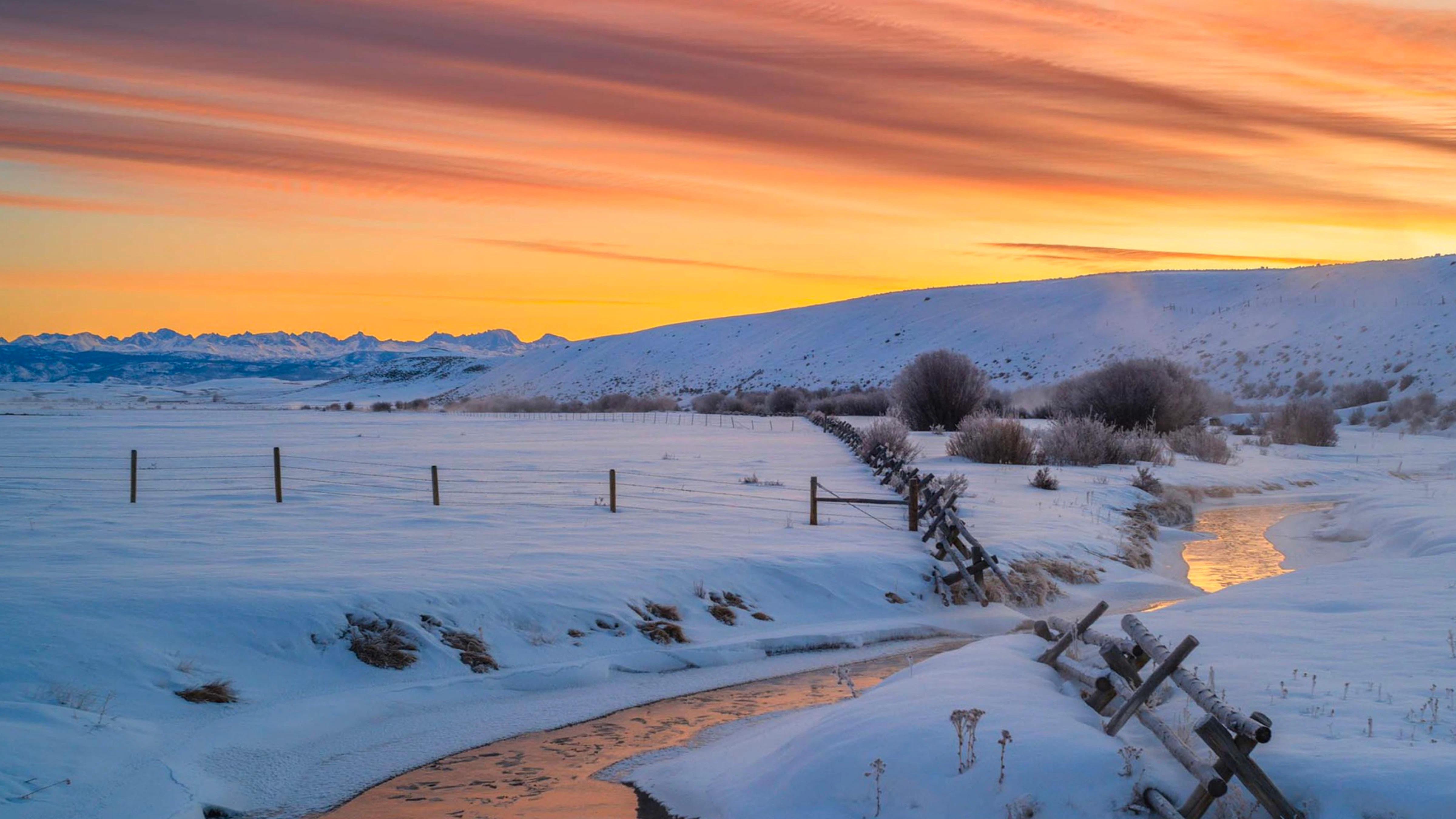
High Wind Warnings across Wyoming, snow squalls stretching from Evanston to Cheyenne, and Winter Weather Advisories in the western mountains, with up to 6 inches of snow anticipated.
And that's only Tuesday.
It’s going to be a very busy week for Wyoming’s weather. It started with 55-mph wind gusts on Tuesday and will continue with several inches of snow across the desperately dry eastern half of the state on Wednesday and Thursday.
Meteorologists aren’t seeing a persistent trend yet, but they see this week of winter weather as a promising sign. And after the winter season so far, beggars can’t be choosers.
“The next several days are going to be very busy,” said Cowboy State Daily meteorologist Don Day. “We’re going to get a little bit of everything.”
Tumultuous Tuesday
The forecast on Tuesday was dominated by High Wind Warnings. Wind gusts of up to 65 mph were anticipated across Wyoming.
Day said the wind was generated by a large storm that hit the West Coast earlier this week. It’s the first of three “separate little storms” that are going to hit Wyoming at different points this week.”
“These storms are coming in pieces,” he said. “The first piece went through the state last night and this morning, and that frontal system is what's responsible for the wind. It also produced the line of heavy snow squalls across I-80.”
Snow squalls are sudden, heavy snowstorms that emerge from strong cold fronts. Day said southern Wyoming was covered with a massive snow squall that stretched from Evanston to Cheyenne overnight.
“Anybody who was on the interstate overnight and early this morning drove through 10 minutes of heavy snow, really strong winds, and very bad visibility,” he said. “That was the first salvo of this week’s weather.”
While snow squalls covered southern Wyoming on Tuesday, heavy snow covered the western mountains. By 8 a.m., Togwotee Pass was completely covered by several inches of wet, heavy snow.
That’ll be good news for the declining snowpacks in the mountains, which tend to absorb most of the moisture from these systems. However, that won’t be the case this week.
“There's a little bit of a breather tonight,” Day said. “The next piece comes through tomorrow into Thursday morning, and many places will get enough snow to shovel.”
Wintery Wednesday
The forecast for Wednesday’s winter weather looks promising. Meteorologist Adam Dziewaltowski with the National Weather Service (NWS) office in Riverton said central and eastern Wyoming are certain to get some snow.
“We have a chance for a couple of inches of snow coming up for Wednesday into Thursday,” he said. “That’s honestly might be double what many places have seen so far this year, which is good news.”
Some of that snow could manifest as snow squalls, which could catch many Wyomingites off guard. Dziewaltowski cautioned people to prepare for genuine winter weather conditons, which have been rare this winter.
“A lot of people haven't seen snow in a while, so be sure to be prepared to be driving in the snow,” he said. “A couple of isolated snow squalls are possible, which will quickly drop visibility.”
Even the southeast corner of Wyoming should see some benefit, even if it’ll be getting the last scraps of the system.
“We're only looking at about one to two inches of total snowfall in southeast Wyoming,” said meteorologist Colby Goatley with the NWS office in Cheyenne. “As we move a bit further north, specifically Converse and Niobrara Counties, it looks like they could get closer to two to four inches of widespread snowfall.”
It’s not a lot, but it’s better than nothing.
“It’s a lot better than the last several weeks, when it’s been completely dry,” he said. “We have a chance of precipitation, at least.”
Below Average, For Once
As precipitation falls across Wyoming, temperatures will also precipitously fall. Overnight lows could reach into the teens and single digits, or even lower.
“Temperatures will be below-average, for once,” Dziewaltowski said. “We're going to see daytime highs in the upper 20s across much of Wyoming, and depending on how much snow falls, we could see overnight temperatures go below zero.”
Wednesday and Thursday will be the coldest this winter has been since the last wave of Arctic air in late January. For a change, the great impacts will be felt in south-eastern Wyoming.
“I’d draw a box from Lander and Riverton, up into the southern and eastern Bighorn Basin, to Sheridan, Buffalo, Gillette, Newcastle, Sundance, and back down to Douglas, Casper, Wheatland, and Torrington,” he said. “Those locations are probably looking at two to five inches of snow, and single-digit temperatures for overnight lows.”
Day, Dziewaltowski, and Goatley agreed that the incoming winter weather isn’t that significant, but it’s a marked difference from the above-average temperatures and below-average precipitation that have dominated the winter season.
“It’s nothing to write home about, but it’s unlike anything we’ve had in a long time,” Day said.
The Weekend Wave
The third and final “piece” of this winter weather system will reach Wyoming on Friday. Day said it won’t be as impactful as Tuesday through Thursday, but it won’t be devoid of winter-like weather.
“That'll be an I-80 corridor thing,” he said. “A little more snow, reinforced by cold air. After that, there's going to be about a three- or four-day period, Sunday through probably Wednesday of next week, where temperatures will rebound.”
Goatley said long-range forecasts indicate temperatures will once again be above average, with highs reaching the low 60s, once this winter system passes.
“That’ll still be 10 to 20 degrees above normal for this time of year,” he said. “We’re getting another ridge of high pressure, which is what has kept us dry and unseasonably warm this winter.”
These “logjams” have made the 2025-2026 winter season one of the warmest in Wyoming’s recorded history. The good news, according to Goatley, is that this logjam won’t be as strong as those from December and January.
“I am seeing some smaller systems trying to break through that ridge,” he said. “That’ll give us another shot at some precipitation, at least.”
Beggars Can’t Be Choosers
Wyoming will be blustery, snowy, and cold this week. In short, it’s everything we’ve missed for most of the winter season, up to this point.
“I'm certainly in no position to guarantee anything, but I'm encouraged by this week’s weather,” Day said. “These systems are going to impact the entire state, and we're going to start to see the frequency of storms and the opportunities for precipitation to increase.”
Dziewaltowski and Goatley were also cautiously optimistic.
“It’s been a month or two since we've really seen snow in eastern Wyoming,” Dziewaltowski said. “We're still very below what we need, but hopefully this is the start of a trend of increased chances for precipitation going into March. Beggars can’t be choosers.”
Andrew Rossi can be reached at arossi@cowboystatedaily.com.