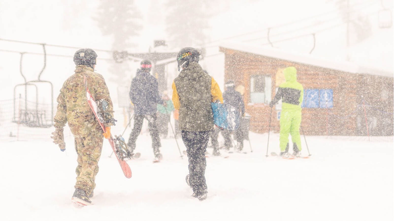
After last week’s Thanksgiving onslaught of winter, Wyoming’s ski areas are excited for more — and they’re going to get all they can handle this first weekend of December.
A very favorable weather pattern is expected to dump several inches of snow in Wyoming’s mountains, starting Thursday evening and continuing through the weekend into Monday. That means the foundation for the upcoming winter recreation season will be down and ready to build a phenomenal snowpack.
Let It Snow
Nick Piazza owns the Sleeping Giant Ski Area near the East Entrance of Yellowstone National Park. After watching the forecast for weeks, he’s giddy.
“I’ve been tracking the storm all week,” he said. “I see we’re expecting around 16 to 18 inches at Sleeping Giant. That’s going to be awesome.”
Saturday is the first day of Sleeping Giant’s winter season. A blizzard’s worth of snow will be welcome after a disappointingly dry fall.
“It’s been a really dry and warm snow year for us,” he said. “Night temperatures haven’t gotten as low as we’d like them to be. This big snowstorm should be a great start for us.”
Cowboy State Daily meteorologist Don Day thinks Piazza and winter sports enthusiasts have plenty of reason to be excited. The approaching winter pattern is “very favorable” for dumping a lot of white stuff on the mountains.
“For for skiers who been wanting a bit more snow in the mountains, you're finally going to get it,” he said. “This is a really good pattern for a nice shot of snow.”
Heavy Hitters
Day believes all of Wyoming’s ski areas will get plenty of snow, but he anticipates the winner will be Grand Targhee Resort near Alta and Jackson.
“This is a pattern where I could see Grand Targhee getting in upwards of 18 to 24 inches,” he said. “Probably around a foot for Jackson Hole Ski Area, probably 6 to 12 inches, maybe a little bit more for the other ski areas in the state.”
The key factors for heavy snowfall in the mountains are elevation and alignment. Day used Grand Targhee and Sleeping Giant as examples of how being on different sides of the mountains makes a difference in how much snow each resort will see.
“The east side of ranges that tend to get sheltered a little bit,” he said. “Grand Targhee’s going get a lot on the west side while Sleeping Giant’s going to get some, but not as much as Targhee.”
The weekend snowstorm won’t be equal, but it will be somewhat equitable. All the ski areas in Wyoming’s major mountain ranges can expect a great snowfall over the weekend.
“This is going to be a really good snow event for all alignments now,” he said.
Better Luck Next Time
As always, there’s a catch. While major mountain ranges will be covered in powder, smaller ranges won’t receive as much.
Day cited the Casper Mountain Ski Area as one where the storm will leave something to be desired.
“The storm that hit over Thanksgiving was for Casper Mountain,” he said. “In this kind of storm, it’s the bigger mountain ranges that are going to feel the full effects of the snow this weekend.
Up High, Not Down Low
Several feet of snow might make Wyomingites nervous, especially if they have to travel. The Thanksgiving weekend snowstorm dropped enough snow to close sections of Interstate 80 for several hours and caused multiple crashes and slowdowns on other state and federal highways.
Day expects some travel impacts. This will probably be the storm that closes the Battle Mountain Pass between Encampment and Baggs, and there could easily be delays on the Teton and Togwotee passes.
Beyond that, Day said the rest of Wyoming should be largely unaffected. This weekend’s weather pattern is distinctly different from last weekend’s pattern, so the areas of impact should be varied.
“This seems really counterintuitive,” he said, “but the type of weather pattern that's really good for the mountains to get a lot of snow is not the same pattern that's really good for the low elevations to get snow.”
Day said the storm that crippled Wyoming’s highways last weekend dropped more snow on the lower elevations than it did in the mountains. Some of those areas might see some snow over the weekend, but nothing significant.
“That was a good low-elevation snow, a good pattern for low elevations to get snow,” he said. “This one is a pattern that gets to the mountains.
Cheerfully Cold
The better news for Wyoming’s ski areas is that whatever falls is going to stick around. Temperatures have been cold enough for the snow to stick to the ground, building up the snowpack for the rest of the season.
“Those shady north-facing slopes hold the snow now,” Day said. “There's a lot of mountains that aren't really seeing the sun much at all right now, so the snow that is going to lay down is going to be a good base builder for these key areas.”
It’s an early Christmas gift for Piazza and many others, and there’s more to come. Piazza said the extended forecasts he’s following are giving him plenty of optimism for a strong season ahead.
“Temperatures are supposed to get a bit cooler, and the following Friday, we’re supposed to get another dump,” he said. “Old Man Winter’s a little late, but he’s coming in hard!”
Andrew Rossi can be reached at arossi@cowboystatedaily.com.