Not since 2010 have conditions been as ripe for flooding in southern Wyoming as they are this spring.
That year, rainfall and elevated snowpack, along with warmer temperatures, caused low-lying areas in the towns of Lander and Hudson to flood. Then-Gov. Dave Freudenthal requested — and was granted — federal assistance for Fremont County and the Wind River Indian Reservation.
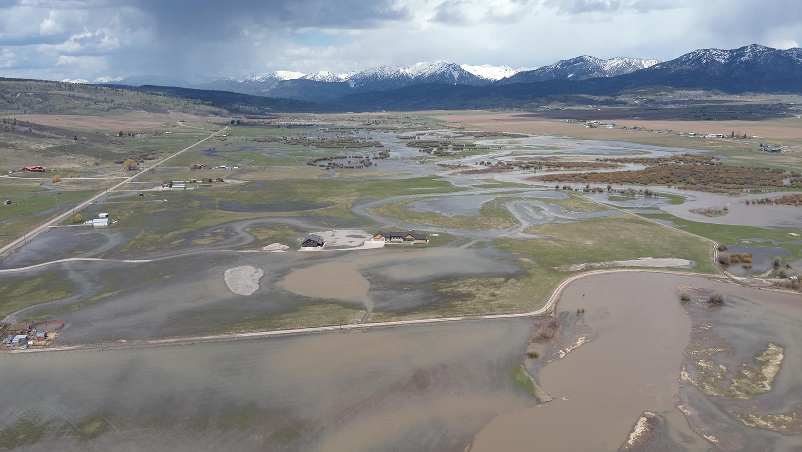
This year, conditions are lining up to create the same outcome, this time in the entire southern tier of the state. That’s according to Jim Fahey, a watershed and hydrology consultant and former hydrologist for the state of Wyoming.
“The North Platte near Saratoga, the Encampment River near Encampment and then the Little Snake going through Dixon and Baggs, those areas we’re really looking closely at,” Fahey told Cowboy State Daily. “The weather trends that are going to be in place the next two weeks could be interesting.”
Southern Wyoming On Alert
Fahey said that in any river basin in the intermountain west, including Wyoming and Colorado, the main flooding issues come from warming temperatures, followed by rain, on top of snowmelt.
And those conditions are lining up in the southern part of Wyoming, he said.
“We are looking at a little bit of above-average temperatures, and then staying rather wet through that two-, even three-week period from now,” he said. “And that area is really susceptible to rain-on-snowmelt events.
“But you have to look at the areas that still have a lot of snow to melt, and the southern areas of Wyoming — the whole southern tier, really — has the snow to do that.”
The Upper Bear River through Evanston and the Bear Valley could also expect some serious flood events.
“There's people there, of course, but it's a lot of agricultural flooding that occurs there,” said Fahey. “It takes a really good rain event to get flooding in Evanston, but that is in the forecast.”

Minor Flooding In Other Parts
Fahey said there is potential for flooding in other parts of the state as well, but he sees no signs that damaging floods could happen outside the southern part of Wyoming.
“We’ve got some minor flooding going on at the Salt River near Star Valley,” he said. “And if they get a little rain on top of that, it might create a little problem, but over the last 20 years that I've worked in Wyoming, that's usually pretty minor.”
Fahey said there’s always a chance that any basin in the state could flood, if there’s enough rain that falls in one storm.
“Like in the Wind River, where I used to live, that's always primed and ready to go,” he said. “But there’s not a lot of snow this year up there in the upper part of the Wind. But it's not going to take as much rain to get the Little Snake, the North Platte, the Laramie and the Upper Bear to start flowing very high.”
Echoes of 2010
Fahey said in May and early June 2010, a similar hydrology pattern was in place.
“There was just about the same amount of snow down there, and it was a rain on snow melt event,” he said. “It was, I think, the 8th to the 10th of June when we had the major floods down there.”
Fahey pointed out that in the Dixon-Baggs-Savory area of the Little Snake River watershed, river restoration efforts took place after the floods in 2010.
“But you know, if you don't keep up the restoration, Mother Nature tends to take over again,” said Fahey.
And he pointed out that this time of year, it’s normal for temperatures to go up and snowmelt to accelerate.
“But the kicker this year is, all the models have seen, and all the forecasts have seen, that it's really going to be wet,” said Fahey. “So that just exacerbates the problem with flooding. But it's all timing.”

‘Patterns In Chaos’
Fahey said there are parts of the state in which snow is “ripe” for melting and just waiting for the right conditions to release.
“It's water laden, ready to melt down and to create a flood, but it’s looking for a kicker,” he said. “And the kicker could be the rain that's forecast for the next three weeks, off and on.”
But, he said, timing is everything.
“If we don't warm up as much as it predicts, and it rains on top of the snow, it might not be as bad,” said Fahey. “Or if we melted out, and then it rains on top of it, but we don't have a lot of snowpack left, then sometimes we're OK.”
Fahey stresses that every runoff event is completely different.
“As scientists, we try to see some kind of pattern in all the chaos,” he said. “I tell people, hydrology and meteorology is just finding patterns in chaos.”


