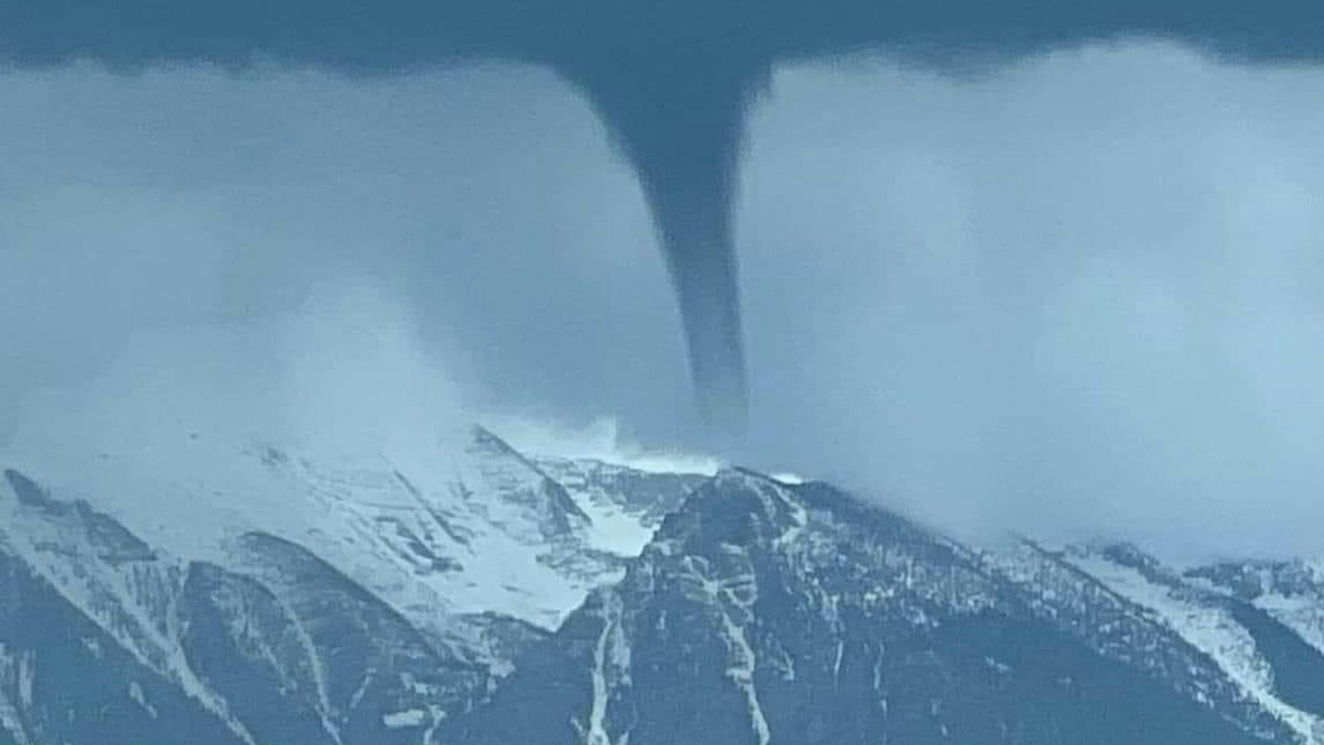
The image is confusing. Is that really a tornado touching down on a mountaintop in Montana?
The video of a funnel cloud high up in the Mission Mountains in western Montana on May 9 is both fascinating and could be alarming to Wyoming residents who don't think tornados can happen in the mountains.
But Cowboy State Daily meteorologist Don Day said appearances may be deceiving.
“It actually was not in the mountains, it’s in front of the mountains,” he said. “It's kind of one of those optical illusions, where the perspective really does look like it's touching down on the mountains, when in reality that was not the case.”
‘Land Spout’
Day said the weather phenomenon captured in the video is more likely what he calls a “land spout,” similar to the waterspouts that can develop over bodies of water.
“There's two different terms to describe what that was,” he said. “One is what's called a ‘land spout,’ or a ‘cold air funnel.’ And we do tend to see them in the spring season when we start to get thunderstorms, but the air is really cool and moist.”
Day said a funnel cloud like this would register as an F-0 on the Fujita tornado scale, which means it could bring wind speeds up to perhaps 90 mph, but the phenomenon would be brief.
“It is basically a very weak tornado,” he said. “And the extra moisture in the air in the spring allows you to maybe see circulation that in a drier time of year you would never see. You wouldn't even know it's there. So, it's better described as a land spout.”
Not Uncommon
These F-0 phenomena are not uncommon in the Western high plains and Rocky Mountains, Day said, although they tend to happen more often on the eastern plains.
“A lot of the tornadoes that people see are in this F-0, F-1 category, they tend to be the weakest ones,” he said. “But it's not going to be one of those situations where as it goes on the ground, it goes for a long period of time and blows over mobile homes and that type of thing.”
There was one notable exception.
The Teton-Yellowstone tornado, which touched down July 21, 1987, was a rare phenomenon, reportedly the most violent high-altitude tornado ever recorded in the U.S. with damage happening at elevations ranging from 8.500 to 10,000 feet. It also was the only recorded F4 tornado in Wyoming history.
“It knocked trees over and everything else,” said Day, referring to the estimated 1 million trees that were felled by the phenomenon. “But it was not a land spout, it was a tornado.”
The fascinating video captured this week in Montana, however, was not nearly as dramatic.
“Yes, it looked like a tornado, but to say it was a true tornado, like an Oklahoma tornado like we normally would see in the summer, this isn't really the case,” said Day.


