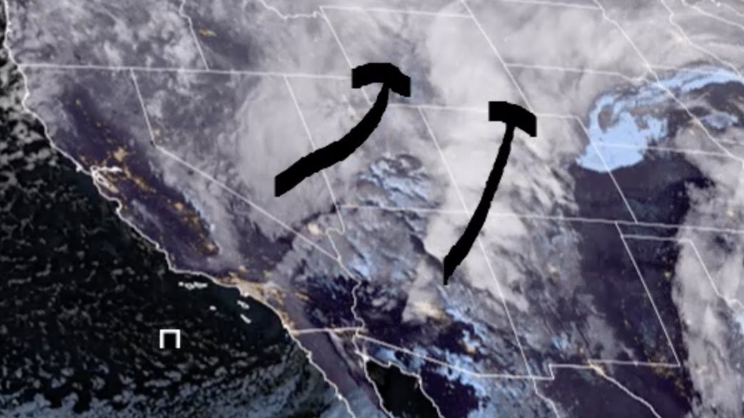
It’s Wednesday, February 212nd – and winter storm warnings are in effect for the entire state.
Roads are closed in half the state, and travel will be difficult – at best – in the rest. Temperatures are exceedingly cold, with winds making the air outside even more dangerous. In other words – stay inside if you can!
Central:
Casper can expect 3-7 inches of often heavy snow today, with temperatures falling to around -7 by late this afternoon and wind chill values as low as -35; windy, with gusts as high as 41 mph. 3-7 inches of snow is expected in Lander today, with temperatures falling to around -4 this afternoon and wind chill values as low as -20. Widespread blowing snow today in Jeffrey City, with accumulation of 3-7 inches possible and temperatures falling to around -7 this morning (wind chill values as low as -35); windy, with gusts as high as 41 mph.
Snow is likely to continue tonight in Casper (less than a half inch possible), with a low around -24 and wind chill values as low as -35; breezy, with gusts as high as 21 mph. There’s a 10 percent chance of snow in Lander this evening, with a low around -23 and wind chill values as low as -35. Jeffrey City has a 30 percent chance of snow tonight, with a low around -20 and wind chill values as low as -35; blustery, with gusts as high as 23 mph.
Southwest:
Widespread blowing snow is expected in Rock Springs today (1-3 inches expected), with temperatures falling to around 0 this morning and wind chill values as low as -25; very windy, with gusts as high as 55 mph. 1-3 inches of snow could fall in Evanston today, with a high near 13 and wind chill values as low as -15; blustery this morning, with winds between 19 and 24 mph. Lyman can expect 1-3 inches of new snow today, with temperatures falling to around 4 this morning and wind chill values as low as -17.
Rock Springs has a 30 percent chance of snow overnight, with a low around -13 and wind chill values as low as -25; breezy, with gusts as high as 26 mph. There’s a 20 percent chance of snow tonight in Evanston, with a low around -2 and wind chill values as low as -10. Lyman has a slight chance of snow overnight, with a low around -11 and wind chill values as low as -20.
Western Wyoming:
Thayne can expect 1-3 inches of snow today, with temperatures falling to around 5 and wind chill values as low as -10. 3-5 inches of new snow is expected in Big Piney today, with temperatures falling to around -1 and wind chill values as low as -25; breezy, with gusts as high as 34 mph. Pinedale can expect 2-4 inches of snow today, with temperatures falling to around 1 and wind chill values as low as -20; breezy, with gusts as high as 31 mph.
Snow is likely overnight in Thayne (less than half an inch accumulation), with a low around -1 and wind chill values as low as -15. There’s a 20 percent chance of snow overnight in Big Piney, with a low around -21 and wind chill values as low as -35; breezy, with gusts as high as 28 mph. Pinedale can expect an extra inch of snow overnight, with a low around -15 and wind chill values as low as -30; breezy, with gusts as high as 26 mph.
Northwest:
Snow in Jackson today (less than an inch expected), with a high near 9 and wind chill values as low as -20; blustery, with gusts as high as 26 mph. 1-2 inches of snow is expected in Dubois today, with temperatures falling to around 0 and wind chill values as low as -25; windy, with gusts as high as 38 mph. At Old Faithful in Yellowstone National Park, patchy blowing snow is expected this morning (less than half an inch possible), with a high near 1 and wind chill values as low as -30; blustery, with gusts as high as 28 mph.
Snow is likely overnight in Jackson (less than half an inch possible), with a low around -9 and wind chill values as low as -25; breezy, with gusts as high as 21 mph. Snow is likely in Dubois tonight (less than half an inch expected), with a low around -11 and wind chill values as low as -20; breezy, with winds gusting as high as 20 mph. Less than half an inch of snow is expected in Yellowstone tonight, with a low around -15 and wind chill values as low as -25.
Bighorn Basin:
Greybull can expect 1-3 inches of snow today, with temperatures falling to around -5 and wind chill values as low as -25; blustery, with gusts as high as 30 mph. Cody can expect less than an inch of snow today, with temperatures falling to around -14, but wind chill values as low as -45; windy, with gusts as high as 48 mph. Less than an inch of snow is expected in Lovell today, with temperatures falling to around -5 and wind chill values as low as -30; windy, with gusts as high as 41 mph.
There’s a 40 percent chance of snow overnight in Greybull (less than half an inch possible), with a low around -24 and wind chill values as low as -30; breezy, with gusts as high as 24 mph. Cody has a 40 percent chance of snow overnight, with a low around -21 and wind chill values as low as -45; blustery, with gusts as high as 33 mph. Less than half an inch of snow is expected in Lovell today, with a low around -11 and wind chill values as low as -30; blustery, with gusts as high as 31 mph.
North Central:
Buffalo can expect 2-4 inches of new snow today, with temperatures falling to around -7 and wind chill values as low as -30; blustery, with gusts as high as 23 mph. 3 inches of snow is expected in Sheridan today, with a steady temperature around -2 and wind chill values as low as -25. Big Horn can look for around 4 inches of new snow today, with a steady temperature around -2 and wind chill values as low as -25.
There’s a 50 percent chance of snow overnight in Buffalo (less than half an inch possible), with a low around -16 and wind chill values as low as -30. Sheridan can expect less than one inch of snow overnight, with a low around -17 and wind chill values as low as -30. Snow is likely tonight in Big Horn, with a low around -17 and wind chill values as low as -30.
Northeast:
Gillette could see up to 5 inches of snow today, with a high near 2 and wind chill values as low as -24; blustery, with gusts as high as 26 mph. Sundance can expect heavy snow today (3-7 inches possible), with a high near -2 and wind chill values as low as -33; blustery, with gusts as high as 30 mph. 3-5 inches of snow is possible near Upton, with a high near 3 and wind chill values as low as -20; breezy, with gusts as high as 21 mph.
Another inch of snow is expected in Gillette overnight, with a low around -19 and wind chill values as low as -32; breezy, with gusts as high as 21 mph. Sundance can expect 1-2 inches of snow tonight, with a low around -20 and wind chill values as low as -35; blustery, with gusts as high as 24 mph. Upton can expect an inch of new snow overnight, with a low around -22 and wind chill values as low as -36.
Eastern Plains:
Torrington can expect 2 to 4 inches of new snow, with temperatures falling to around 0 and wind chill values between -15 and -20; breezy, with gusts as high as 25 mph. 2 to 4 inches of snow is expected in Kaycee today, with temperatures falling to around -9 and wind chill values as low as -35; windy, with gusts as high as 38 mph. Wright could see between 3-5 inches of new snow today, with temperatures rising to near 3 by noon, then falling to around -2 during the remainder of the day and wind chill values as low as -20; breezy, with gusts as high as 20 mph.
There’s a 50 percent chance of snow in Torrington overnight, then gradually becoming partly cloudy, with a low around -18 and wind chill values between -20 and -30. Kaycee has a 40 percent chance of snow tonight (less than half an inch possible), with a low around -24 and wind chill values as low as -35; breezy, with gusts as high as 21 mph. Snow is likely tonight in Wright (less than an inch expected), with a low around -22 and wind chill values as low as -36.
Southeast:
Cheyenne can expect 2 to 4 inches of new snow today, with temperatures falling to around 1 and wind chill values between -10 and -15. Medicine Bow will see widespread blowing snow (2-4 inches possible), with temperatures falling to around -2 and wind chill values between -20 and -25; windy, with gusts as high as 50 mph. Laramie can expect 1 to 2 inches of snow today, with temperature falling to around 4 and wind chill values between -5 and -15; breezy, with gusts as high as 35 mph.
There’s a 40 percent chance of snow overnight in Cheyenne, gradually becoming partly cloudy, with a low around -15 and wind chill values between -20 and -30. Medicine Bow has a 40 percent chance of snow, with a low around -21 and wind chill values between -25 and -35. There’s a 40 percent chance of snow tonight in Laramie, with a low around -14 and wind chill values between -20 and -25.
South Central:
Rawlins can expect heavy snow today, with 5 to 9 inches possible and temperatures falling to around 0, with wind chill values between -15 and -25; windy, with gusts as high as 45 mph. 3 to 5 inches of new snow is expected in Saratoga today, with temperatures falling to around 13 and wind chill values between zero and 10. Encampment could see between 2 and 4 inches of new snow today, with temperatures rising to near 29 by 10am, then falling to around 14 during the remainder of the day and wind chill values between zero and 10; breezy, with gusts as high as 30 mph.
There’s a 50 percent chance of snow overnight in Rawlins, with a low around -16 and wind chill values between -25 and -30; blustery, with gusts as high as 35 mph. Saratoga has a 40 percent chance of snow tonight, with a low around -12 and wind chill values between -15 and -25. There’s a 50 percent chance of snow in Encampment overnight, with a low around -9 and wind chill values between -15 and -25; breezy, with gusts as high as 25 mph.


