Communities across Wyoming are digging out from several snowstorms that have blown through the state since the first of the year.
Casper and Lander have each recorded 56 inches of snowfall so far this winter, which puts Casper two feet over its average for this time of year, and Lander 20 inches above its average.
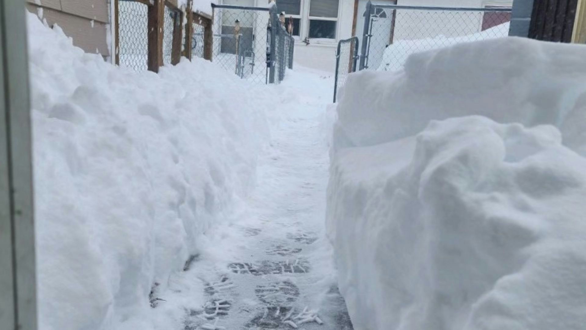
Riverton has seen the most impact from recent snowstorms, according to Joshua Rowe with the National Weather Service office in Riverton.
“We have already broken our all-time snowfall record for January, and those records go back to 1907,” Rowe told Cowboy State Daily. “Jan. 12, we had 18.7 inches in downtown Riverton, and the previous record for January (in 2017) was actually 16.8 inches.”
But not all parts of Wyoming have been snowed in. Cowboy State Daily Meteorologist Don Day pointed out that the northern part of the state has been spared major impacts from recent storms.
“The northern half of the state hasn’t really seen much – Buffalo, Gillette, Sheridan, over to Cody and Powell,” Day said. “But a couple of hundred miles away, it was a completely opposite situation.”
‘Way Off The Scale’
Communities in the central part of the state – cities such as Casper, Lander, Riverton and Rawlins – have seen amounts of precipitation over the last four to five weeks that are “way off the scale for normally what they get this time of year,” Day said.
He said Rawlins has received more than 15 times as much precipitation as its average – 2.18 inches of snow-water equivalent vs. an average of 0.14 inches – just since the beginning of January.
Clearing the Streets
In places like Rawlins, where a New Year’s Day storm dropped at least 24 inches of snow in town, local governments have had to ask staff to work long shifts to make streets passable.
“Over just the very beginning of the year, we had about 2 feet fall in about two days,” said Mira Miller, spokesperson for the city of Rawlins. “We’re used to getting snow throughout the year, but it usually falls, you know, 4 inches now, then 2 inches and then 6 inches.”
Miller said city officials issued a travel advisory within city limits, asking people to stay off the streets unless absolutely necessary.
“That provided a lot more access for our crews to be able to be out cleaning the roads, and not just dealing with people being stuck,” she said.
Miller said staff from various departments were called on to clear streets, working 12-hour shifts for several days.
“Our Streets Department, of course, and then our Utilities Department, but then we also had people from Community Development and Public Works (clearing streets),” she said.
But the storm didn’t just stretch the city’s personnel – it also stretched available equipment. In addition to the city’s snowplows, crews were driving pickups with snowplow blades attached to clear side streets.
“As of Jan. 4, which was kind of getting toward the end of the big push, we’d already put in almost 1,000 man-hours since Sunday evening (Jan. 1),” said Miller.


Addressing The Drought
Day said that thanks to the recent storms, snowpack in most of the state is off to its best start in several years.
“Snowpack, for the most part, is way above average in parts of the state or near average elsewhere,” he said, noting that the prospects are very good there will be elevated melt off into Wyoming’s reservoirs come runoff season.
“The only snowpack that’s far below average is in the southeast corner of the state around Cheyenne, which is about 70% of average,” said Day.
More to Come
The cold and snow isn’t over yet, Day said.
“The next four weeks, we’re probably going to be colder more often than not,” he said.
But he said the snow to come will hopefully be less severe than the storms that have been sweeping the state in recent weeks.
“I don’t see the intensity of the snow nearly as what we have seen,” said Day. “Because we’re going to see the California wave-train that’s been happening kind of take a break.”
However, he said the potential for a snowy spring is still “on the table.”
“As we go into March and April, there is a fairly good likelihood that these recent upswings in precipitation (will) continue in the spring,” said Day.


