Rivers in and around Yellowstone National Park have swollen to record levels this week, destroying roads, sweeping houses off their foundations, and stranding visitors and residents in the area.
Data from the U.S. Geological Survey, which tracks river flows and water levels in the area, showed the Clarks Fork of the Yellowstone River was at the highest flood level ever recorded, according to Cheryl Miller, a hydrologist with the USGS.
“It is the highest flow we have on record, and that’s 100 years’ worth of data,” Miller told Cowboy State Daily. “Previously, the highest discharge was in 1981 at 14,800 (cubic feet per second) and today we measured 23,900.”
Torrential rains have fallen for the past several days on melting snow left by a blizzard in the area, resulting in flooding, rockslides, mudslides and collapsing roads that prompted park officials to remove all visitors from the park Monday

Rivers across the area are running well above normal, according to the USGS, which has almost 300 stream gauges in Wyoming and Montana, including some in locations where river depths have been monitored for almost 120 years.
The stream gauges collect data every 15 minutes and on the hour the information is transmitted to the internet.
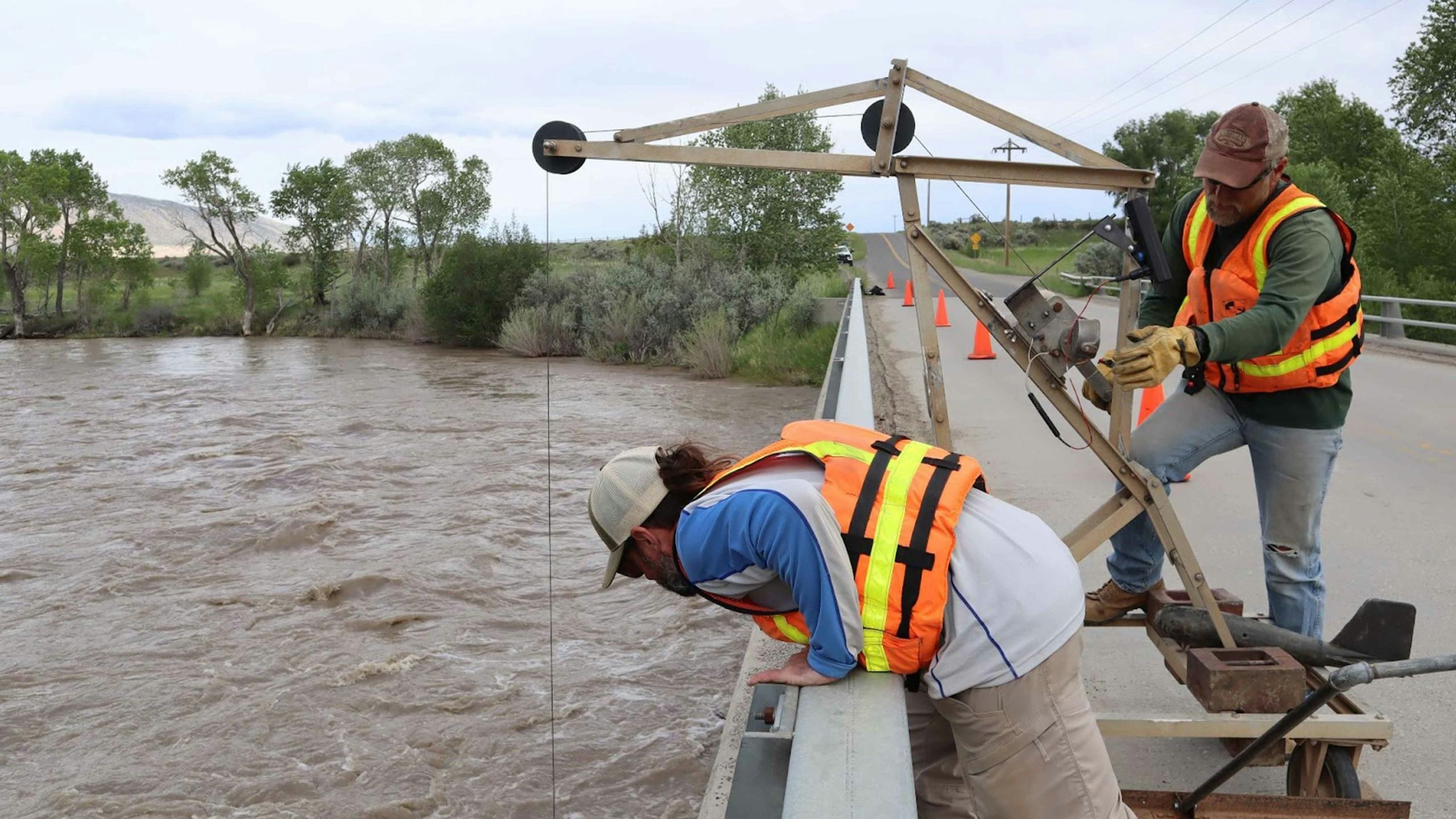
Jason Swanson and Jacob Neumiller, USGS employees based in Casper, were on a bridge over the South Fork of the Shoshone River on Monday afternoon, measuring the stream flow and validating the readings from an upstream gauge.
Those gauges showed that the South Fork of the Shoshone River, which runs from the Absaroka Mountains in Yellowstone National Park, is flowing more than four times faster and higher than this time last year. As of 7:30 a.m. Monday, the Shoshone was running at 6,060 cfs. On the same date and time last year, the river was flowing at just 1,310 cfs.
The Clarks Fork, which flows southeast into the Shoshone National Forest in northwest Wyoming, east of Yellowstone National Park, then northeast back into Montana, has blown by its previous record high levels near Belfry, Montana, just across the Wyoming state line.


Measurements Monday showed its depth at 12.76 feet – compared to the previous record high of 9.97 feet on June 9, 1981.
Miller noted that the water level has risen sharply just over the last few days.
“On June 9, (the river) was down more like 5 feet of gauge height at Clarks Fork Yellowstone,” she said, “where today it’s up to almost 13 (feet).”
But Miller said that the current flooding situation has affected the agency’s ability to report at some locations.
“We lost the gauge on Rock Creek up (in Red Lodge, Montana) because the river bridge washed away,” she said.


