A vigorous Pacific storm system moving into Great Basin Thursday night was expected to rapidly intensify into a strong storm over far southwest South Dakota on Friday night into Saturday morning, bringing heavy snow to most of Wyoming.
Forecasts suggested that the northern half of Wyoming will receive the heaviest amounts of rain or snow and cold temperatures. Only extreme southeastern Wyoming, including Cheyenne, will be spared bad weather, according to meteorologists.
Anyone with travel plans along Interstates 90, 25 and 80 or on secondary highways adjacent to those interstates can expect poor travel conditions by late Friday night that will continue through Saturday night. Conditions will also be poor in all of Wyoming’s mountain passes.
“There is strong consensus among the modeling that an intense storm will develop rapidly Friday evening and into Saturday, especially in the northeast corner of the state,” said Don Day of DayWeather, Inc.
“The model agreement combined with the fact that historically, April can bring intense storm systems of this type, gives us high confidence that storm will come to fruition,” Day said. “We expect as much as 1 inch to 3 inches of water content (rain and snow combined) will be possible with this storm.”
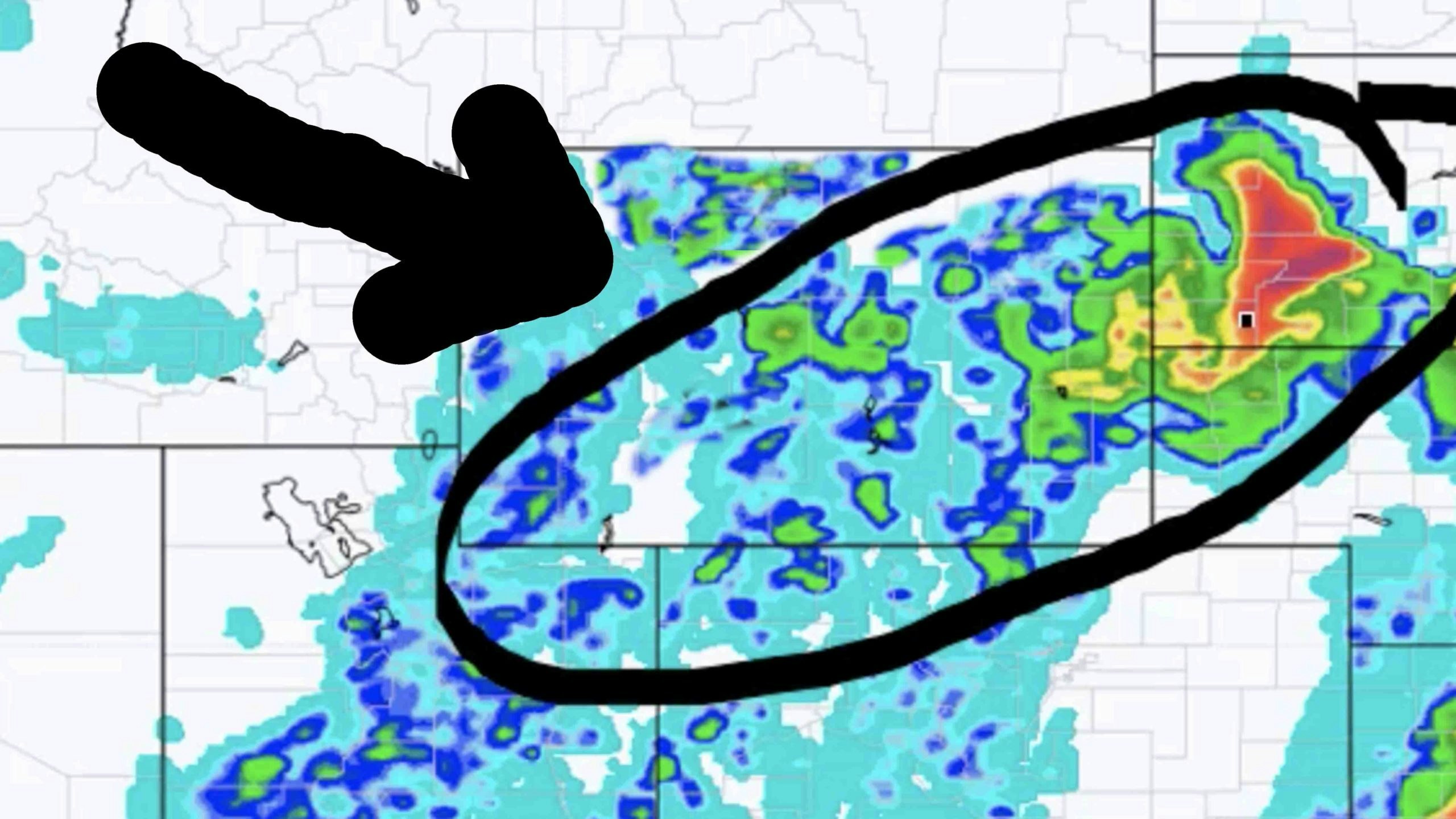
According to Day, Sheridan, Campbell, Crook, Weston and Johnson counties will receive the most precipitation, with some locations in those counties receiving very heavy snowfall.
“Although the storm will start as rain, a change over to snow will be likely late Friday evening and will persist through Saturday,” he said. “I anticipate Sheridan, Campbell, Crook, Weston and Johnson counties may receive upwards of 6 to 15 inches of heavy, wet snow with Campbell and Crook counties most likely to have the heaviest snowfall outside of the mountains.”
The storm will mean another nice shot of snow for Wyoming’s mountains to boost the snowpack. Forecasts call for a foot or more of snow to fall over most of Wyoming’s high mountain ranges, with up to 2 feet possible in the Big Horns, Beartooths, Wind Rivers and higher Black Hills.
The Snowy Range and Sierra Madres are also in store for heavy snow accumulations with high water content. Elsewhere across the lower elevations, snow will accumulate, but mainly on the cold surfaces.
Moderate rain and snow amounts will be found across Park, Washakie, Big Horn, Fremont, Natrona, Hot Springs, Converse and Niobrara counties. There may also be a patch of heavier rain and snow from western Albany to Carbon to eastern Sweetwater counties along I-80.
Day urged ranchers to prepare for cold, wet and windy conditions that will be stressful to livestock from late Friday through early Sunday, especially in the northeast counties. Expect a warm and breezy day on Friday with showers and thunderstorms developing rapidly late Friday through Friday evening.
“As with most Wyoming spring storms, there will be pockets of heavier snow in some areas, the track of this storm can bring heavy snow to parts of the Big Horn Basin, especially the Thermopolis area,” Day said. “This will be a nice shot in the arm in regards to badly needed moisture, especially for the northeast counties of the state as well as the state’s mountain ranges.”


