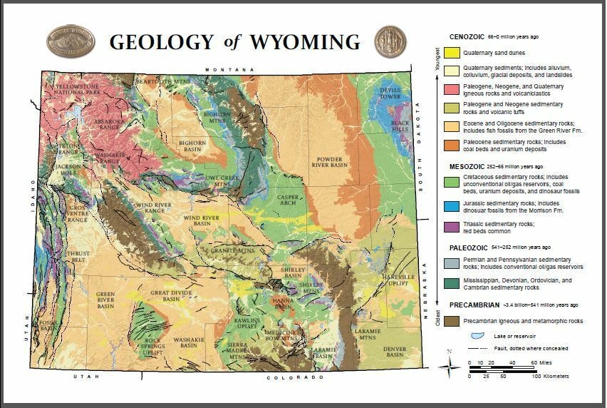
A new, free postcard being offered by the Wyoming State Geological Survey is displaying all of Wyoming’s geological marvels across the state.
The 4×6-inch postcard includes a colorful map of rock formations, faults, basins, mountain ranges and other geologic features across Wyoming. This is a modified version of the map first published in 1985.
The postcard shows features as young as active modern sand dunes to igneous and metamorphic rocks that date back more than 3.4 billion years. Many of the “new” sand dunes can be found throughout the middle portion of the state, through Casper and the Wind River Basin.
The billion-years old igneous rocks are seen stretching from the southeast portion of the state to the western portion around the Wind River Range and in the north near the Bighorn Mountains.
The map also points out rock units that are important to Wyoming’s economic geology and highlights certain areas that contain fossils.
The postcard is available free online, although shipping is around $7.50 for a 10-pack of the cards. They can also be obtained at the WSGS office on the University of Wyoming campus or can also be ordered by calling the WSGS at 307-766-2286.


