Wyoming’s weatherman Don Day doesn’t mince words.
“This is the real deal. There is no turning back folks. This is going to be a very intense storm in front for this early in September,” Day said in his daily forecast.
“First, we have a shot of very cold, arctic air coming in, then overrun by warmer moist air coming up over on top of it. So we’ve got a perfect setup for heavy precipitation,” Day said.
That means heavy rain in some areas, heavy snow in some areas, record breaking low temperatures in some areas.
It depends on where you are in the state of Wyoming, but wherever you are, you will be impacted by this storm.
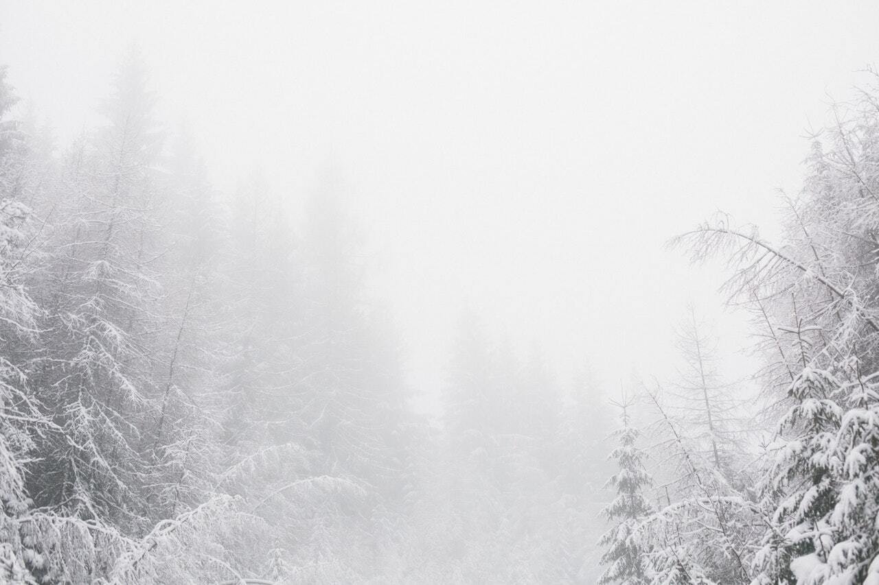
Computer models are showing up to 17 inches of snow in the Wind Rivers, 13 inches of snow in the Big Horns, and 12 inches of snow in the Snowys.
On the plains along the I-80 corridor, 8 – 12 inches are possible while the I-25 corridor could see the same.
There are few areas of the state that won’t get hit by precipitation.
As for the cold air, expect anywhere from 12 – 50 degrees below normal temperatures for this time of year.
As Day said last week, this is a “good news, bad news” situation. The good news is that the fire season is likely over. The bad news is that the growing season is likely over.
If you want to attempt to salvage the growing season, Day had Shane Smith, Director Emeritus of the Cheyenne Botanic Gardens on his podcast this morning to share tips on how to save your plants.
The following is a computer-generated transcript of the podcast. Or you can watch the video embedded above.
Welcome to Monday, Labor Day, September 7 2020. Well, it’s 2020. Right, you can throw everything normal out the window and we’re gonna do that. Over here the next 24 to 72 hours. This is the real deal. There is no turning back folks. This is going to be a very intense storm in front for this early in September.
If this was late September, early October really wouldn’t be unusual. But this is something that seems to be about four to six weeks early. We got to go back really to the 80s. There was a front like this in 1985.
They came into the Rockies with a similar situation and similar amounts of snow and cold. It’s not a matter of will the growing season and will it will for most of you. Not all of you but in many areas, especially east of the Continental Divide, growing seasons over although we’re going to get some tips from Scott Smith here at the end. To help us maybe get through this. If you want to keep that garden going snow is going to be down to 4000 feet.
Hunters are going to go from hunting and shirtsleeves, the hunting and, well snow travel impacts will be high tonight through Tuesday night, interstate 80, interstate 70, and I 25 will all have poor travel conditions, maybe some closures.
Now in typical fashion when we have these early season fronts like this, you usually have great fall weather behind them. And that’s exactly what we’re gonna see by this weekend. And next week we go right back to nice weather again, snow will be melting away, but boy, it’s gonna leave some impacts.
And Shane Smith is going to visit with us. He’s going to help give us some tips on how to prepare for this onslaught of cold and snow. Here comes the cold front. This is by six o’clock mountain time tonight, boy and you can really see it.
Here’s all the heat that we’ve had here since late last week and over the weekend, much above average temperatures, but you can see by six o’clock tonight. Basically the front is going to be right along here. Now it always gets held up
By the continental divide a little bit, but you see that purple, that’s the really cold air. So we’re going to get through most of this Labor Day for this part of the region right here is going to stay warm. This is going to be another very warm above normal September day.
But if you go up into Montana, northern and central Wyoming, South Dakota, Northern Nebraska, all Montana, back into Idaho, we’ll look at all the cold. Moving on and look at the western extended the colder air, pushing all the way into Eastern Washington and Oregon. This is a huge cold front.
Now here we are with the Jetstream. And there’s no reason why this isn’t going to happen. We’ve got this big ridge of high pressure in the Gulf of Alaska. We know what happens with that. That is bringing in this wave of cold and really here is the bulk of the cold and the energy right here. Then you can see the northerly wind flow coming in to bring in that cold air. There’s nothing that’s going to stop the cold air once it gets to this point. There’s no turning back
Cold air is dense, it’s heavy. And once it starts moving, you can’t stop it. Now by Tuesday noon, notice we’ve got a closed low. Over you top, the cold air pours over the divide. And what we have here in this situation what’s called over running, the very cold air gets along and east of the Continental Divide, the counterclockwise spin around the low throws moisture over and on top of the cold air.
This is a great way to make it rain and snow. So what we have at first is a shot a very cold, arctic air coming in, then overrun by warmer moist air coming up over on top of it. So we’ve got a perfect setup for heavy precipitation.
And you can see the cold air continues to advance. And this is what precipitation looks like with the storm. Look at all of the yellow, the blue, and the orange and even the reds. This is something that’s interesting showing up right here in the most recent model trends. If that upper level low stays out, over
Utah, well, we’re going to have a lot of help in Colorado’s mountain areas to get significant snow and single stars rain but we’ll turn as snow. Look at the Front Range areas here. And the eastern plains with this wide swath of an inch or more in many areas, even areas out here in eastern Colorado in western Kansas, a half to three quarters to an inch of water.
And notice these little stretches of orange in the mountains look at the Wind River mountains. Look at the Big Horn mountains, the southern mountains of Wyoming in northern Colorado. We’re going to be looking at hopefully an end of the fire season.
The camera peak fire near Estes Park Colorado has raged over the last several days in this heat and wind but hopefully this front will put it into that fire or go a long way to ending it. But you can see extensive amounts of precipitation in the form of rain and snow we haven’t seen in a long time. west of the divide once you get past Utah here, Idaho you’re
likely not going to see much precipitation, but even the western slope of Colorado, the western slopes of Wyoming, look at all the way down into New Mexico. Then you can see the heavier precipitation down here in Texas and Oklahoma, as that low swing south through there, this is what it looks like with snow.
I think this is a good representation of where the heavy snow will be. They have a snow in the purple areas there but anywhere you see gray or blue snow could certainly accumulate at least on the grassy areas. But we’re gonna see the major mountain ranges catch the bulk of the snow, places like Cheyenne places like chugwater places like Denver along the Palmer divide the foothills west of Fort Collins Loveland.
Gonna see significant September snow. These are temperatures by Wednesday morning. This is why we’re likely going to see an into the growing season in many areas, if there’s anything encouraging is is that due to the fact that the storm looks like it’s slowing down, that may add additional cloud cover Tuesday night, any year
That don’t have clouds Tuesday night could be looking at record breaking temperatures. These are probably record breaking temperatures for any for many areas anyway, as we look ahead, these are temperatures relative to average by Wednesday. Look at this Denver 48 degrees below average for Denver by noon on Wednesday.
Many other areas are 30 to 40 degrees or more below average look at the extent of the cold west of the divide, even digging in the air. Look at this Page, Arizona 32 degrees below average. So this is a bonafide real big cold front. You don’t see these very often. Now as we get into Thursday.
The cold air does begin to march off to the east but the upper level low is left back over Utah still basically gets cut off from the flow. So what this means is do not expect a quick warm up during the workweek into Wednesday into Thursday and into Friday. It’s going to still stay very cool. However, by
The weekend, high pressure rebuilds. We have a low up here helping to build high pressure back into the region. Now we’re not going back to the heat, but we’re going to go into that really nice September weather that you get. When you get these strong cold fronts like this, you do tend to get some nice fall weather.
Don’t worry, we’ve got lots of fall coming, lots of nice fall weather coming. It’s just that the growing season for all of you, and most of you rather I should say, is coming to an end. And this is going to be one storm to remember for sure. We’re going to wake up Wednesday morning to many areas in Wyoming, Colorado with the most snow we’ve seen, going back to last winter. Now let’s hear from Shane Smith, author Director Emeritus of the Cheyenne Botanic Gardens. He’s gonna help us get through this.
If you’re in an area where you’re pretty sure that you’re going to freeze which is an awful lot of your listening area.
Number one is I would go out and do a big harvest, you know, even if some of your tomatoes aren’t quite ripe, you know, some squashes there. Depending where you live, there is a much that can survive when you get down into the lower 20s of the teams. You can do some covering, and you might be able to eke out a save.
It’s just depends where you live and how the weather is going to hit you. And if it’s looking like, you know, the low, the low 20s and into the teens, it’s it’s over.
But if it looks like you’re in an area where it’s going to get down, dip, dip below freezing and not for that many hours, meaning down into 28 or so. Then easily you can cover stuff, you probably don’t have to do much of a harvest. And, you know, there’s some other strategies you can do for those of you that might be fortunate with that slightly below freezing mark and that would be besides covering
sometimes you can if you water the plants down really good the water we talked about this in spring the latent heat of water can help prevent a frost This is what you see the fruit growers do down in Florida where do you see icicles on the oranges and, and so that’s a old method that works but it only works down to about 2827 at the best. And getting back to covering things.
Quite often the first thing people grab is a clear piece of plastic film, you know visqueen are polyethylene and and that works fine except if it’s coming with heavy snow. You might need to put some stakes up to support that plastic so the snow doesn’t come collapsing down on top of your tender crops and crack the binds and leaves and such. The other thing if you’re using it any sort of clear covering
As soon as the day comes that the sun is out and we’re getting back above freezing, or even getting close, keep an eye on it because those little clear tents that you build to protect your plants become super super hot and you go from dealing with frost dealing with 100 and 1500 and 20 degree situations under the plastic and so you might have saved and saved the night and then you lost it during the day so just don’t walk away from it. You know, keep keep an eye on things.
You know, just in general getting back to people who might be facing a lighter frost. The main priority the most sensitive plants are the fruiting crops, tomatoes, cucumber, peppers, eggplant, squashes, those guys don’t like it below freezing at all.
There are some crops that can take a light for us that would be your leafy crops. Let us spend
That would be plants that we call the coal Colm coal crop family. That would be things like cauliflower, broccoli, cabbage,
they can all take a very light frost without much problem. Again, it’s kind of a cumulative thing. If you get down to 2827. And you hold it for many, many hours, that’s harder on a plant than if you just dip down to that a few hours before sunrise. So the length of those temperatures also have a cumulative effect of the damage. But so if you’re going to prioritize and you’re in a lighter frost area, that’s a way to prioritize spend your energy covering the fruiting crops.
But beyond that,if we’re seeing a snow event coming which it sounds like there’s a lot of your listening area that will see snow, unfortunately.
Number one, you might go see a therapist just to For the depression of seeing your summer and just had such a brutal way, but number two, if the leaves are still on the trees, which of course they are, even if they’re frost Brown, they’re going to accumulate snow much quicker than a naked tree in the wintertime. And so expect to see some breakage and also plan on going out and shaking your trees during the course of the snow even if it’s in the middle of the night. You might be able to save a shrub or a tree, especially a young one
from total destruction. And the tip I always tell people if you’re going to go out and shake the snow off of a tree, be sure to put on a wide brim hat. That way you won’t get dumped on your head.
But it’s it’s just such an important maintenance thing to try to keep these trees going especially on the High Plains or trees are so so precious. Losing one tree is is awful.
So be prepared and beyond that, you know, if you wake up to death and destruction and pretty much the garden is done and brown and black,
I would suggest turning everything under chopping it up with a sharp shovel. In fact, it helps to sharpen your shovel and chop up the stems and the stocks and whatever else can be chopped up.
And then just lightly turn it under, and that will give you more return nutrition to your soil than if you just let it sit there and dry up on top of the soil. So
that’s least one way to not lose a lot of hard work going into having a healthy crop, at least the nutrients of that crop are going to go back into the soil a little bit better. Thanks for your advice, Shane. Certainly I know a lot of gardeners are disappointed on not having their growing seasons as long as they had hoped it would be Shane’s gonna join us
With some other tips for this upcoming fall season and future programs


