Welcome to the Day Weather Podcast on Thursday, February 20.
Not a lot going on over the region for the next three days. We are in a nice break in the weather. Something we haven’t seen recently is a break in the weather pattern — this will help us out in traveling.
We did see some snow last night and early this morning in parts of central and southern and eastern Colorado. That’s moving away.
Cold, high pressure is going to move in today which should last through Saturday in most areas.
It’s very cold out there in many areas. Below zeros in many areas. Some fog.
There will be a small moderation in temperatures. Yesterday’s snow flurry activity which affected some should be moving on out.
One thing to watch — we don’t get to show you this very often. For those folks who live along the I-80 corridor, you know how nasty the Elk Mountain/Arlington can be — look at this.
This shows you how nice the weather is. The wind gusts at Arlington / Elk Mountain this morning is six miles an hour. The average wind speed is only two miles an hour. Wonderful to see.
One reason for that is that it is so cold, it settles the wind down a bit. For a change, instead of talking about blowing snow and strong winds, sometimes we can show you that indeed the wind can slow down or even stop at times during the winter. Just not very often.
Here is the forecast for the next three days. This snowfall, right here, already has happened overnight and early this morning. But you can see through Saturday morning the snowfall forecast is almost non-existent all across the northern Rockies through Saturday morning.
So today, Friday, and Saturday we’ll see a nice break in the weather. Things change though.
This is by Sunday afternoon and then on to early Monday. We’ve got a storm system that is going to come up out of Southern California and then through central and southern Colorado.
One thing that makes us kind of nervous is this area right here. Some computer modeling is taking this storm a little more to the north. So, there’s the possibility that Sunday into Monday morning, the I-80 corridor could see some now.
It could also stay south into Colorado. One thing is for certain, for folks in Colorado — especially west central and southwest and southern Colorado — you’ve got another good chance of snow coming in on late Saturday night and Sunday.
Some front range areas and eastern plains of Colorado could be under the gun for some accumulating snow in that Sunday/Monday timeframe.
Then as we get into early next week, we’ll see things change. This is that low that comes through Sunday. You can see it staying over southern Colorado.
But if it tracks a little more north, I-80 in Nebraska and Wyoming could be looking at a little bit of snow.
We’ll update you tomorrow. We should have a better idea if Sunday’s snow creeps into Wyoming or not.
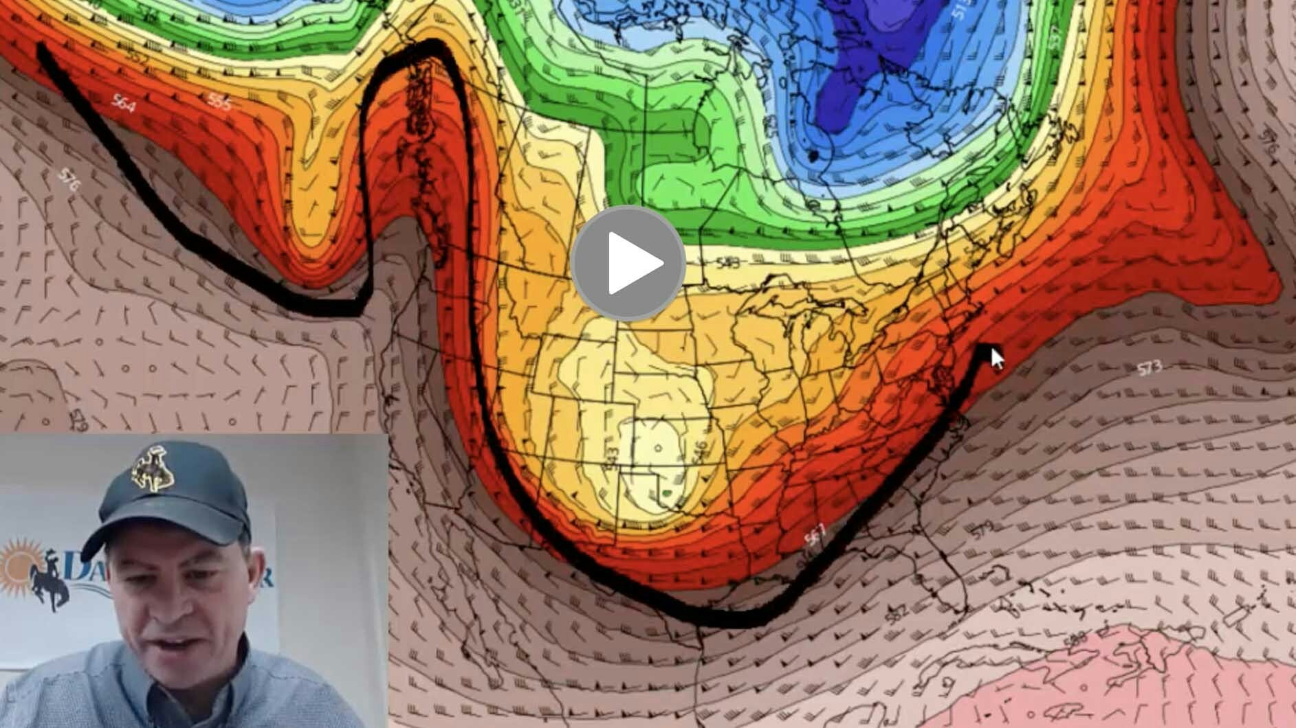
Taking a longer range look, this is for Tuesday, notice the jet stream takes a bit dip and the door to Canada is wide open.
After three days of quiet weather, beginning Sunday and heading into early next week, the door to Canada is open and temperatures will fall.
It’s not a really snowy pattern in terms of heavy snow. But some light snow will fall in the high plains and Rockies early to mid next week. Plan on that if traveling. This is a pattern that really favors the mountains again to build on their snowpack even more.
Thanks for watching the Day Weather Podcast. Enjoy the quiet weather here for the next three days.