By Don Day
Wyoming’s weatherman Don Day looks ahead to the weekend with his weather forecast.
Don’t have time to watch the video? Here’s a rough transcript:
It’s Friday, February 7 you are watching to the Day Weather podcast.
The strong and moist jet stream winds coming in from the Northwest continue to slide through Wyoming and Colorado.
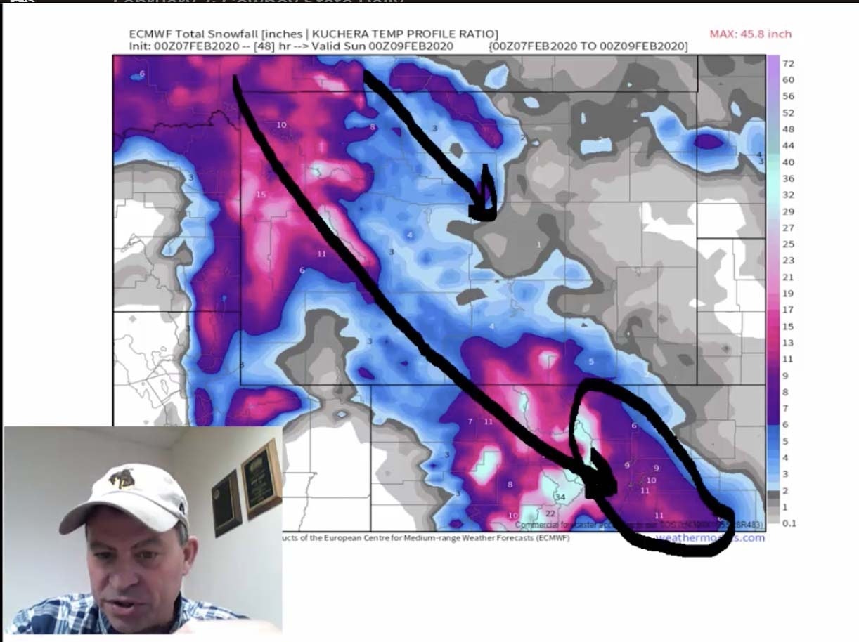
One and two feet of snow were reported in the mountains of southern Wyoming and northern Colorado last night.
Two feet of snow was reported at Jackson Hole Ski Area. In fact, Teton Pass is closed for avalanche control.
Some avalanche conditions around Alpine Junction, Wyoming. And we have avalanche warnings in affect for the mountains of central and northern Colorado.
The mountains will see probably see another foot of snow today, tonight, and early tomorrow.
For the lower elevations, a little bit of good news for some areas if you don’t like the snow. It does not look like the heavy snow will get into Cheyenne — probably about 1 -3 inches.
You can see the northwest to southeast trend of where the snow is falling. And notice the snow wants to fall in the mountains and close to the mountains. but we also have this wedge of snow extending into the I-25 corridor of Colorado and the I-70 corridor of Colorado, so you Front Range podcast listeners it looks like you might be receiving a bit more snow than expected. As the heavier snow has shifted more south than west.
This pattern will continue to produce snow and snow showers over the near mountains today and tonight but only light amounts once you get east of the Divide.
As we look forward, we see another system. This is the next system that comes late Saturday night and Sunday.
We have another chance for a little bit of light snow in the central and northern Rockies. But the amount isn’t very heavy.
There’s another little wave diving in with the jet stream from the northwest that will bring a shot of colder air to Colorado and Wyoming Saturday night and Sunday. And maybe a little more in the way of light snow.
This is the current jet stream pattern that we’re in right now. This is going to continue to keep systems coming in from the Pacific Northwest and western Canada and riding thru the western United States.
Our pattern is going to remain active. And the door is open to Canada to keep us cold.
We will see the general trend of plain old-fashioned winter weather. Nothing brutally cold but just chilly and more episodes of snow chances will roll through the Rockies and High Plains off and on throughout next week.
There is nothing that we see that would bring a major snow event our way — just remaining wintry pattern.
Temperatures over the next 10 days. Huge contrast between the central and eastern United States and the colder wet conditions across the western United States.
That’s how things are trending.
Thanks for watching!


