Following Monday’s subzero surge that saw temperatures plummet to minus 20-40 across much of Wyoming, the state has been blown away Tuesday by strong winds as the latest winter weather system makes its exit.
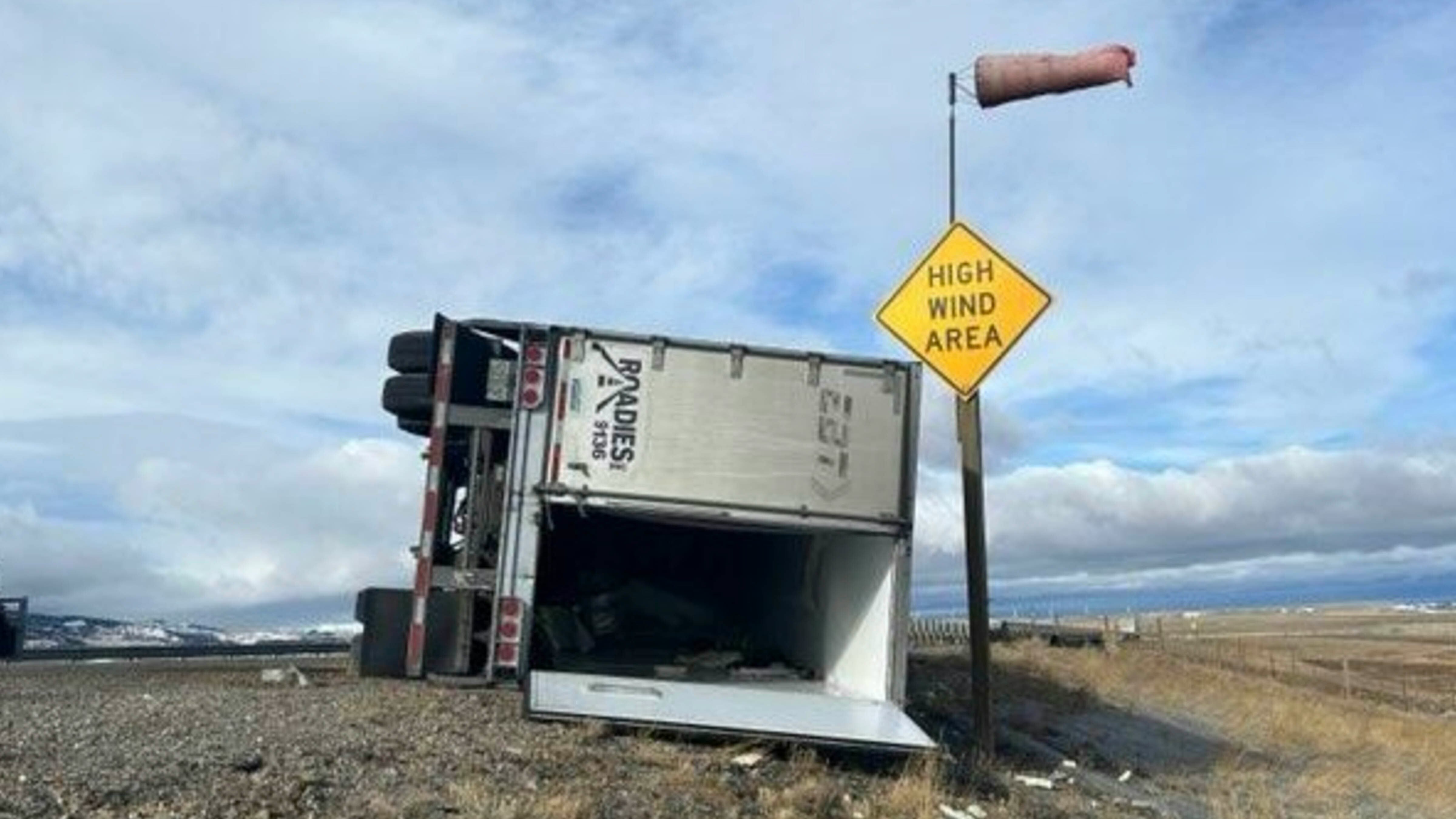
Winds gusting nearly 90 mph in some places have been blowing over semitrailers along Interstates 25 and 80, the Wyoming Department of Transportation reports.
Northwest and southeast Wyoming were under High Wind Warnings on Tuesday, and WYDOT reported multiple blow-overs with wind gusts in many areas topping 70 mph., and one hitting 88 mph at Bordeaux, Wyoming, about 10 miles south of Wheatland along I-25.
I-80 between Rawlins and Cheyenne and I-25 between Cheyenne and Wheatland were closed to high-profile vehicles because of extreme blowover risk. Sustained winds of 44 mph were reported along the highways, with gusts near Arlington hitting 65 mph.
This is all part of the “third phase” of the outgoing Arctic air, said Cowboy State Daily meteorologist Don Day. When there’s a sudden rise in temperature in the Rockies, there’s always an abundance of wind.
“When arctic air retreats, you get a pressure change that kicks the wind up,” said Day. “That always happens on the back end of an Arctic surge, which tends to be a problem for travelers.”
A Classic Chinook
Chinook winds are prevailing warm, westerly winds generated by the warming of air that has lost most of its moisture. These conditions create turbulent winds, especially in the mountainous terrain of Wyoming.
Day described Tuesday as “a classic Chinook.” Wyoming’s geography already makes it a perfect wind tunnel, which makes Chinooks even more powerful and treacherous.
“When temperatures jump that quickly, you get a lot of wind,” he said. “At this time of year, when Arctic air starts to back out of the Rockies and head more out into the plains, that tends to bring increasing wind.”
The severity of the wind is highly dependent on temperature.
Meteorologist Chris Jones with the National Weather Service Office in Riverton anticipated that northwest and southeast Wyoming would be the nexus of the worst wind.
“The warmest areas will be the most wind-prone,” he said. “That would be Cheyenne up along I-25 and then also along I-25 near Buffalo and Cody, the Cody foothills, and other places that might push 30 degrees on Tuesday after the subzero temperatures on Sunday and Monday.”
The Cody foothills were under a High Wind Warning on Tuesday, with winds of up to 75 mph anticipated along the summit of the Chief Joseph Highway.
Blow Hard
The additional hazard Tuesday’s Chinook winds created was the risk of snow blowing. The subzero surge didn’t produce much snowfall, but everything that fell was light and dry, making it easy to churn up and blow across highways.
“The problem with a gusty southwest wind is that it could cause some areas of blowing snow and reduced visibility in the same areas where it’s blowing hardest,” Jones said. “We’ve had fairly dry, fluffy snow, and we’re seeing how that plays out with the wind.”
Day described the “vacuum” of the vacating polar wind as a perfect catalyst to create clouds of blowing snow along the I-80 corridor. With 80 mph winds and vast clouds of blowing snow, it’s no wonder WYDOT closed sections of I-80 and I-25 to high-profile vehicles.
“These systems always cause a lot of headaches,” he said.
That’s true, figuratively and literally.
Oh, My Head
Chinook winds can cause more than powerful wind gusts and blowing snow. There’s scientific evidence that they can impact personal health, too.
A study published in Neurology in 2000 examined whether the onset of Chinook winds led to migraine headaches. The University of Calgary Department of Clinical Neurosciences studied 75 patients who recorded the onset of migraines, which were correlated with weather data monitoring Chinook winds.
The researchers concluded that many patients experienced migraines on the days leading up to Chinook winds or when Chinooks were in full swing. However, most patients were only susceptible to one or the other rather than both.
There has been little additional research into the health impacts of Chinook winds, but the data collected by the University of Calgary makes a compelling case.
Staying Busy
The Chinook winds dominating Tuesday should be gone by Thursday. However, Wyomingites shouldn’t rest on their laurels at this time of year.
By the weekend, temperatures will drop again as another weather system brings clouds, cold and higher chances of snow across Wyoming. Overnight temperatures will be in the teens or single digits and possibly lower.
If those subzero temperatures suddenly swing up, the Chinook winds will churn up again and cause more blowovers on Wyoming’s highways. That’s par for the course in the thick of the winter season in the Cowboy State.
“The weather is going to stay busy, meaning there will be more of these systems funneling into Wyoming, bringing cold and more chances for snow,” Day said. “We're just going to stay in a pattern where systems will want to come through the western United States and give us all they got.”
Andrew Rossi can be reached at arossi@cowboystatedaily.com.


