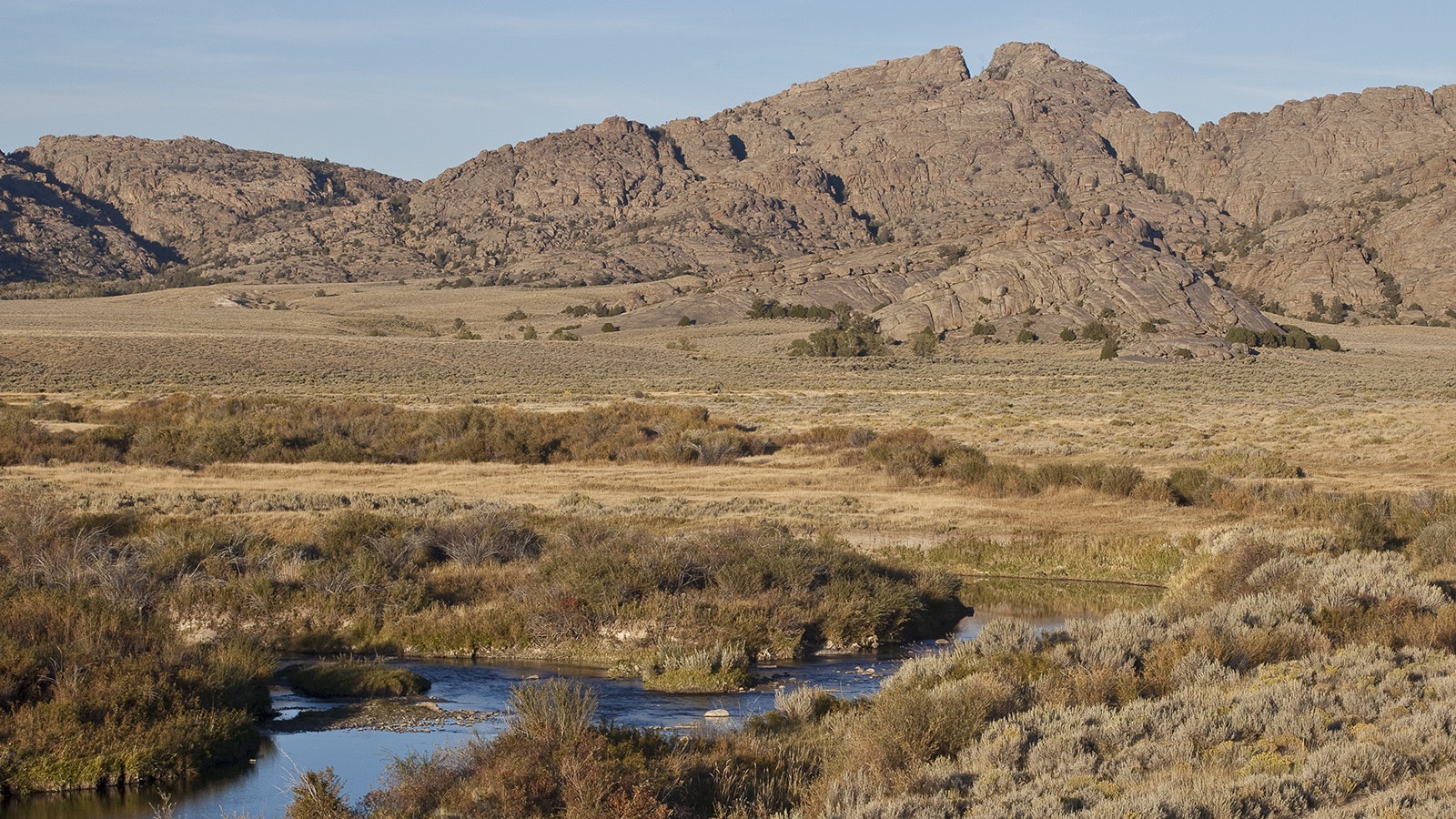
Traveling along U.S. Highway 287 in Wyoming’s Sweetwater River Valley, visitors can see a gun-sight type notch at the top of the Granite Mountains.
It’s the same landmark that became an important destination for pioneers traveling West through the territory in the mid-1800s. And while today it’s an interesting landmark with some historical significance, seeing it more than a century and a half ago often was life-or-death for travelers.
It is known as Split Rock, and the distinctive granite split sits about 1,000 feet above the sagebrush prairie below and pointed thousands of pioneers toward South Pass.
National Trails Interpretive Center interpreter Reid Miller said when the Wyoming Department of Transportation was doing road improvements in 1984 in the area, they encountered some artifacts.
A subsequent excavation by the state archaeologist’s office excavated “a pit house site that represents the earliest known cultural occupation here in central Wyoming to be sure.”
It shows that the landmark was one of the main landmarks along the Oregon, California, Mormon and Pony Express trails, a confluence of Manifest Destiny.
“So, you can extract from that (excavation) that Split Rock is easily visible for 20 miles east and west up and down the Sweetwater River Valley,” Miller said. “That would have been a landmark from the earliest occupation of Wyoming, really. I find that significant.”
As part of the Granite Mountains, Split Rock sits in an ancient mountain range that Miller said geologists believe was once higher than the Ferris Mountains south of the river.
The Granite Mountains have slumped into a fault that runs through that area, and the erosion of “countless millennia of wind and ice” have broken them down into “beautiful and well-rounded shapes.”
A description of the mountains in a private journal by a traveler named Orson Pratt in 1847 described the difference between the mountains on the south side of the valley, the Ferris Mountains, from those Granite Mountains to the north.
“The valley of the Sweetwater varies in breadth from 5 to 8 or 10 miles, bounded up on the north and south by mountainous ridges, isolated hills and ragged summits of massive granite, varying from 1,200 feet to 2,000 feet in height,” he wrote.
“Those upon the south being the highest and are covered with snow and well-timbered with pine, while those on the north are entirely bare, which the exception of here and there an isolated pine or cedar in the clefts or benches of the hills.”
A Guide
Miller said there is no doubt that those who traveled the California, Mormon and Oregon trails that merged through central Wyoming would have used Split Rock as a guide headed for South Pass.
A reference at the Interpretive Trails Center has information from dozens of diaries of women who crossed the territory, but there was just one reference to Split Rock.
“In 1864, Mary Ringo referred to it as Split Rock and camped nearby there,” Miller said. “That doesn’t reflect the fact that the landmark was certainly visible to the immigrants for easily two days before they reached it. For folks that haven’t seen it, it is a real distinctive sort of gunsight notch in the Granite Mountains there that is just unmistakable, even from a great distance it is very distinctive landmark.”
The landmark is one of three for those who traveled from east to west through the Sweetwater River Valley.
The first the emigrants headed West would have seen was Independence Rock. Many left their names there. The second landmark was Devil’s Gate 5 miles to the west.
Then 15 miles further upriver Split Rock dominates the landscape.
Reid said travelers typically made visible as well as strategic goals for their days on the trail.
“They were wanting to find fresh water and fuel for a campfire and shelter from the wind and so forth. Even just measuring their distance was a goal,” he said. “Split Rock gave them an opportunity to do that.”
Those who would have traveled with a guide who had been along the trail as far as the Oregon Territory and had come back to Saint Joseph or West Port, Missouri, to lead another wagon train likely would have heard about the landmark.
“So, it certainly could have been, and would have been, a topic of conversation as a goal,” Miller said.
However, those who used the Mormon Trail’s William Clayton’s emigrant guide for Latter-day Saints after 1847 would not see a reference to the rock. There were references to Independence Rock and the Devil’s Gate.

'Cleft … Rent … Chasm'
The words of a traveler through the valley in 1849 named Joseph Middleton are used by the National Park Service to describe the peaks. Split Rock is a designated site on the National Register of Historic Places.
“Yesterday from the time we started we steered to this cliff with a steadiness that was astonishing, never deviating from it more than the needle does from the North Pole, excepting once for a short time,” Middleton wrote.
“I think this cleft or rent, or chasm is very conspicuously seen from the Devil’s Gate, which I think is 11 miles from here; and I think it is still at least six or eight miles ahead.”
Another emigrant named William Carter was also impressed with the rock formation and wrote about it in 1857.
“The picture was worth the pencil of an artist,” he wrote. “Our camp was near what is called the Split in the Rock, a remarkable cleft in the top of the mountain which can be seen at a great distance in either direction.”
Miller said during the 1860s there was stage station as well as a Pony Express relay station near the base of the landmark ,and in later years starting in the mid-1880s when people started homesteading along the Sweetwater River there was a post office located within sight of Split Rock.
A historical marker on U.S. 287 to the west of the rock honors its legacy as a reference point for all generations.
“It’s always been a cultural landmark of significance clear back to the earliest time of human presence in Wyoming,” Miller said.
Dale Killingbeck can be reached at dale@cowboystatedaily.com.


