Google Maps has a bad habit of sending would-be travelers headed across the Cowboy State in winter down a frozen garden path instead.
The situation has led to 28 search and rescues in Sweetwater County alone, leaving misdirected motorists stranded in below-freezing weather at locations that might have snowdrifts as high as 16 to 22 feet.
To make matters worse, those locations are not generally within range of a working cellphone tower or safe walking distance of a gas station, making it an obvious tragedy waiting to happen.
“It was definitely interesting what routes (the apps) were picking,” WYDOT spokeswoman Jordan Achs told Cowboy State Daily. “We were seeing it ourselves. Just, you know, pulling up Google Maps and typing in ‘Cheyenne to Salt Lake,’ so we knew we needed to act.”
Working through its engineering and environmental consulting partner, Laramie-based Trihydro, WYDOT is now offering expanded third-party access to its Situation Data Exchange system so that Google and other mapping companies and apps have better information about the status of alternative routes during interstate closures.
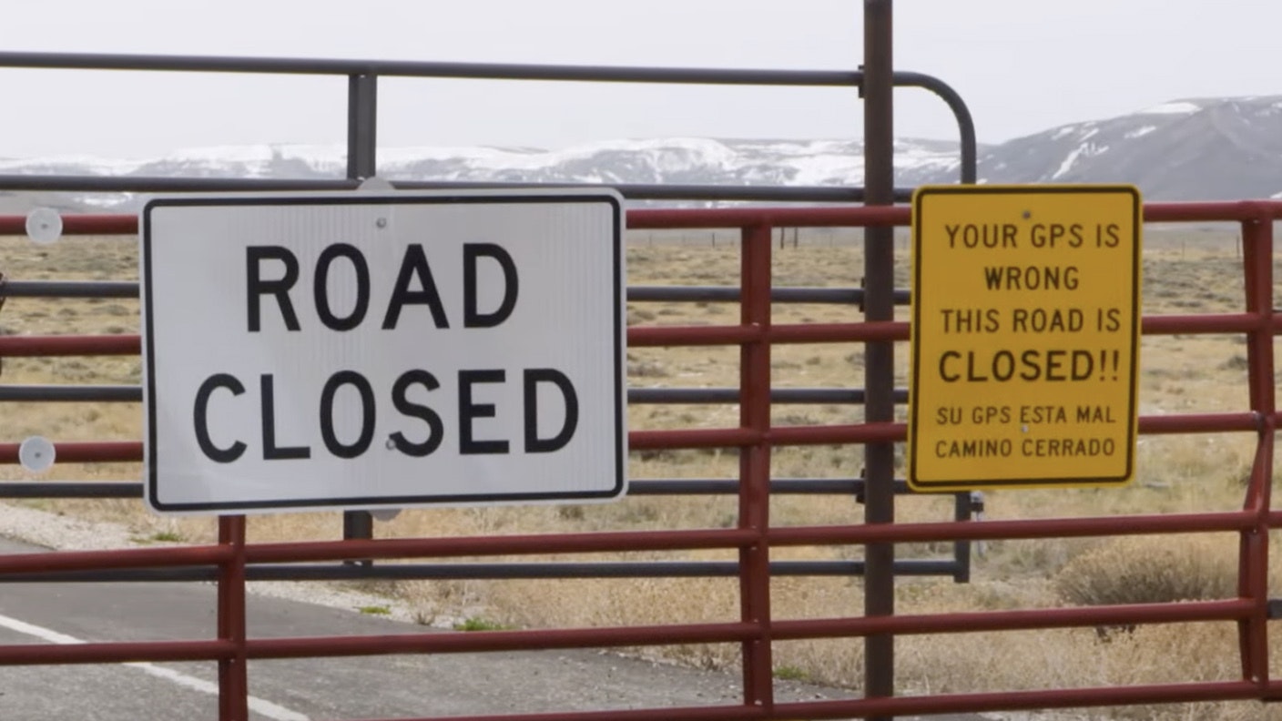
“We’ve also been working with different counties around the state who want their closed roads, seasonally closed roads and unmaintained winter roads to be included in that data, so Google will stop using those roads as potential alternative routes,” Achs said.
Interstate 80 The Biggest Culprit
Most of the problems in Wyoming seem to stem from cases where Interstate 80 has to be closed, generally in the Rawlins area.
“Wyoming gets a lot of cross-country traffic on I-80,” Achs said. “And folks will try to keep moving during weather closures and delays. And we do see a lot of, you know, non-Wyoming centric traffic — people going coast to coast, people taking deliveries in their commercial vehicles or, you know, tourists headed to Yellowstone.”
Often, those drivers have less familiarity with the state and are more likely to be misled when apps recommend a questionable route.
But even those with some familiarity with the state can sometimes be led astray. Achs herself has seen instances where a driving app suggests a route that might not seem sketchy on the surface.
“One of the reroutes I personally saw was following a highway in Colorado, northern Colorado,” Achs said. “It would have gone across Walden, Craig and Steamboat.”
That would mostly be two-lane highways, Achs added, and definitely not shorter than other alternative ways a motorist should go if I-80 is closed.
“One thing I would say is to still not blindly trust that GPS,” Achs said. “You know, make sure you know what to expect on that route. You know, use our 511 app to kind of corroborate your route and see what you can expect on your travels.”
Wyoming’s 511 app is updated in real time and includes information about road closures, strong winds, significant ice or snow and other situations where motorists need real-time data.
But at least one warning sign that a motorist is being led astray is fairly obvious, Achs added. Unpaved routes should throw up a huge red flag.
“In Wyoming, all the state highways are paved,” she said. “So if it’s paved, that’s a good sign that it’s a well-traveled road.”
Don’t Ignore Road Closed Signs
Given the situation, some motorists decide just ignoring a road closed sign is better.
But they couldn’t be more wrong.
Wyoming closes roads only when they are unpassable, and no one wants to end up like the California guy who drove around a gate on I-80 during a blizzard in a Mini Cooper a couple years ago.
Or the Montana guy who tried to flee a Wyoming Highway Patrol vehicle on a closed portion of I-80 that ended up having 5-foot snowdrifts.
Drivers who ignore closed roads can face fines of up to $750 or 30 days in jail or a combination of both. That’s in addition to finding themselves stranded in below-freezing weather with an undetermined wait-time for search and rescue to finally get to rescuing them.
Wyoming does have a program allowing limited travel past a closed gate in select cases. It’s called the Wyoming Travel Authorization Program, or W-TAP.
Wyoming travelers can apply for up to seven segments of authorized travel past a road closure gate so they can get to and from specific destinations like between work and home.
The travel authorizations are only issued if a specific segment of closed road is safe for travel. They also still remain at the discretion of the Wyoming Highway Patrol trooper manning a given gate.
Renée Jean can be reached at renee@cowboystatedaily.com.