It’s been beyond chilly the past four days in Wyoming, even by the standards of the hardiest, cold-tempered Wyomingites. With temperatures negative well into the double digits — before factoring in windchill — the Cowboy State has been in hunker-down, ride-it-out mode.
And while it’s been too cold to be outside for any length of time, this winter blast also brought some welcome snow for the Wyoming mountains.
The polar vortex that descended on Wyoming on Friday and has kept things frigid through Monday was unusually intense, said Cowboy State Daily meteorologist Don Day.
In Worland, the minus 36 degrees measured Monday morning was the coldest ever for the town since record-keeping there began 64 years ago. And in Buffalo and Gillette, the windchill dropped the mercury to minus 60.
“We don't necessarily get one of these (storms) every winter,” he said. “This one was certainly on the edge of extreme.”
Cold, Colder, Coldest
After months of mild weather, the first winter storm of 2024 was a lot of cold and snow all at once. Day said Wyoming hasn’t had a storm like it in several winter seasons.
“The size and magnitude of this arctic outbreak is the strongest and largest since 2021,” he said. “This is a severe outbreak causing a lot of problems all across the U.S., and we'll hear about it for a little bit longer.”
Day was referencing the latest surge of cold wind from the Arctic that hasn’t left Wyoming yet. Some of the coldest temperatures of the last several days were recorded early Monday morning.
Lance VandenBoogart, a meteorologist with the National Weather Service Office in Riverton, said it was “exceptionally cold” in the Bighorn Basin.
“Worland (Municipal) Airport had a low of minus 36,” he told Cowboy State Daily. “The old record was minus 29, set in 1993. Beating the old record temperature for that day by seven degrees is pretty impressive.”
Bear in mind that the minus 36 recorded was Worland’s actual temperature. It could have easily been much colder with the windchill.
A bit farther north, Greybull tied its previous record for lowest temperature at minus 28, set in 1998.
Elsewhere around Wyoming on Monday, it got down to minus 11 in Lander, minus 18 in Big Horn, minus 21 in Gillette, minus 25 at Devils Tower, minus 17 in Lusk, minus 16 in Cheyenne, minus 14 in Laramie, minus 20 in Rawlins, minus 11 in Wamsutter, minus 20 in Cody, and minus 5 in Green River.
As of Monday, several windchill warnings were still in effect throughout Wyoming, which VandenBoogart said also are rare.
“It's pretty rare that we end up issuing windshield warnings that widespread,” he said. “And again, windchill is apparent temperature. So that's a combination of cold air plus wind that quickly pulls that heat away from your body. That's when we issue those windchill warnings.”
Packing It In
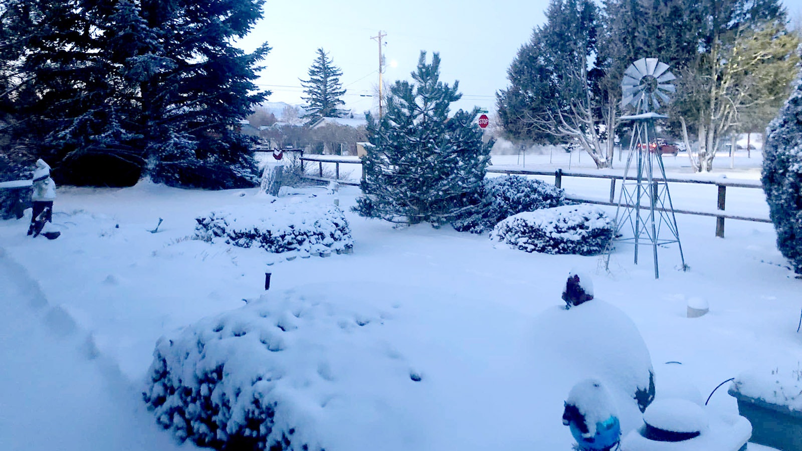
Windchills were the worst part of Wyoming’s impact from the polar vortex, but there was a decent amount of snow. That’s good news for the mountainous regions and ski areas in the Cowboy State.
“There's anywhere from 12 to 15 inches across the Salt River and Wyoming Ranges up into the Tetons,” VandenBoogart said. “The Wind Rivers also had about a foot in new snow. The Upper Green River Basin got between an inch and 2 inches of new snow, and the Wind River Basin also got an inch or 2.”
Getting snow is one thing, but keeping it is quite another. Day looked at the latest snowpack reports from the Natural Resources Conservation Service and noticed dramatic improvements.
“Before the snow started, the Little Snake River drainage was at 67%,” he said of the area’s normal snowpack. On Monday morning, “it was at 91%. The upper North Platte was 64% versus 85%. The Lower Green River drainage was 75% and went to 91%. And then the opera bear went from 73 to 101. We saw snowpack seeing 20% to nearly 30%.”
A nearly 30% increase in snowpack statewide is welcome news. The noticeable lack of snow in Wyoming through December and January (so far) has many people concerned.
Day has often told Wyomingites to be patient since historical records show the snow season doesn’t start in earnest until February and March. The weekend’s winter weather should be a promising sign of the snow yet to come.
“This is the kind of storm that can right the ship,” he said. “If we can follow that up with more storms, that can change things for the rest of the season. We're not in the second half of the snowpack season. We're still in the front side of it.”
Warming Up?
As of Monday, it’s still scary cold across Wyoming. Most Cowboy State communities had a fourth consecutive day with apparent temperature (actual temperature and windchill) in double-digit negatives.
Both Day and VandenBoogart anticipate the week will get warmer as it progresses. However, “warmer” is determined by who’s reading what thermometer, and those impacts differ in a state as large as Wyoming.
“Most of this week is going to feel fairly chilly,” VandenBoogart said. “It depends on where you are. Some places will warm up. A lot of the basins in central Wyoming are going to have a hard time warming up too much just because that cold air is settled in place.
“Our message for the week is that it’s not necessarily going to feel a lot warmer. It will moderate a little bit towards the end of the week and especially into the weekend.”
“The good news is we're going to see relief from the severe cold starting Tuesday afternoon in most states,” Day added. “But it's also going to mean increasing wind, and we'll have some blowing snow problems. This is typical in Arctic air retreats. There's a void that has to be filled in when the wind comes in.”
Day said the changing temperature will be particularly impactful along the Interstates 80 and 25 corridors. Stronger winds mean blowing snow across the highways, a hazardous combination that usually brings slick surfaces and poor visibility.
“There’s still going to be a lot of winter weather to contend with,” he said. “It's going to be wintry here through the week.”
Andrew Rossi can be reached at arossi@cowboystatedaily.com.