A mysterious river that disappears into the side of a mountain, winding roads up the side of a mountain, deep blue mountain lakes, and over it all, stands the towering Wind River Mountain Range, Wyoming’s tallest by far.
Those are the benefits of a wonderful ride high above Lander that we took this past Sunday afternoon.
Folks who live on the east side of those Wind River Mountains have a tradition of getting “looped,” as often as possible. This is my term for driving the spectacular Loop Road.
Last Sunday, there was such an abundance of green color everywhere as we headed for the mountains. It sure felt like spring, but the colors were still green and summer-like.
We were re-visiting a magical place that cast a spell on us a half century ago when we saw it for the first time. Sinks Canyon and the Loop Road outside of Lander are what caused my wife Nancy and me to move to Wyoming from Iowa.
It is every bit as beautiful now as it was then. I recall telling Nancy about being blown away by how the Popo Agie River was so picturesque. The scenes looked like color photos I had seen on calendars but never dreamed that these places really did look like this. It is a transcendent experience.
Canyon Is Gateway To The Winds
Sinks Canyon is the primary gateway to the Wind River Mountain Range from the east. Located just south of Lander, the canyon’s sheer cliffs and magical river make it a haven for sightseers.
The remarkable reason for the name of Sinks Canyon is that the river disappears into the side of the canyon wall and reappears a quarter mile downstream on the other side of the canyon. If you have not visited this eighth wonder of Wyoming, you should. There are wonderful visitor centers there to explain things.
Then you climb out of Sinks Canyon and head up the Loop Road. The highway up the paved switchbacks and soon you are climbing up to the saddle below Fossil Mountain and Windy Point.
I always thought Windy Point should be called Chief’s Head, as it looks like old Chief Washakie looking up to the heavens. Another theory is that it looks like a bust of President Thomas Jefferson. That would be appropriate since he acquired all this land through the Louisiana Purchase.
Beautiful lakes in the form of Frye Lake, Worthen Reservoir, and Fiddler Lake greet you along this first section of the Loop Road, which is graveled but passable for sedans.
(Cowboy State Daily Staff) 
(Cowboy State Daily Staff) 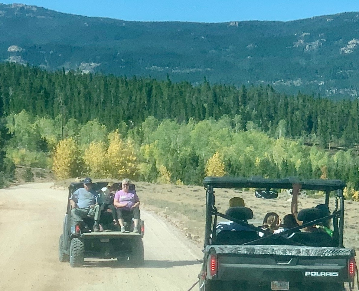
(Cowboy State Daily Staff) 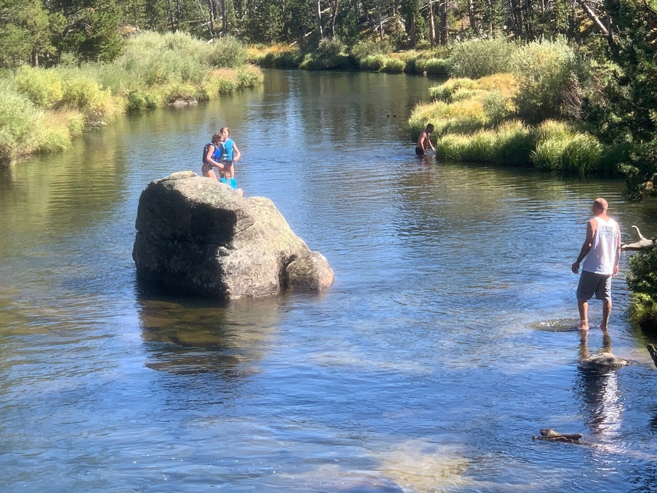
(Cowboy State Daily Staff) 
(Cowboy State Daily Staff) 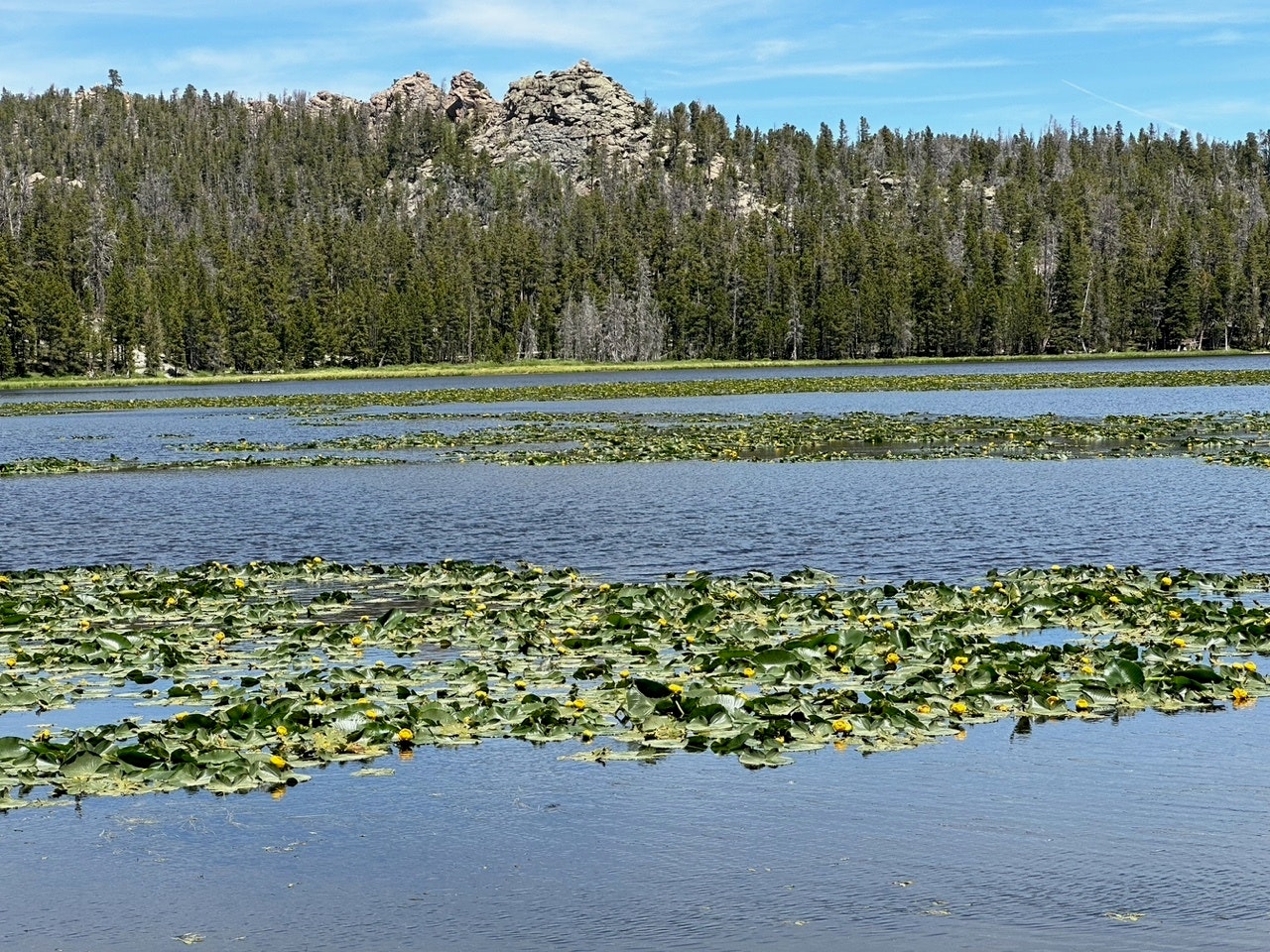
(Cowboy State Daily Staff) 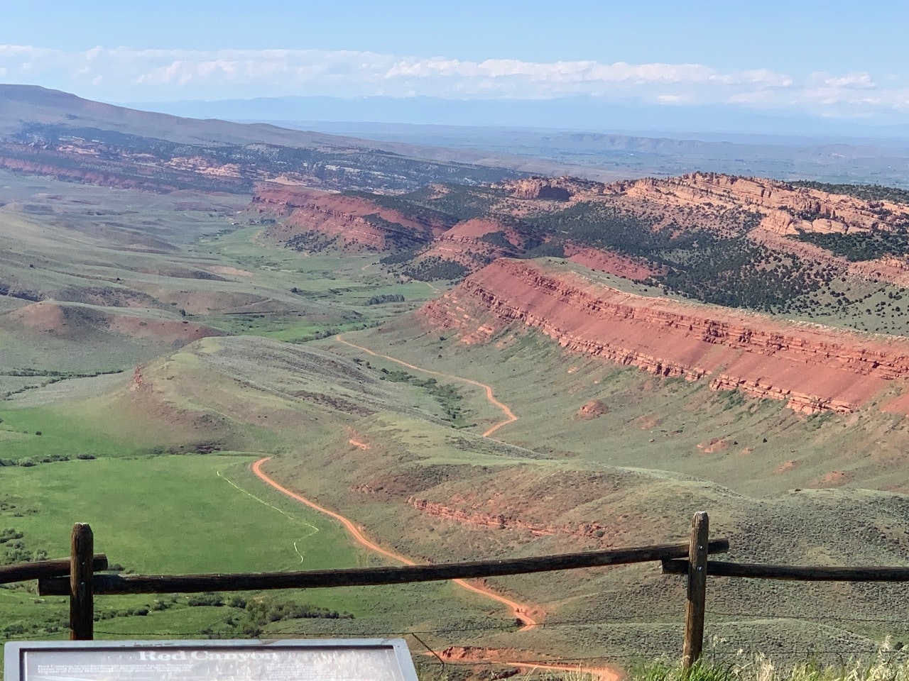
(Cowboy State Daily Staff) 
(Cowboy State Daily Staff) 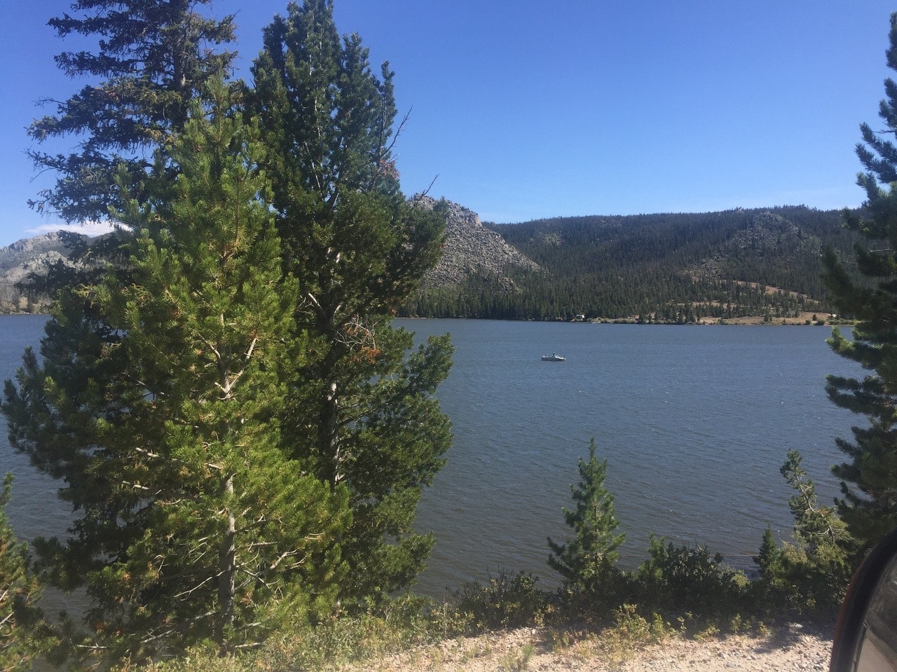
(Cowboy State Daily Staff)
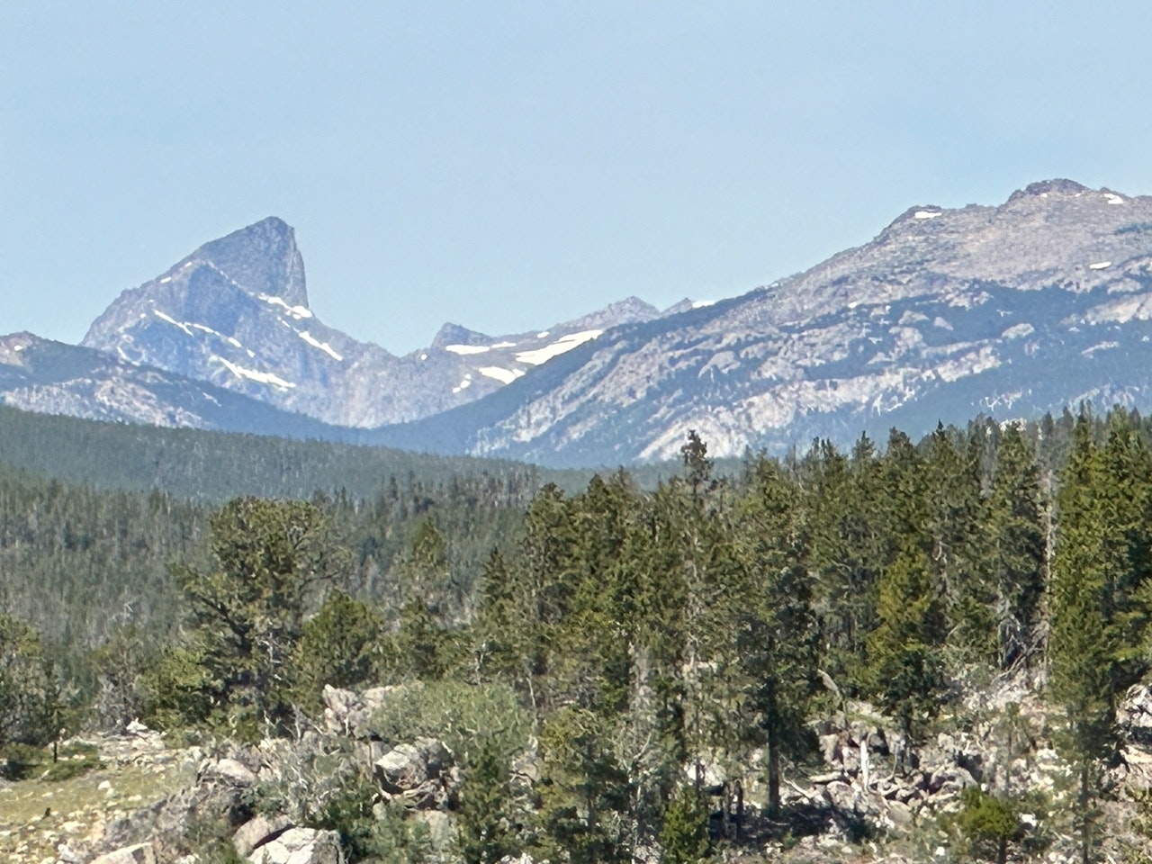
The gigantic form of Wind River Peak at 13,192 feet looms over this entire scene. It is the tallest mountain in the southern Wind Rivers. It has plenty of snow on it now and glistens in the distance.
Another monolith that shows up in your rear-view mirror is the massive hunk of rock known as Lizard Head Peak, which is 12,842 feet high. It is one of the signature mountains in the famous Cirque of the Towers. It is amazing that you can see it so well from the Loop Road, but you need to know where and when to look.
Highest point of the road is Blue Ridge, which sits at 9,578 feet above sea level. A short hike farther up and you can climb stone steps to an old Forest Service fire lookout station. Again, well worth the trip and the view is breathtaking for 360-degrees.
There is a spectacular spot where the road crosses the Little Popo Agie River. I stopped and snapped some photos and then saw a gal swimming in the frigid river. She climbed out of the water onto a big rock and started to sun bathe. It must have been very invigorating. She was from Washington state, according to the license plate on her small car parked nearby.
Louis Lake (pronounced Louie) is the showpiece of the Loop Road. It is a very deep lake. It has nice beaches on its east end and is a favorite place for boating, canoeing, fishing, and just enjoying life.
From Louis Lake to WYO Highway 28 on South Pass, the Loop Road goes by Grannier Meadows and up and around Dead Horse Curve.
The reason it is called the Loop Road is that you never need to backtrack. You just keep going and complete the loop drive to Highway 28 back to Lander.
You Can See The Vast Red Desert
As you get to South Pass, you look off at the vast Red Desert, which is one of Wyoming’s seven legitimate wonders. Continental Peak and the Oregon Buttes stand out in the distance.
On the way back down the mountain back to Lander the most stunning sight is Red Canyon. This is a huge box canyon, which is striking by all the red rock of the Chugwater Formation. It is one of the most photographed places in this part of Wyoming.
Before heading home, we enjoyed a lunch at the Atlantic City Merc, a famous joint high in the mountains. It was crowded on this day at 2:15 p.m. We chatted with RVers from Texas and three guys riding the Continental Divide Trail by on their bikes.
And then we were back home, having enjoyed a wonderful three-hour drive. It reinforced all the wonderful reasons of why we live here and try to get “looped” in our big mountains at often as possible in the summer.