Although Wyoming was in the crosshairs for expected severe weather on Wednesday, the severe storms happened south and east of the state instead.
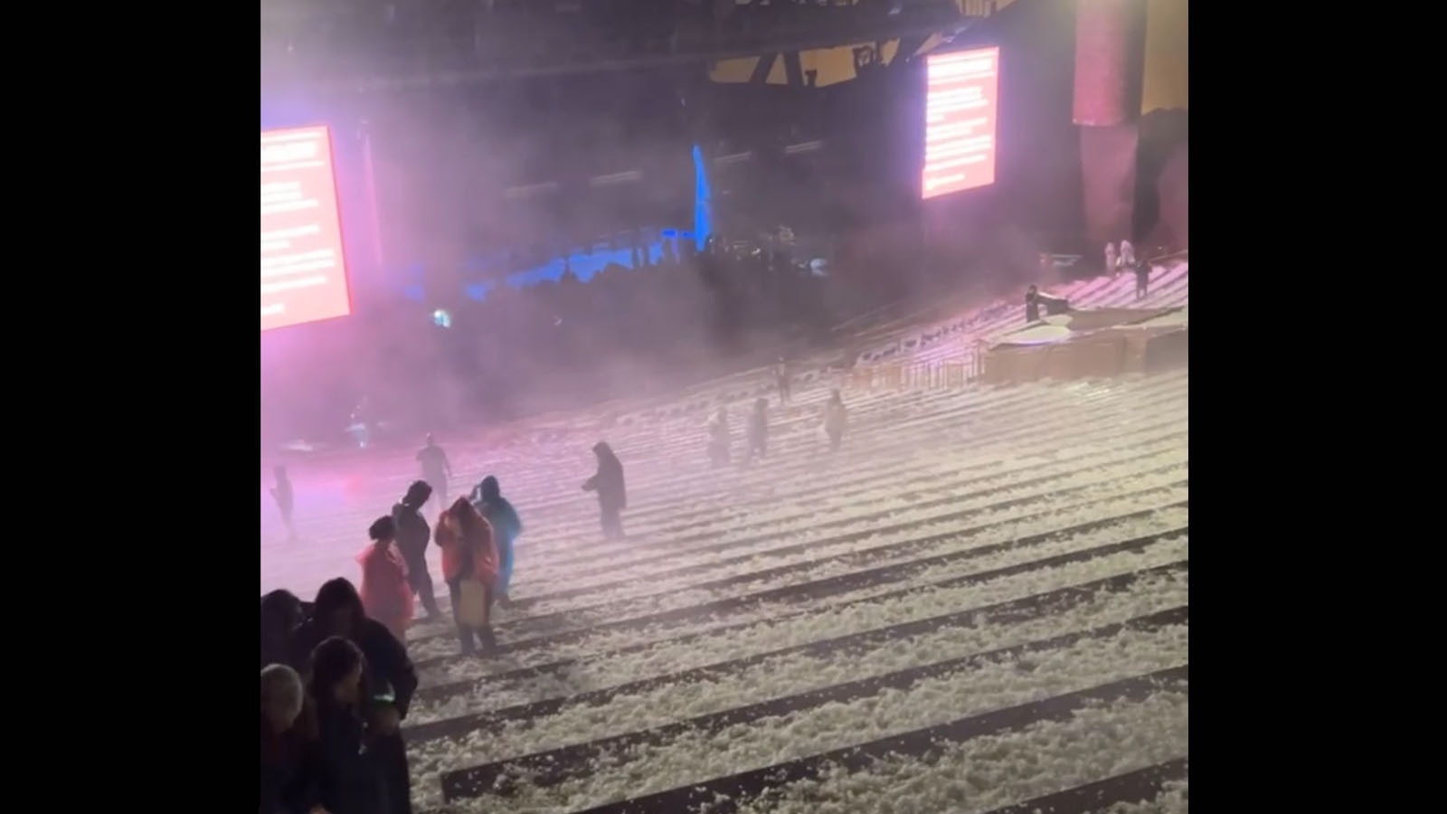
The most dramatic storm activity occurred Wednesday night at the Red Rocks concert venue in Morrison, Colorado, where tennis ball-sized hail fell during a Louis Tomlinson show.
More than 90 people were treated for injuries ranging from cuts to broken bones. Seven people were hospitalized.
One concert attendee said the experience was "the scariest night of my life."
"It started pelting people with hail at Red Rocks and my sister and I luckily found shelter under a sign," Nikkitbfh tweeted. "I am bleeding and have huge bumps on my head from the hail. Hoping everyone made it out safely."
She later said the sign they were using for protection fell apart but were rescued by other attendees of the concert.
"Biggest shoutout to the random guys at Red Rocks who sheltered us in their car during the hail storm after the sign we were hiding under broke. Literally saved our lives, if not a serious concussion," she said.
Alyssa Schifano, another concertgoer, called the storm was "traumatizing."
Hid under a tree with my boyfriend and about 25 other people all crowded together and getting pelted by golf ball sized hail," she said via Twitter. "Our concession stand let people crowd under it but we saw several people bleeding..."
Earlier in the day a pair of twin tornadoes, a rare weather occurrence, were filmed near the town of Akron — about 2 1/2 hours south of Cheyenne.
What made the storm system more interesting is that the weather pattern sat in the same place for more than an hour.
No damage was reported from the tornadoes although flights were delayed up to an hour at Denver International Airport.
Additionally, many areas of eastern Colorado received quarter to half dollar-sized hail.
Thursday And Friday
Although Wyoming escaped the most damaging storm conditions on Wednesday, meteorologist Don Day said there were several tornado and flash flood warnings in Albany, Platte, Goshen and Laramie counties.
Be looking for the same type of weather on Thursday and Friday, Day said.
“We have the same weather patterns expected on both days,” Day said on Thursday morning.
Day said the Storm Prediction Center has highlighted a stretch of land ranging from southeastern Wyoming through all of eastern Colorado to northeastern New Mexico as the most highest risk today for severe weather.
“There’s a good chance for hail in these areas and tornado activity as well,” Day said.
Expanded Risk
The same setup is in store for Wyoming on Friday but expect the rain to be more widespread across the state.
As for severe weather activity, Day said the range will expand on Friday to all of eastern Wyoming and a large portion, in particular, of the northeastern portion of the state.
Don Day's forecast can be viewed here.
Jimmy Orr can be reached at jimmy@cowboystatedaily.com.


