WYOMING WEATHER - April 4, 2023
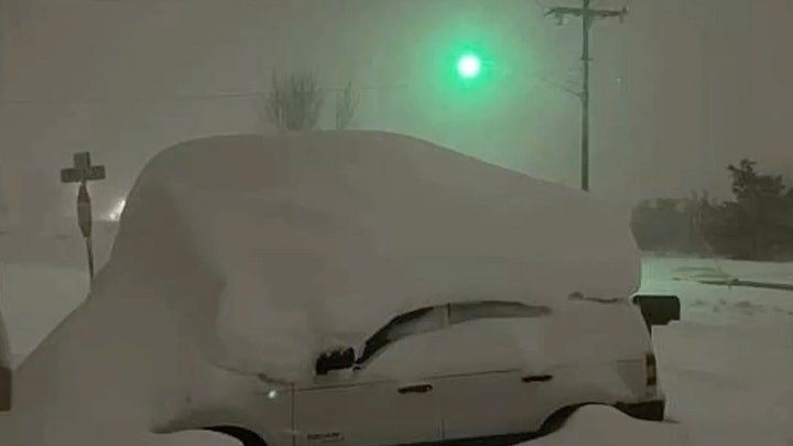
It's Tuesday, April 4, and highways in more than half of the state are closed this morning, as a massive winter storm hit much of Wyoming again. Casper received 27 inches of snow which makes it the snowiest day on record with records going back to 1937. Snow will continue in many areas of the state today.
Central:
WINTER STORM WARNING IN EFFECT UNTIL 6 P.M.
Casper can expect 2 to 4 inches of snow today, along with wind gusts as high as 44 mph and a high near 24. 2 to 4 inches of snow is expected today in Lander, with a high near 26; blustery, with gusts as high as 33 mph. There's an 80 percent chance of snow today in Glenrock (2 to 4 inches of snow possible), with areas of blowing snow and gusts as high as 35 mph; a steady temperature around 21.
Casper could see less than an inch of snow tonight, with a low around 14; blustery, with gusts as high as 34 mph. There's a 50 percent chance of snow overnight in Lander, with a low around 5 and wind chill values as low as -5; new snow accumulation of less than a half inch possible. Glenrock has a 40 percent chance of snow tonight, with a low around 11 and wind chill values between zero and 5; blustery, with gusts as high as 30 mph.
Southwest:
WINTER STORM WARNING IN EFFECT UNTIL 6 P.M.
Rock Springs could see 1 to 2 inches of new snow today, along with wind gusts as high as 33 mph, and a high near 31. 1 to 3 inches of snow is expected today in Evanston, with a high near 24 and wind chill values as low as 2. There's 1 to 3 inches of new snow possible today in Cokeville, with a high near 27.
There's a 40 percent chance of snow tonight in Rock Springs, with a low around 12; breezy, with gusts as high as 20 mph. Snow showers are likely tonight in Evanston, with a low around 12 and wind chill values as low as zero; new snow accumulation of around an inch possible. Cokeville could see around an inch of new snow overnight, with a low around 0 and wind chill values as low as -10.
Western Wyoming:
There's a 50 percent chance of snow today in Pinedale (around an inch possible), otherwise partly sunny, with a high near 24 and wind chill values as low as zero; blustery, with gusts as high as 24 mph. Snow is likely today in Star Valley (less than half an inch possible), otherwise mostly cloudy, with a high near 33. WINTER STORM WARNING UNTIL 6 P.M. TODAY in Big Piney, with less than one inch of new snow possible and a high near 24.
Pinedale could see less than half an inch of new snow overnight, with a low around 2 and wind chill values as low as -10. There's a 50 percent chance of snow tonight in Star Valley, with a low around 9 and wind chill values as low as zero. 1 to 3 inches of new snow is possible overnight in Big Piney, with a low around -2 and wind chill values as low as -15.
Northwest:
Dubois can expect less than a half inch of snow today, with a high near 28; breezy, with gusts as high as 23 mph. There's a 30 percent chance of snow today in Yellowstone National Park, otherwise partly sunny, with a high near 27; blustery, with gusts as high as 22 mph. There's a 50 percent chance of snow today in Jackson (less than half an inch possible), with a high near 30; blustery, with with gusts as high as 25 mph.
There's a 40 percent chance of snow tonight in Dubois (less than half an inch possible), with a low around 6 and wind chill values as low as -5. Yellowstone has a 20 percent chance of snow tonight, with a low around 9 and wind chill values as low as zero; breezy, with gusts as high as 21 mph. Mostly cloudy with a chance of snow tonight in Jackson (less than half an inch possible), and a low around 4, with wind chill values as low as -5; breezy, with gusts as high as 20 mph.
Bighorn Basin:
Cody could see 1 to 2 inches of snow today, along with wind gusts as high as 55 mph, and a high near 25. Less than half an inch of new snow is possible in Greybull this morning, otherwise partly sunny, with a high near 32; very windy, with gusts as high as 50 mph. WINTER STORM WARNING UNTIL 6 P.M. TODAY in Thermopolis, with 1 to 2 inches of new snow possible and a high near 32; very windy, with gusts as high as 47 mph.
There's a 30 percent chance of snow overnight in Cody, with a low around 12; blustery, with winds gusting as high as 31 mph. Greybull has a 20 percent chance of snow this evening, otherwise partly cloudy and very windy, with a low around 16 and wind gusts as high as 49 mph. Less than half an inch of new snow is expected overnight in Thermopolis, with a low around 14; windy, with gusts as high as 43 mph.
North Central:
WINTER STORM WARNING IN EFFECT UNTIL MIDNIGHT
Sheridan could see around 6 inches of new snow today, along with winds up to 26 mph, and a high near 26. Around 5 inches of snow is expected today in Clearmont, with a high near 26; windy, with gusts as high as 38 mph. Story can expect around 9 inches of new snow today, with a high near 23; breezy, with winds increasing to 21 to 26 mph this afternoon.
Around 2 inches of new snow is expected overnight in Sheridan, with a low around 12 and wind chill values as low as -5; breezy, with winds 16 to 21 mph. Clearmont could see around an inch of new snow overnight, along with winds up to 39 mph, and a low around 14, with wind chill values as low as -5. Story can expect around 2 inches of new snow tonight, with lows around 11 and wind chill values as low as -10; windy, with gusts as high as 39 mph.
Northeast:
WINTER STORM WARNING IN EFFECT UNTIL NOON WEDNESDAY
Newcastle can expect less than an inch of new snow today, with wind gusts as high as 29 mph and a high near 28, with wind chill values as low as 7. 3 to 7 inches of new snow is expected today in Gillette, with a high near 24 and wind chill values as low as 4; blustery, with gusts as high as 38 mph. Upton could see 1 to 2 inches of new snow today, with a steady temperature around 22 and wind chill values as low as 4; blustery, with gusts as high as 31 mph.
Snow is likely tonight in Newcastle (less than half an inch possible), with a low around 12 and wind chill values as low as -9; blustery, with gusts as high as 40 mph. Snow is likely overnight in Gillette, along with wind gusts as high as 37 mph, and a low around 13, with wind chill values as low as -4. Less than half an inch of new snow is expected overnight in Upton, with a low around 12 and wind chill values as low as -8; blustery, with gusts as high as 37 mph.
Eastern Plains:
WINTER STORM WARNING IN EFFECT UNTIL 6 AM WEDNESDAY
Douglas could see 2 to 4 inches of new snow today, along with wind gusts as high as 35 mph, and a high near 24, with wind chill values between zero and 5. 3 to 5 inches of new snow is expected today in Wheatland, with wind gusts as high as 30 mph and a steady temperature around 21. Guernsey can expect 1 to 3 inches of snow today, along with winds gusting as high as 35 mph, and a high near 26.
There's a 40 percent chance of snow tonight in Douglas, with a low around 8 and wind chill values between -5 and 5; blustery, with gusts as high as 35 mph. Wheatland has a 30 percent chance of snow tonight, with a low around 11 and wind chill values between zero and 5; blustery, with wind gusts as high as 35 mph. There's a 40 percent chance of snow in Guernsey overnight, with a low around 14 and wind chill values between zero and 10; windy, with gusts as high as 45 mph.
Southeast:
Laramie can expect less than one inch of new snow today, along with wind gusts as high as 30 mph, and a steady temperature around 20. Less than half an inch of new snow is expected in Cheyenne today, with a steady temperature around 21; windy, with gusts as high as 40 mph. WINTER STORM WARNING UNTIL 6 PM TODAY in Medicine Bow, with 1 to 2 inches of new snow possible and a high near 21, and wind chill values between zero and 5.
There's a 20 percent chance of snow tonight in Laramie, with a low around 8 and wind chill values between -5 and zero; blustery, with gusts as high as 30 mph. Cheyenne has a 30 percent chance of snow tonight, with a low around 12 and wind chill values between -5 and zero; windy, with gusts as high as 40 mph. There's a 30 percent chance of snow in Medicine Bow overnight, with a low around 8 and wind chill values between -5 and 5.
South Central:
WINTER STORM WARNING IN EFFECT UNTIL 6 P.M.
Saratoga could see around an inch of new snow today, with a temperature falling to around 18 by 5pm; blustery, with gusts as high as 30 mph. 2 to 4 inches of new snow is expected in Rawlins this morning, with a steady temperature around 18 and wind chill values between zero and 5; blustery, with gusts as high as 35 mph. Baggs can expect less than half an inch of snow today, along with wind gusts as high as 35 mph, and a high near 29.
There's a 20 percent chance of snow tonight in Saratoga, with a low around 9. Rawlins has a 20 percent chance of snow overnight, with a low around 10 and wind chill values between zero and 5. Mostly cloudy overnight in Baggs, with a low around 7 and wind chill values between zero and 5.
Be sure to check out the road conditions if youre traveling today!


