A collaborative effort between the city of Laramie and Albany County to update a plan guiding protection of the aquifer that provides drinking water for much of the city and county is entering the final stages of a yearslong process.
The original Casper Aquifer Protection Plan was first published in 2001, but the city and county have since issued differing updates, the most recent of which is more than a decade old.
“It’s overdue for updating by both entities,” said Sarah Gorin, a member of the advocacy group Albany County Clean Water Activists.
The plan, also known as the CAPP, guides management of areas within the Casper Aquifer Protection Area, which covers 72 square miles on the eastern side of the city and into the Laramie Range. It is not a regulatory document, so any regulations that flow from it must be codified by the city and county.
High-Quality Water
The Casper Aquifer supplies more than half the drinking water for the city of Laramie and is the sole water source for many county residents. It’s a high-quality water source, and should it become contaminated, a water treatment facility would cost tens of millions of dollars to bring into operation.
Though aquifer protection itself may not be a contentious issue, locals have sparred for years about the sources of potential threats to the aquifer, how likely those threats are, and what should be done to mitigate them.
The updated plan faces multiple public hearings on its journey to adoption, but both the Laramie City Council and Albany County Board of Commissioners have indicated willingness to support it.
Vulnerable Water Source
The Casper Aquifer is located within hundreds of feet of porous underground sandstone and limestone formations, replenished by snowmelt that drains down the western side of the Laramie Range.
In the higher-elevation recharge zone, the aquifer formations are closer to the surface, while a layer of shale protects the aquifer as it moves west toward the city and dives deeper underground. The aquifer is most permeable and vulnerable where the sandstone and limestone have been fractured, with such features found across the protection area.
The CAPP points to two potential sources of contamination: hazardous materials transported through the aquifer zone along Interstate 80 and the Union Pacific Railroad, and nitrates presumably leaching from residential septic systems outside Laramie city limits.
Testing of domestic wells in the area in 2009 found that 29% of wells had nitrate levels above 5 milligrams per liter, while three wells had nitrate levels above 10 mg/L, which is a threshold for public safety identified by the U.S. Environmental Protection Agency.
“There’s a reason why (nitrate concentrations) are regulated,” said Mark Stacy, a hydrogeologist with the consulting firm Stantec, which was hired to draft the updated plan.
The plan recommends requiring that new and replacement septic systems in small-lot developments where the shale layer is shallow have advanced treatment technology. It suggests that septic systems be inspected every three years and pumped every five years.
“The focus would be on high-density areas,” Stantec said.
Other suggestions include prohibiting larger commercial animal feeding operations and commercial turf operations that demand fertilizers, herbicides and pesticides and lots of watering.
Property Rights Claims
While many of the public comments on a draft plan published in September expressed support for the updated plan, a handful of focused on the extra burden placed on homeowners in the county to make expensive upgrades.
And not everyone is convinced that septic systems pose a threat to water quality.
“We feel this is so invasive to our property rights, when there is no proof of contamination,” said one comment.
During a public meeting this fall, Laramie resident Brett Glass echoed that sentiment.
“This could cause real problems for people who live there or who have bought land and hope to build there,” he said.
Gorin said septic systems by design allow wastewater to percolate through soil.
“That doesn’t make them bad, but that does mean that you have to think pretty carefully about where you put them, and how many you put in,” she said.
Transportation Corridor Threat
In 2019, the city and county funded an airborne geophysical study that collected electromagnetic and magnetic data to learn more about groundwater movement within the aquifer system.
The airborne survey measured electrical resistivity through the subsurface layers, as differences in resistivity correlate with water content and permeability. Geophysicists at the University of Wyoming used the data to create a model of groundwater movement.
The multi-year study suggested that the city of Laramie’s main well, Soldier Springs, isn’t vulnerable to contamination from Interstate 80, though private wells in the vicinity of the travel corridor might be.
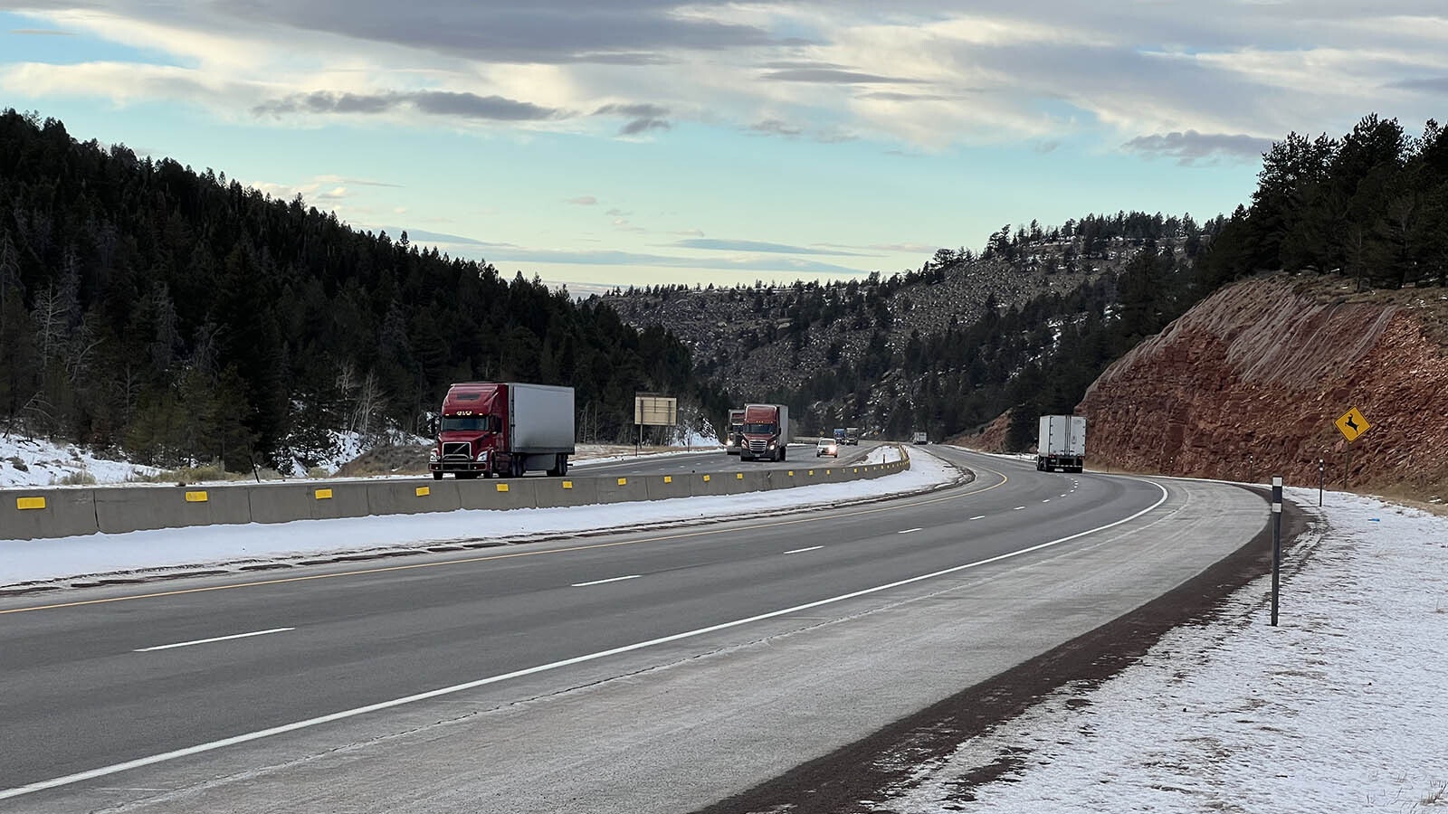
Interstate 80 travels above the aquifer while descending through Telephone Canyon east of Laramie. Thousands of vehicles use the interstate every day, many transporting hazardous materials.
Research scientist Bradd Carr said a spill high up in the canyon, where recharge occurs, would probably take months to work its way through the aquifer, depending on the time of year. A spill at a lower elevation, meanwhile, would have a hard time even reaching the water table.
“If nothing were to change in current pumping conditions, it’s unlikely that a contaminant from the lower part of I-80 would get to Soldier Springs,” he said.
Pilot Hill Project
Much of the most vulnerable portion of the aquifer recharge zone was protected from any future development with the completion of the Pilot Hill Project in 2020.
Warren Livestock sold more than 5,000 acres of undeveloped land in the Laramie Range foothills adjacent to Laramie city limits to the Wyoming Office of State Lands, Bureau of Land Management and University of Wyoming. The area is now managed in partnership with the Wyoming Game and Fish Department and will remain non-motorized open space.
Changes To Western Boundary
Stantec said the plan doesn’t change the north, east or south boundaries of the aquifer protection zone, but it does tweak the western border, which runs through the city of Laramie.
“We spent a fair amount of time working on the western boundary,” Stantec said.
The updated boundary uses the latest available information to determine where at least 75 feet of Satanka Shale overlie the aquifer. That was the thickness the original authors of the CAPP decided would provide enough protection such that it could mark the edge of the protection area.
The plan also aligns the western border with property lines and section lines so it’s easier to delineate.
That border is important because landowners within the aquifer protection zone are subject to aquifer protection regulations as determined by the city and the county, which include submitting to a site-specific investigation for any proposed developments.
Commissioners Pete Gosar and Heber Richardson have frequently clashed over how much power the county should have to regulate development on private land within the protection area, such as the ability to deny subdivision proposals because they would result in the installation of more septic systems.
According to Stantec, about 200 existing water wells and other site investigations were used to determine the updated boundary.
Update Process
The Albany County Board of Commissioners and Laramie City Council began collaborating on an updated CAPP in early 2021, shortly after Commissioner Sue Ibarra replaced Terri Jones on the commission, tilting the complexion of the three-person board.
The city and county formed a joint steering committee, enlisted help from the city/county Environmental Advisory Committee and hired the Colorado-based firm Stantec, which produced a draft document after about a year of work.
A draft plan was released in September and public comments were accepted this fall.
The original Casper Aquifer Protection Plan was a joint effort published in 2001. The city created an updated plan in 2008, while the county updated its own version in 2011.
In November, during a joint meeting of the Albany County Planning and Zoning Commission, the Laramie Planning Commission and the Environmental Advisory Committee, county planner David Gertsch said he has enjoyed collaborating with the city so far.
“We didn’t always see eye to eye on everything, but we worked through a lot of things,” he said.
Gertsch said likes the changes to the western boundary.
“I think it takes in science as well as administrative boundaries to make sure that we have a clean line that no one can really argue about it,” he said.
At the same time, he still has questions about suggested regulations surrounding septic systems.
“I feel this will be a huge burden on people who already have homes in this area, to basically double the cost of replacing their system,” he said.
Gorin said she appreciates the investment the city and county have made in returning to a unified plan that draws on the most recent research.
“The aquifer doesn’t recognize these superficial boundaries, and it’s just a fact that most of the aquifer recharge area lies in the county, but most of the water drinkers, who are also county residents, live within the city limits of Laramie,” she said.
The draft plan must pass through the city and county regulatory processes before its adoption, which could take another six months and will include a handful of public hearings.