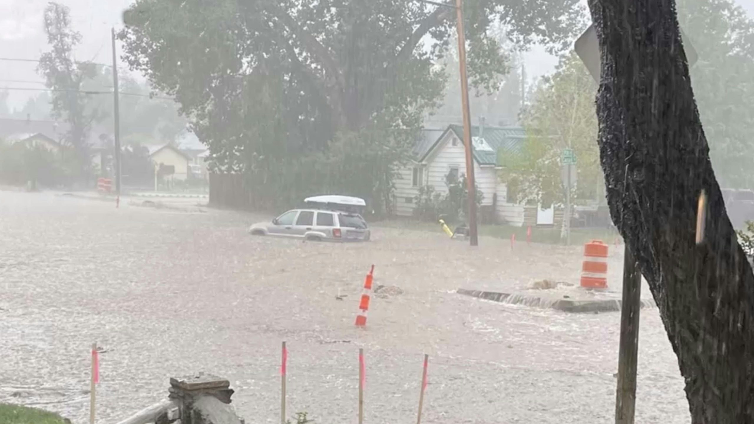
Saturday in Laramie changed from a pleasant summer day to a sledgehammering-deluge of heavy rain and large hail, with lightning strikes directly over town.
A “monsoon” storm hit Laramie at about 4 p.m., in some places dumping more than 2 inches in of rain in less than two hours. Streets became ponds and curbside gutters turned into roiling rivers. A sunken green space near Scout Park just east of north 22nd Street became an impromptu lake. It drew curious onlookers after the storm past, as well as a few bolder souls who waded out into the water.
During the peak of the storm, hailstones large enough to hurt came hurtling down; venturing outside without a hardhat would have been ill-advised.
While the downpour might have seemed unprecedented to those caught in the middle of it, such storms are normal in the region this time of year, meteorologist Don Day told Cowboy State Daily on Monday.
“A lot of the time it (a monsoon rainstorm) happens out over the prairie, and not over populated areas,” so people assume such storms are unusual, he said.
The storms are caused when warm, moist air masses from Mexico and Central America collide with cooler air over the prairies and mountains in Wyoming and Colorado, typically in late July and early August, said Day, who hosts a weather podcast for Cowboy State Daily.
“The atmosphere is really primed, typically this time of year, to produce those really heavy rains,” he said. “It’s like a monsoon, with those giant rain drops coming down in a deluge.”
The heart of downtown Laramie and sectors of the city northeast of the University of Wyoming were apparently the hardest hit, with gauges measuring about 2 ¼ inches-2 ¾ inches in less than two hours, he said.
“It’s really hard for urban drainage to keep up with that. There were reports of flooding in some basements,” he said.
And typical of such storms, people not far away had a completely different experiences, Day said.
“These events tend to be highly localized,” he said. “A few miles outside of town, there wasn’t even ½ inch of rain.”
After possibly more rain Monday, warm, dry weather is expected for most of the rest of the week in southeast Wyoming, Day said. However, monsoon conditions could return toward the weekend and early next week, although probably not as severe as Saturday’s storm.
Flash flooding is the greatest hazard associated with such storms. In years past, some in the region have turned deadly, Day said.
The worst in recent history was the Big Thompson Flood. It killed 144 people in the Big Thompson Canyon area of Larimer County, Colorado. on July 31, 1976. A thunderstorm over Estes Park, Colorado. triggered the flood, and the death toll was made worse because crowds had gathered to camp in the canyon on what was the eve of the state’s centennial anniversary.
A heavy rain and hailstorm over Cheyenne on Aug. 1, 1985 caused flash flooding that killed 12 and injured 70. On July 27-28, 1997, a storm stalled over Fort Collins, Colorado. dumping 14 ½ inches of rain in 31 hours and causing 5 deaths.