Wyoming’s weatherman Don Day said nothing significant changed overnight that would alter the forecast for the big snowstorm that is heading toward our state over the weekend.
Day, in his daily morning forecast, said parts of Wyoming are still on tap to receive many feet of snow.
The only thing that has changed since yesterday is the speed of the storm. It’s slowing down a bit.
That means peak activity won’t happen until Saturday afternoon instead of Saturday morning.
“Be patient, it’s gonna take a while this is a really slow mover,” Day said. “It’s going to be the latter part of Saturday and Saturday night when the storm starts to get real western.”
Day said he was still uncertain about how much of the storm will hit northeastern Wyoming.
“To the folks living along Interstate 90, from Sheridan to Buffalo to Gillette, to Sundance on the way to Rapid City, you’re on the northern fringes, where a slight change in the track of the storm will make a big difference,” Day said.
The bullseye, he said, continues to be southeast, east central Wyoming, and northern Colorado.
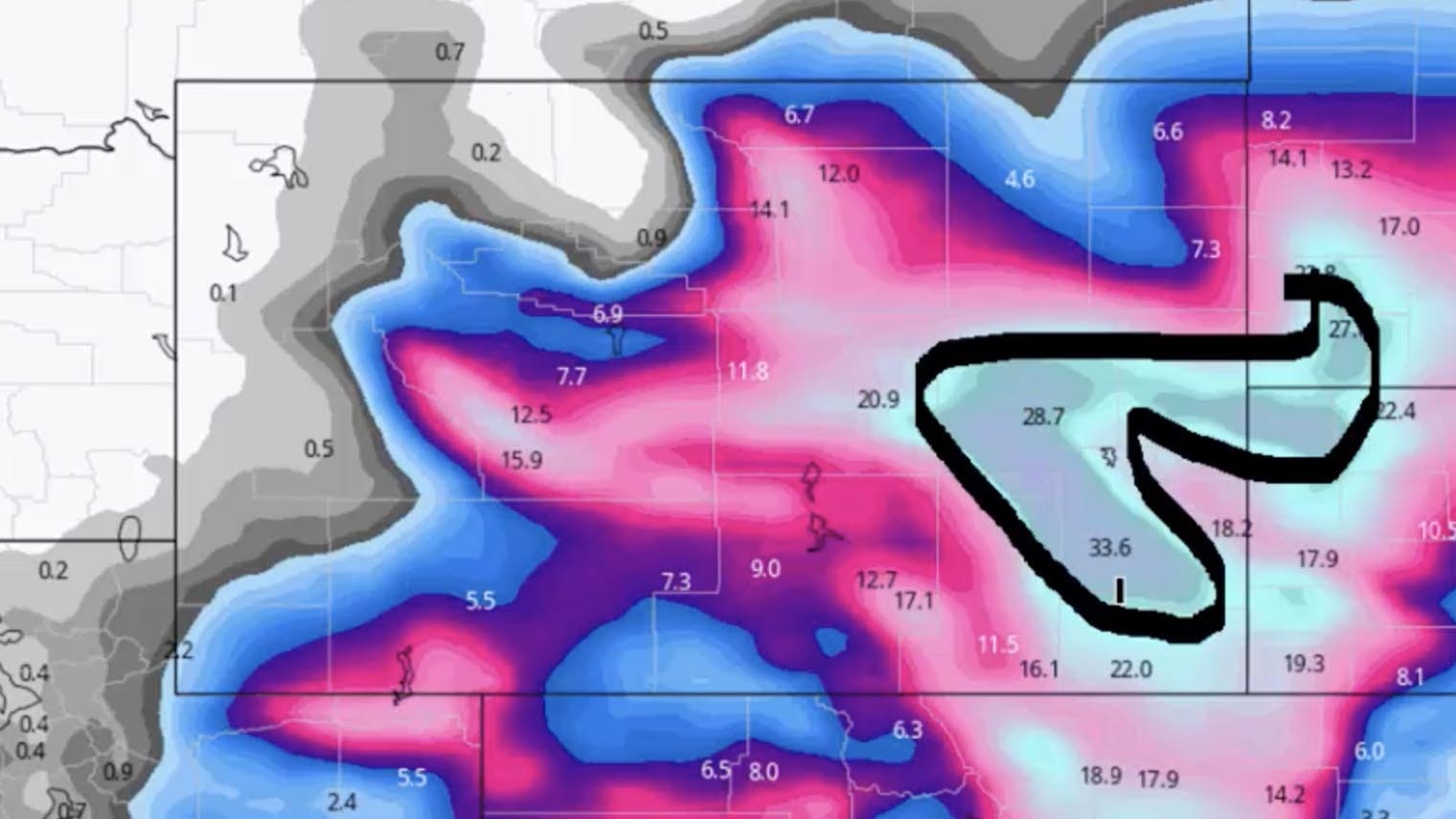
In an interview with Cowboy State Daily on Thursday, Day said the Centennial area, the Laramie summit and the foothills of Wheatland and Douglas could see the largest amounts, mentioning that 2 to 5 feet of snow is possible.
Cheyenne, Wheatland, Torrington, Casper, and Lusk could all receive between 12 and 24 inches of snow, with higher amounts a possibility.
“Snowfall amounts may be a little shorter than the 2003 storm but the total snowfall of the 2003 storm is hard to beat. But we’ll come close, we’re gonna have some really impressive snow,” he said.
He also said some of the forecasted amounts might be a bit excessive mentioning a computer model showing Wheatland receiving 34 inches but only time will tell.
Don’s complete weather forecast can be viewed here.


