By Mark Davis, Powell Tribune
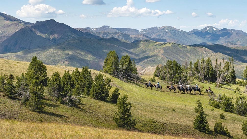
As the end of an extended public comment period nears on the Shoshone National Forest’s long-debated Travel Management Plan, local recreational and conservation groups, scientists and politicians are taking stands and alerting supporters to the ramifications of the potential new rules in the 2.5 million acre forest.
Several entities fired off letters and comments asking that specific issues be considered in the changes. Some, including the Park County commissioners, have suggested all planning should be suspended. However, according to Shoshone officials, once the public comment period ends on Monday, a final plan will be determined.
At least one alternative proposed by Shoshone officials could close or restrict popular snowmobiling areas in the High Lakes. And to some scientists, working under the assumption the area is a perpetual Research Natural Area, over-snow travel already breaks the rules — and they accuse forest officials of not enforcing rules already in place.
Even plans on individual North Zone trails, one of many multiples in the vast forest, have significant impacts to public access, ranching and wild flora and fauna.
Park County commissioners have been particularly concerned about the potential loss of motorized trails and snowmobiling areas. The board would prefer Shoshone officials leave the current plan in place.
“They keep taking, taking, taking and they revisit this every number of years, so we need to try and stand our ground. That’s the bottom line,” Commission Chairman Joe Tilden said at a meeting last week, adding, “There’s plenty of room for everybody up there and it seems to be working great now.”
A years-long process
Shoshone officials started the planning process in June 2015 to designate a sustainable system of roads, trails, and areas open for motor vehicle use. Public input is being sought on three alternatives for the north section of the forest.
Under the “no action” alternative, the current rules would be left in place.
“It reflects current management, what’s going on out there right now and includes approximately 349 miles of system roads for summer motorized use. Of that, 184 miles have seasonal closures to protect resources and wildlife,” Sue Eickhoff, the then-ranger for the Wapiti Ranger District, explained at a recent virtual meeting.
However, there are currently no summer motorized trails in the northern section of the forest — a fact that local off-highway enthusiasts would like to change. There are 27 miles of groomed and 31 miles of ungroomed over-snow trails, with 266 square miles of open area for oversnow use.
Alternative two would resultsin 11 fewer miles of system roads overall, but it does include an addition of 6 miles of small spur roads to allow legal access to dispersed campsites. So the total for alternative two is 338 miles of motorized roads for summer motorized, with 13 miles including seasonal closures to protect wildlife and resources. There are 4 miles that would be decommissioned, and 10 new miles of summer motorized trails, to address loop and youth riding opportunities brought forward a couple years ago.
Alternative two would include the same number of oversnow trails and the same number of square miles for oversnow use, Eickhoff said, but would limit the oversnow season from Nov. 1 to May 31.
Alternative three is a modified version of alternative two with minor changes in response to public comments made in 2017, Eickhoff said: It has 26 fewer miles of system roads and the addition of only 3 miles of spurs to access dispersed campsites. It also includes plans to close portions of the High Lakes Wilderness Study Area to reduce the potential for user conflicts. It has a total of 323 miles of road, which is the fewest number of miles of all the alternatives. Alternative three has 10 more miles of roads with seasonal closures to protect wildlife and resources and 3 miles to be decommissioned.
Alternative three has no season for snow use, but would rely on special orders to achieve resource protection as necessary, Eickhoff said.
Despite the five years of effort that have been poured into the planning stages, that seems to be a popular option at this point with many involved, including some conservationists.
Ken Lichtendahl of Clark believes the decision should wait until more studies can be completed.
“When you think about the Shoshone — the oldest national forest in the U.S. — and it runs from here all the way to the South Pass and beyond … it is a huge undertaking and I don’t think that anybody knows everything about every trail it [the Travel Management Plan] impacts,” Lichtendahl said.
Recent turnover at Shoshone headquarters has slowed the project. Eickhoff left to become the supervisor of the Ashley National Forest and the public relations staff has been temporarily raided for other projects, including fighting wildfires.
Jennifer Lyman, a biologist doing longterm research in the alpine zone above the tree-line in the Beartooth Range, thinks the forest should perform a more comprehensive environmental impact statement that goes beyond the current environmental assessment. Lyman said there isn’t an alternative that is acceptable and that one isn’t needed, since much of the High Lakes area is already a Research Natural Area. She believes the High Lakes should be closed to snowmobiling.
Lyman said the location is extremely important because the road over the Beartooth pass gives unparalleled access for scientists to study the fragile, slow growing and easily damaged area.
“It violates clauses of a Research Natural Area,” she said. “[Snowmobilers] shouldn’t be in the area. That’s tough, get over it.”
However, the Cody Country Snowmobile Association also penned a letter, saying it would “fight closures to the end” to keep the High Lakes open to motorized oversnow travel.
“… In our own mind we are environmentalists ourselves, because we want to take care of the land; we want to do our sport properly,” Bert Miller, the snowmobile club’s president, told commissioners last week.
Miller said in an interview that the organization could live with alternative one, but would prefer a mixture of alternatives one and two — which would add an ungroomed trail called the Ghost Creek Trail in the Crandall area. However, the club is leery of opening and closing dates for over-snow travel, hoping to use dates based on snowfall rather than a one-size-fits-all option — and Miller does not want snow measuring.
“The snowmobile club has a great relationship with the Shoshone National Forest, so we want to make sure we keep that going smooth,” he said. “But, you know, we’ve been up there snowmobiling for 40 years or better. And we’ve proven that the High Lakes Study Area needs to continue as it is — allowing snowmobiling.”
Meanwhile, former county commissioner and off-highway vehicle enthusiast Loren Grosskopf told the board he’s concerned about motorized trails being lost.
Under alternative number two, he said 131 miles of roads from the system would be removed.
“That’s huge,” Grosskopf said. “You’re talking 20-30% of the roads — one of which is severing the Morrison Jeep Road, the Sweetwater Road [goes] away and lots of other ones, just in our neck of the woods.”
In their letter, commissioners echoed the concerns, citing increasing demand for OHV access.
“Each year Park County depends more on tourism dollars than we have in the past. It is vitally important that there are no road closures and the Shoshone National Forest remains accessible to the general public for motorized use,” the letter states. “We ask you to minimize the use of seasonal restrictions except in the case of wildlife mitigation.”
Alternative two doesn’t sound that bad at first blush, Commissioner Tilden said, because it suggests there’s a potential for new, looped roads in exchange for the ones being considered for closure. However, “my mind is telling me that with the budgetary constraints that they have at the federal government right now, we’re not going to see any looped roads,” he said.
County commissioners also expressed unhappiness about the virtual nature of the meetings on the proposal. They suggest in the letter that the planning project be suspended “until in person public hearings can be put into place for public comment and questions, so the public can better understand the Shoshone Travel Management Plan and ask meaningful questions.”
Commissioner Dossie Overfield said it’s been difficult to see exactly what roads and trails are being proposed for changes, and the process could have been made much easier given the modern mapping tools that are available. The process, she said, could be “a whole lot better.”
Eickhoff said in her video that she would have preferred to meet in person, “but right now, we are in unprecedented times.”
No matter where you stand on the issue of use in the forest, the time is running out for your voice to be heard. The comment period was extended due to the pandemic, but closes on Monday, Sept. 28.
Send an email to SM.FS.shonfcomment@usda.gov with “Shoshone NF Travel Management Planning Project” in the subject line or by mail to Mark Foster, Environmental Coordinator, Shoshone National Forest, 808 Meadow Lane Ave., Cody, WY 82414.


