UPDATE: From the Sunday evening Incident Overview.
Aerial resources were successful is checking fire growth to the east & southeast, keeping it from entering the Rambler area.
Ground & aerial operations were successful in securing 2% containment near the fire’s heel on the west side
Fire growth was not as intense as expected, with mainly interior burning & some expansion around the middle of the burn. The fire has slowed after coming out of wilderness.
Updated fire size & perimeter will be available Monday. More precise heat perimeter mapping is expected to refine fire location & size.
———
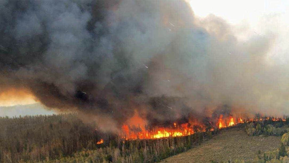
The Mullen Fire in the Medicine Bow National Forest almost doubled in size in less than a day and is now affecting 13,835 acres.
In its Incident Overview released on Sunday morning, the U.S. Forest Service said the fire, which was estimated to have affected 7,000 acres on Saturday evening, had grown to the northeast, north, and south, but ground crews and helicopters were successful at stopping growth to the west.
“It appears the fire has not yet reached Rob Roy Reservoir, but is very close,” the agency reported.
Aerial resources, the agency said, continued to drop fire retardant in the Rambler area.
Despite the growth of the fire, there was some good news. Rain showers were reported on parts of the fire Saturday night and the weather forecast called for cooler weather Sunday. But strong and gusty winds were still expected.
As reported yesterday, the fire has crossed the Savage Run Wilderness boundary on the south flank and the fire is now established in the Platte River Wilderness.
Late yesterday, the Forest Service expanded the closure area. “Please help us spread the word, as this fire is quickly evolving,” the agency tweeted.
Smoke from the fire will affect southeast Wyoming, parts of Colorado, and Nebraska. The National Weather Service released a simulated smoke dispersal model which highlights the impact of the smoke.


