Yes, if you go to many supermarkets now you’ll see an array of ceramic jack-o-lanterns, giant inflatable goblins, and other Halloween-related Halloween.
But that doesn’t mean summer is over yet — especially summer weather. And all the evidence you need that summer weather is still here happened over the weekend in South Dakota.
Grapefruit-sized hail, measuring 4.5 inches, and 80 mph winds clobbered areas of the Black Hills on Saturday.
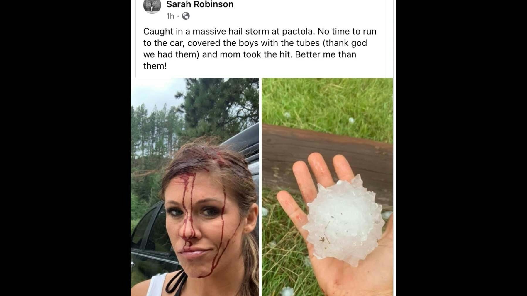
A graphic photo of one of the victims of the hailstorm went viral. The photo showed a baseball-sized hailstone next to her bloodied face.
“Caught in a massive hail storm at Pactola [Reservoir],” Sarah Robinson tweeted. “No time to run to the car, covered the boys with tubes (thank god we had them) and mom took the hit. Better me than them!”
The National Weather Service in Rapid City called the weather event a “mesoscale convective system.”
Whatever you call it, the Cheyenne Weather Service said the storm was a “sobering reminder to have multiple ways to receive a weather warning, especially if you’re traveling.”
Wyoming’s weatherman Don Day said Wyoming has about one more month where weather like this is possible.
“Severe weather season usually winds down very quickly after the first 10 days of September,” Day said. “Until then, we still have the risk of hail and heavy rain, strong winds, and tornadoes but once we hit mid late September severe weather goes down significantly.”


