Winds coming from the south will interact with some upper-level winds coming in from the west, causing severe weather for parts of the state’s eastern half, according to a Wyoming meteorologist.
Meteorologist Don Day said in his Tuesday forecast that it’s going to be a “wild [Wednesday] afternoon and evening” for people in Cheyenne, Torrington, Gillette and the rest of eastern Wyoming.
He sourced his information from the Storm Prediction Center, showing that much of eastern Wyoming was at an “enhanced” risk for severe weather, including possible tornadoes and hail.
“Their job, all day and all night, is to find out where the highest risk of severe weather is going to be, especially severe thunderstorms and tornadoes,” Day explained. “They identify areas of risk.”
There are three levels of risk: marginal, slight and enhanced, and most of Wyoming fell into the latter category.
Day noted that the SPC’s use of “enhanced risk” is fairly rare, driving home the point that the severe weather on Wednesday was something to take seriously.
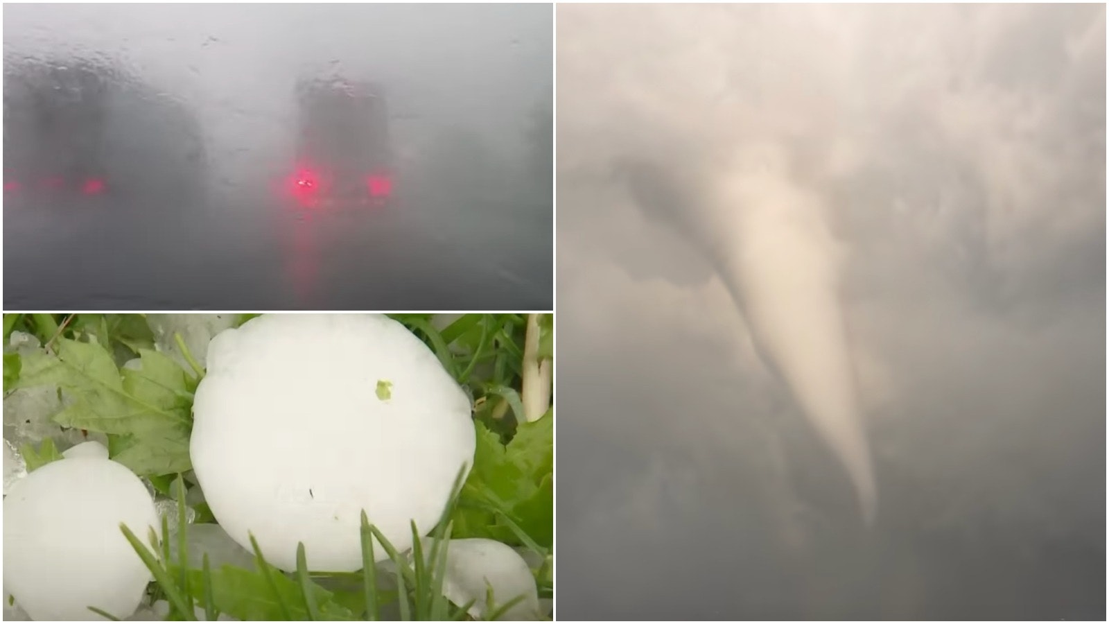
“This is one of those ‘Katie, bar the door’ situations,'” Day said. “There’s going to be a lot of spin in the atmosphere which leads to strong updrafts.”
“Strong updrafts lead to tornadoes, hail, and a lot of heavy rain. It’s going to be a wild,” he said.
The National Weather Service in Cheyenne also posted a severe weather outlook to its Twitter account, showing that golf ball-sized hail was possible Wednesday, as well as tornadoes. Local heavy rainfall may result in flash flooding.


