The following is a rushed transcript of Don Day’s Wyoming forecast for Thursday, April 16. For best results, watch the video.
It feels like January 16, not April 16 out there.
Better weather is coming. The current storm system willl continue to bring snow and unseasonable cold conditions throughout a good part of the day. But I think by early to mid afternoon, I think we’ll see the snow really come to a quick end on the plains although it will continue in the high country.
Possible record cold in many areas tonight. We are looking at lows in record territory.
This storm has brought a lot of cold and snow back into the region. We are getting reports of two feet of snow or more in the mountains of southern Wyoming.
Temperatures are going to moderate some by Friday and through the weekend.

Better weather is coming. It’s going to be more mild but not necessarily a dry pattern. I do see opportunities for more precipitation coming but the good news is that the severe cold — at least for now — is going to ease starting tomorrow and moreso by the weekend.
This is where we are right now. Here is that low we’ve been watching all week. It’s come in about as expected bringing the snow and the cold but it will head off to the east allowing a bit of a change in the weather pattern.
By Sunday, we’ll see more of a westerly flow from the Pacific. We still have a Gulf of Alaska ridge but it is not as strong.
So a more mild air flow.
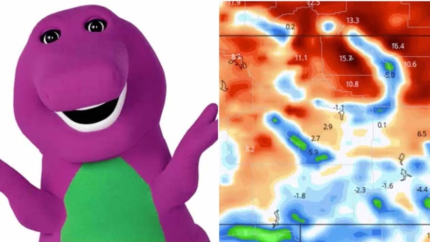
As we look ahead we do see that the temperatures just get off the charts tonight and tomorrow. These are temperatures relative to average for later today.
You can see a lot of purple. Yesterday, I had several questions about the purple monster. This is the purple monster that we were talking about — the severe cold.
It’s not this purple monster but Barney was my inspiration. Notice the color of Barney very close to the color of the severe cold showing up on the weather charts here.
We can say goodbye to Barney and the purple monster and warmer temperatures are heading our way.
Look at all the yellow and orange. We will see the temperatures get a little bit warmer than normal.
We do see some better days coming — not as severely cold.
You can see that with the upper level charts. This is by Tuesday morning. High pressure not nearly as strong in the Gulf of Alaska. This big low is pushing and trying to erase that.
We have this little guy in California that’s going to come our way. This is why we are saying it will be more mild but not necessarily dry.
This low will produce instability and moisture that could bring us some good old fashioned shower activity next week. At least it will be mild.
By late next week and next weekend, here’s our next troublemaker.
We have another low coming in from the Great Basin. This system needs to be watched. Right now, I’ll give it a question mark.
But if we were to talk about the next larger storm, it will be late next week or the weekend of the 25th or the 26th with another low coming in behind it.
What we’re seeing though is notice this blue area here. It is smaller. We are seeing the polar vortex kind of losing steam as we get to late April into early May which is what we would expect.
That should mean not as much cold air getting cut loose. But at the same time, with these systems coming through, precipitation chances are going to remain fairly frequent.

