[This is a rushed transcript of Don Day’s weather forecast for Monday, March 2. For best results, watch the above video].
It’s Monday, March 2. Thanks for tuning into the Day Weather Podcast. Well, the storm system that came in over the weekend, while it didn’t produce a ton of snow, it certainly once again caused big problems.
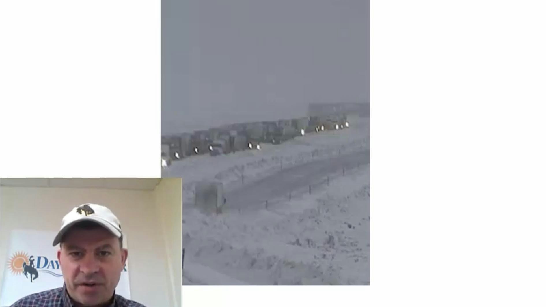
This was Interstate 80 between Rawlins and Wamsutter across southern Wyoming yesterday afternoon. Giant pile-up, chain reaction, crashes, and Interstate 80 eastbound is going to be closed at least for a day between Wamsutter to Rawlins to Laramie area.
The good news is that storm system is moving on out. And actually folks, we have a pretty quiet stretch of weather coming our way this week. And dare I say, by the end of the week it is going to get springlike.
We have to get thru today. Here is the jet stream pattern. You can see the upper level low here in California is what threw moisture this way over the cold front that came through the area during the day Sunday.
As we talked about last week, Pacific air and Canadian air is always a recipe for winter weather.
The good news is this system is going to pull away and look at this: by late Thursday into Saturday, we have a nice area of high pressure which is developing. That system is going to head off to the east.
We are going to be clipped by a little system Wednesday and Thursday but we don’t expect it to do much for us.
I think you’ll notice is this area of high pressure comes in Thursday afternoon and lasts through Saturday.
We could see 50 and 60 degree temperatures — springlike weather under this high starting in this Thursday afternoon through Saturday timeframe.
For those of you who watch these videos and listen to the podcast, you know that upstream is what we’re always looking for. Notice all the waves that are forming. We’ve got four waves here in this forecast across North America by the end of the week.
What tends to happen is we get into these roller coaster situations. We get winter weather, spring weather, winter weather, and back to spring weather.
With this next system upstream and another one behind it, you can guess what’s coming later on.
As we get into Sunday and Monday, that low up there splits up and forms a deep close-low up the west coast. Then we’ve got this wave coming through Sunday and Monday which will likely bring colder weather and snow.
And that Pacific low will throw moisture this way over the cold Canadian air again. So we may have a similar situation Sunday and Monday that we just went through.
And this low off of the west coast is going to spin around in counter clockwise fashion off the west coast for a few days. That could move in mid to late next week.
We’ve got a lot on the table. The good news about this time of year is in between storm systems we do get springlike weather systems that come in like we’re going to get at the end of the week.
Get through today. Tuesday through Friday and Saturday’s weather really looks pretty good. Sunday and Monday is when we we need to watch out for winter weather again.