This is a rushed transcript of today’s Don Day weather forecast: Good morning and good Friday to everybody. Thanks for watching the Day Weather podcast.
Well, we’ve enjoyed some pretty quiet weather. Yesterday, was gorgeous across the region. Sunshine, not much wind, a little chilly but a really day that gives you spring fever a little bit.
For today and Saturday, for the most part, we’ve got two more days of quiet weather across Wyoming. It really looks nice for two more days.
We’ve got a little bit of a storm system that is going to bring some rain to southern California today and tomorrow.
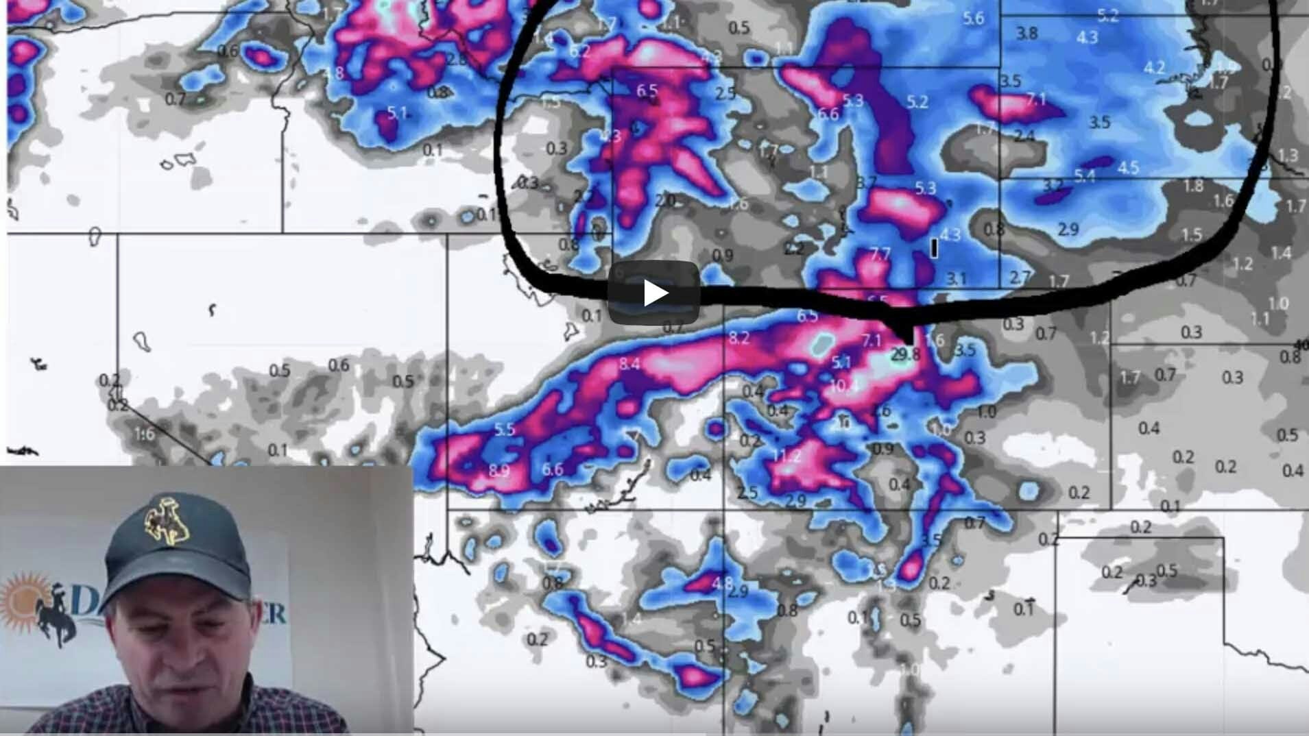
Then it is going to come up and produce some snow. I’ll show you the snow forecast from one of our computer models that takes us through Sunday afternoon.
Notice it will be Colorado’s mountains and western slope that sees the best chance of accumulating snow and look how the northern part of this system just barely gets into southern Wyoming.
This area here is a question mark. If the low tracks a little more north, I think this system could bring some snow to places like Laramie and Cheyenne.
If it goes a little more south, it could all stay south of the border.
There are a lot of question marks right in northeast Colorado. It could very well be dry as the model is showing but this band of snow along Interstate 70 we are pretty confident about.
We may see this band go north or south. I guess what I’m leading up to here is there are a lot of question marks as to where the best snow is going to fall on Sunday especially in eastern Colorado.
The question mark is if it will get into Laramie or Cheyenne because it’s right on the edge.
Notice the rest of Wyoming will have a very nice day on Sunday.
But things will change next week. We go to a colder pattern. Here is the snow forecast through Wednesday.
And you can see the winds aloft coming from the northwest again. That drags some cold air and this will bring cold out into the plains in most of Wyoming from Monday thru Wednesday next week.
This snow, that you see right here, is coming Monday through Wednesday, along with a pretty good drop of temperatures.
So the nice weather lasts for two more days. Three days for some of you. Then early next week, expect a change.
And here, we can see the upper level pattern of the jet stream, this is by Tuesday morning. It gets much colder again.
Tjhis high pressure ridge will move east. Monday thru Wednesday will turn quite a bit colder.
But the end of next week and into next weekend, the high pressure will likely move in temporarily.
One thing I want to show you, we’ve shown it before : the eastern Pacific oscillation. It is an indication of how stormy a pattern may be in the Rockies and the high plains. Anytime we see the eastern Pacific oscillation near this zero line or below it, it means an active pattern.
This is where we are right now. Notice how nice the weather is right now? The eastern Pacific oscillation is in a positive phase.
But as we get into next week and beyond, the oscillation forecast average is right near the zero mark. You see these dips? These ups and downs.
This takes us up to early April. We expect March to be more busy.
Thanks for watching the Day weather podcast. See you on Monday.