By: Brady Oltmans, Pinedale Roundup
PINEDALE – The Gulf Coast is underwater leaving millions in southern Louisiana without power. Hurricane Ida has hit the northeast, claiming at least 17 lives. Over 53,000 people have been forced to evacuate tourism hotspot Lake Tahoe as the Caldor Fire has burned close to 200,000 acres. And somewhere in the middle of it all, cozy little Pinedale is covered in smoke.
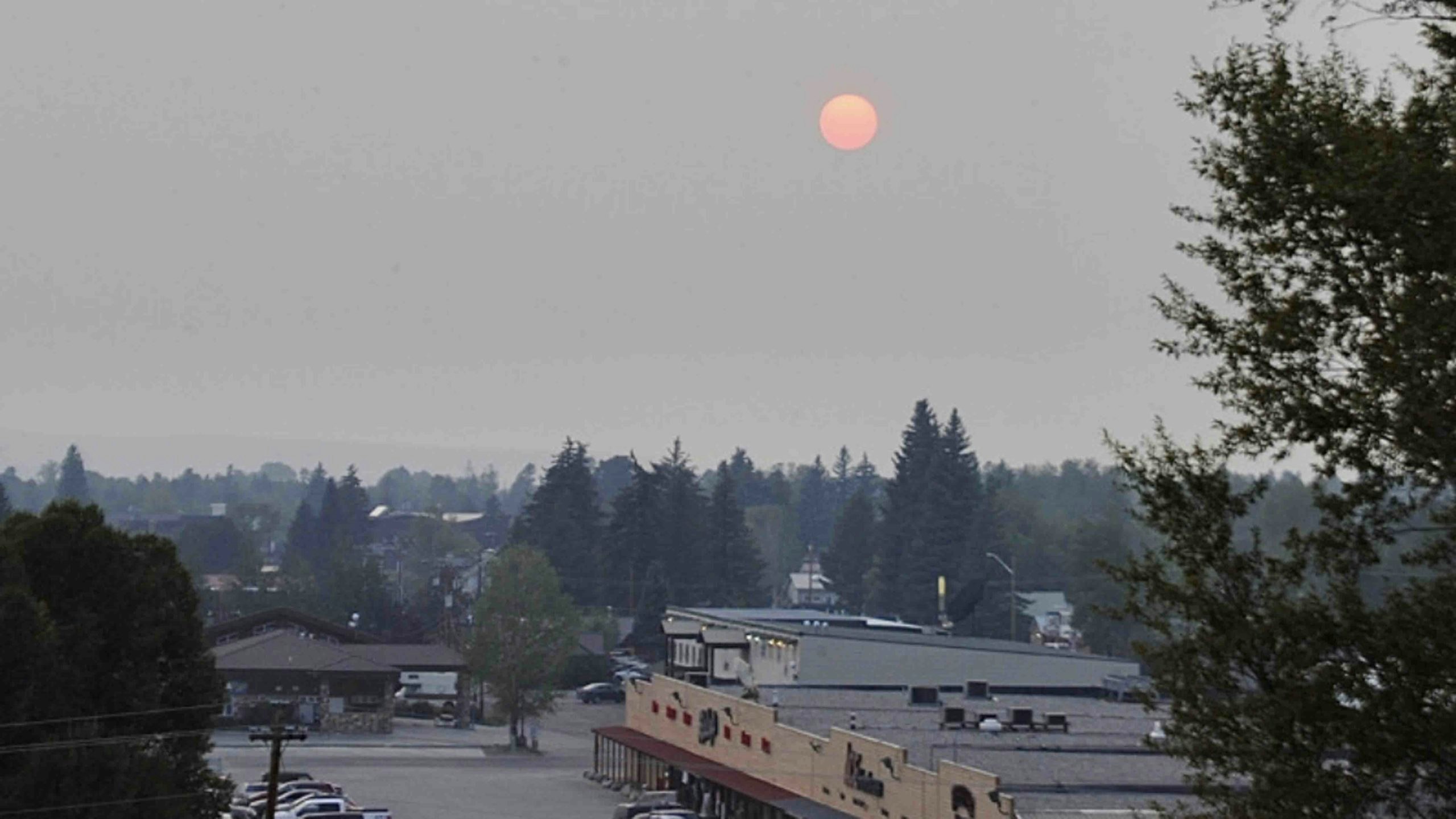
Following nearly ideal late-summer conditions last weekend, air quality in Pinedale took a severe nosedive late Aug. 30. Smoke from nearly 100 different wildfires across the west wafted into the Wind River Range by then, forcing Pinedale residents to stare at a ruby-red sunset that evening. The following sunrise cast a smoky, nearly post-apocalyptic glow among town.
“This is certainly more smoke certainly than in the most recent years we’ve seen,” Keith Guille of the Wyoming Department of Environmental Quality said.
A hazy skyline has reoccurred throughout the county this summer, sometimes blocking views of the Wind River and Wyoming ranges altogether. The latest developments could give way to more potentially dangerous circumstances.
At its worst point over the week, between 6 and 9 a.m. on Aug. 31, the AQI (air quality index) registered 160 on the Environmental Protection Agency’s measuring scale, putting it in the upper echelon of United States cities for hazardous air quality. EPA’s AQI scale lists 151-200 as unhealthy and recommends limiting prolonged outdoor exertion in that range. That was the most hazardous the town’s air quality had been measured this summer. Well, so far.
The EPA’s air quality forecast predicted conditions to worsen into early next week with levels estimated to reach 150 around sunset on Sunday. Air quality forecasts show measurements as high as 180 for noon on Sept. 6.
Guille said the Wyoming DEQ doesn’t follow the EPA’s AQI, although it is a helpful guide for the public. The Wyoming DEQ looks at ambient air monitoring, pollutants and particulate matter. They work with the National Weather Service and Department of Health to put out possible air alerts. Despite using different metrics, what the DEQ has seen so far is concerning.
Experts have no doubt wildfires are the culprit. The National Interagency Fire Center based in Boise, Idaho, reported 84 active large fires nationally as of Sept. 2. That didn’t include individual fires within complexes. According to the NIFC’s statistics, those 84 active fires have burned 2,713,387 acres.
Guille said Wyoming’s air quality entirely depends on weather patterns, where those fires are burning and how much smoke results from them.
“The smoke doesn’t stop at borders,” he said. “A lot of the smoke we’re seeing across Wyoming isn’t coming from Wyoming or even neighboring states. The region is experiencing this from multiple fires.”
Ten different states reported large fires on Sept. 2 – Idaho (20 fires), Montana (18), Washington (15), California (14), Oregon (6), Wyoming (4), Minnesota (2), Nevada (2), Colorado (1), Michigan (1) and Utah (1). Wyoming’s four fires were the Crater Ridge Fire, Morgan Creek Fire, Black Mountain Fire and Muddy Slide Fire. As of the Sept. 2 update, the Morgan Creek fire in the Medicine Bow-Routt National Forests reached 7,509 acres at 24-percent containment. The Crater Ridge Fire in Bighorn National Forest had burned 6,232 acres and was 52-percent contained. The Muddy Slide Fire in Medicine Bow-Routt National Forests burned 4,093 acres and was 80-percent contained. The newer Black Mountain Fire in Medicine Bow-Routt National Forests had burned 416 acres with no containment.
NFIC statistics showed, as of Sept. 2, there have been 43,168 fires that have burned 4,971,541 collective acres. Both of those figures are the highest year-to-date statistics since 2018 – and surpass the 10-year average year-to-date fire amounts – with a considerable amount of the fire season remaining.
“We’re used to having great air quality across the state and when we do see this it is alarming,” Guille said.
On Aug. 30, the Bureau of Land Management’s High Desert District lifted fire restrictions on all BLM land in Sublette, Sweetwater, Lincoln, Fremont, Teton and Uinta counties. The Bridger-Teton National Forest lifted its fire ban and lowered wildfire risk last week. Bridger-Teton National Forest and the Bureau of Land Management still advise all to practice wildfire safety.