The following is a rushed transcript of Don Day’s weather forecast for Monday, February 24.
Welcome to Monday, it is February 24. Thanks for tuning in to the Day Weather podcast.
The week starts off cold and blustery across the intermountain west. One two punch of cold fronts will affect us thru mid-week with much colder conditions after what was a pretty decent weekend for many of you before things started to change on Sunday.
Now we are heading back to winter weather again. What I’m going to be outlining here is the snowfall through Thursday across the intermountain west.
Most of Montana, Wyoming, western South Dakota, western Nebraska, and a large part of Colorado will see some snow. The heaviest snow will fall over and near the mountain ranges and you can see just enough snow will be falling on the plains combined with some very strong and cold northwest winds — which will add some wind chill and make roads and highways icy.
This is not a pattern that is going to bring anyone a lot of snow on the plains. It’s nuisance snow — just enough to make roads and highways slick. Just enough that you might have to shovel the sidewalk, the driveway, wipe off the car windshield — that type of snow.
Temperatures are going to be a lot colder over the next two to three days and plenty of wind along and east of the Continental Divide along the wind prone areas.
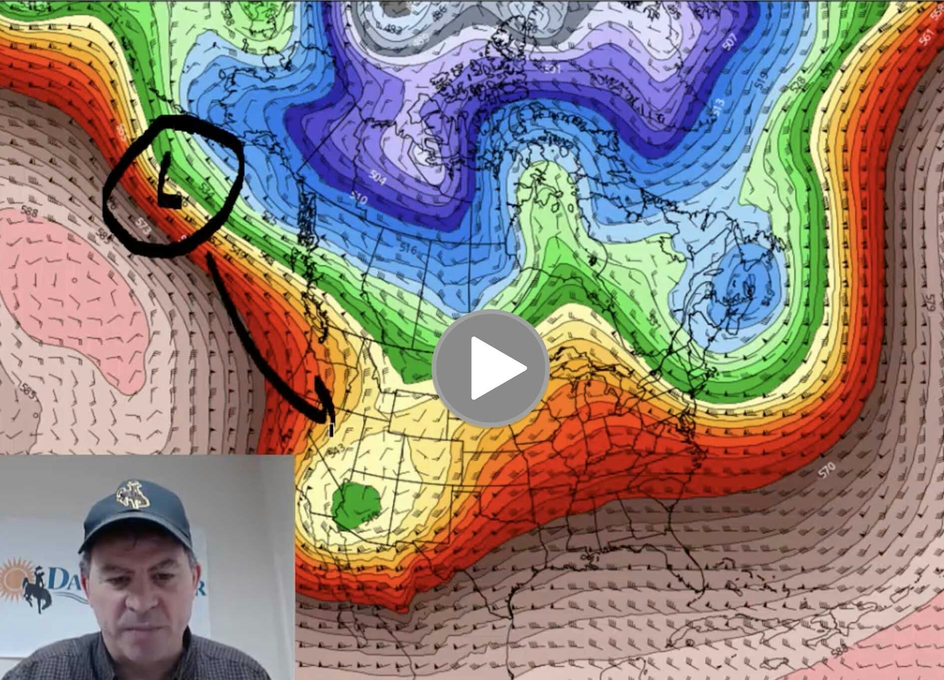
We will see a bit of a change though as the pattern does get better by the end of the week. I want to show you how the jet stream will evolve.
Right now we have high pressure building along the northwest coast. This is causing an area of low pressure to come into the Rockies and high plains.
We are looking at a forecast for Tuesday that is showing the cold air getting pumped in behind the low swinging through the region. That is why is going to be a cold and blustery start of the week.
here’s some good news. This is the jet stream for Friday night into the weekend. Notice we have a little mountain, a ridge of high pressure which will develop over the intermountain west as we get into Friday, Saturday, and early Sunday.
At the end of the week and probably most of the weekend, we will have another break in the weather. Not unlike what happened late this past weekend where we had a bit of a mild stretch. Didn’t have much wind and the weather looked good.
However, off the Pacific Northwest coast, there is another troff poised to come in. As we look ahead into Monday, March 2, that same low digs down into the four corners area.
Here we go. Early next week — Monday and Tuesday — we could be looking at an area of low pressure over the four corners area and the intermountain west just in time for the start of March. Really right on schedule.
As you get into March, as we well know, the weather gets more active. Here’s another system. Doesn’t look like much right now. But this is going to be another low that is going to come in and swing behind it three days later.
So March is going to start off busy. Bundle up. Get ready for a cold blustery start of the week with a little bit of snow. Good weather at the end of the week and the weekend. Then another storm early next week.
Thanks for watching the Day Weather Podcast.